All information on these pages is based on our personal experiences while cycling in Alaska in September and August 2000. We cycled 1600 kms from Anchorage to Valdez, Fairbanks, Denali National Park and finally back to Anchorage. There is a separate page with all the practical info on cycling in Alaska.
Overview of our route
Total distance cycled 1600 kms (or 1000 miles); we followed Highway nr. 4 and 2 from Valdez to Fairbanks and Highway nr. 3 back to Anchorage.
Our route day by day
Anchorage to Whittier
Half of Alaska’s population lives in the Anchorage urban area. It’s busy on the main highways through town; fortunately there is a network of bike lanes. Some of them are shared with pedestrians, some of them are real separate bike tracks. At the Tourist Information offices downtown and at the airport you can obtain a small map with all the lanes.
Traveling south from downtown Anchorage it’s best to take to Old Seward Highway until it joins the New Seward Highway. The New Seward Highway is a freeway and off-limits to cyclists. There is a lot of traffic, the road now has shoulders and along a few kms there are even some bike lanes.
The first bike track starts near BirdCreek Campground and ends suddenly at the bottom of an unpaved track back to the main road. It’s going to be difficult finding this track for those coming from the south. The second bikelane starts at about 6 kms north of Girdwood.
Portage Glacier
At Girdwood you’ll find a shop with limited supplies and an ATM. This is the last shop before you’ll get to Whittier. Another 15 kms further down the road is the turnoff to Portage Glacier. Campgrounds are located 5 kms along this road.
From the Williwaw campground the actual Portage Glacier and it’s Visitors Center are 2 kms further along the road
Getting through the WhittierTunnel
The upgraded tunnel to Whittier that opened in June 2000 for cartraffic, is prohibited for cyclists and pedestrians. We hitchhiked through the tunnel and saw a excellent well-lit road. It’s only 4 kms to the other side. Cycling would certainly not be dangerous but, as mentioned above, it is not permitted. There is a checkpoint at the Portage side of the tunnel, but none at the Whittier side. Traffic is regulated with traffic-lights. Trains do still run from Anchorage to Whittier to connect to the ferry. Note that these trains do not accept large luggage items such as bicycles. Additional information and the tunnelschedules can be found at the official tunnel website.
Update August 2005
It now seems to be possible to travel by train to and from Whittier and take your bike with you. Check current situation with Alaska Railways.
Whittier and the ferry to Valdez
North of Valdez
Whittier is the jumping off point for the ferry to Valdez. There is not much to do or see here. We had made reservations for the boat trip to Valdez, but at the office we were told that for cyclists this was not necessary. They can always squeeze in a bike or two. The boat trip to Valdez takes about 9 hrs. Camping is possible in Whittier but not very attractive. There is a good general store in the center.
Valdez – Glenallen
The nearest campground to the Valdez ferry terminal is the Bear Paw campground. They have hot showers and you can do your laundry here. There is also a well stocked supermarket in Valdez.
Leaving Valdez there is a good bikelane for the first 10 kms out of town. Once you’ve passed through the Keystone Canyon the road starts climbing. After 40 kms you reach the turnoff to the Blueberry Lake State Recreation Area with drinkingwater, picnic tables and pit-toilets.
Another 3 kms of climbing brings you to the top of Thompson Pass (924 m / 2771 ft). The road then descends for about 15 kms to the Tiekel River. Just beyond the Tiekel River there is a picnic area (suitable for camping) and a few kms further the Tiekel River Lodge which also offers camping facilities.
After Alaska Pipeline Pumpstation nr. 12 the road descends until you get to Tonsina (gas and drinks) and the Squirrel Creek campground.
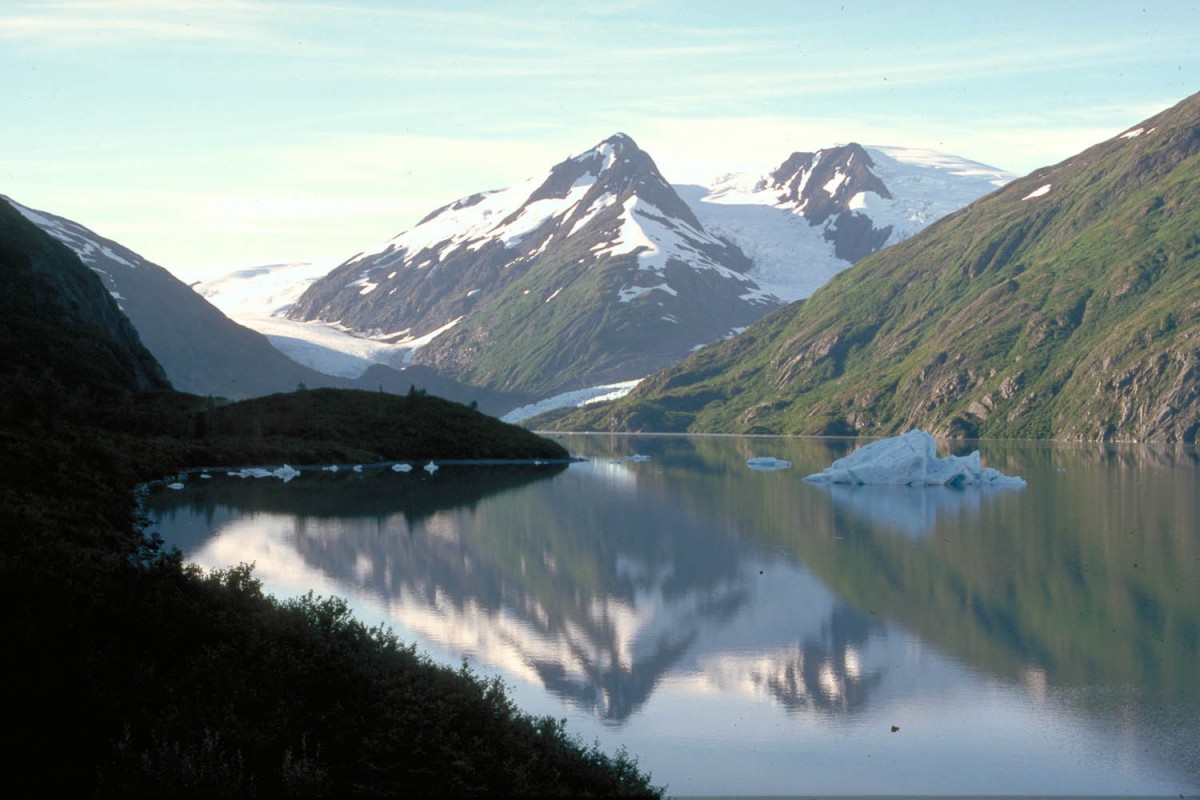
A bit further is Willow Lake which makes an enjoyable stop on a clear day. At the other side of the lake you’ll see the mighty mountains of the Wrangell Range reflecting in it’s surface.
30 kms north of the Squirrel Creek campground is the turn off to the Copper Center Loop Road. Copper Center is a nice little town with a lot of atmosphere. It also has a good general store and a postoffice. The Wrangel St. Elias NP VC is at the northern exit of the loop road.
The town of Glenallen is only a few kms away. It has RV parks, a campground (no hot showers!) and a few stores. Another 4 kms north is the Dry Creek State Recreation Site with the usual basic camping facilities.
Glenallen – Fairbanks
Once you have passed the gasstation at Gakona Junction (turnoff to Tok) traffic becomes less. The road narrows and the shoulder disappears. 55 Kms north of Glenallen is the rather exposed Sourdough Creek campground. We were the only visitors on a very rainy day at the end of August. At the other side of the Sourdough Creek is the Sourdough Creek Roadhouse.
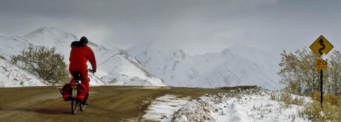
Section of the Richardson Highway just south of Paxson
Just beyond Sourdough Creek the road starts to climb towards the Alaska Range. Good views of the snow covered peaks at several points along the road. Hilly sections all the way. At Meiers Lake there is a roadhouse and lodge. A bit further is Paxson (on the junction with the Denali Highway) with a hotel and a gas station but no store. Another 5 kms of climbing through a wide tundra valley brings you to Summit Lake. At the other side of the lake is Isabel Pass. The nearest campground downhill from the pass (1000 m / 3000 ft) is Fielding Lake. No drinking water here, just picnic tables and a pit toilet. Take water from the lake or rivers and boil or filter it. Nights can be cool here at an altitude of 892 m / 2973 ft.
After Fielding Lake it’s downhill all the way to the Donelly Creek Campground. After spending the night at Donelly Creek campground we had to battle the steep slopes of Donelly Hill for almost 10 kms.
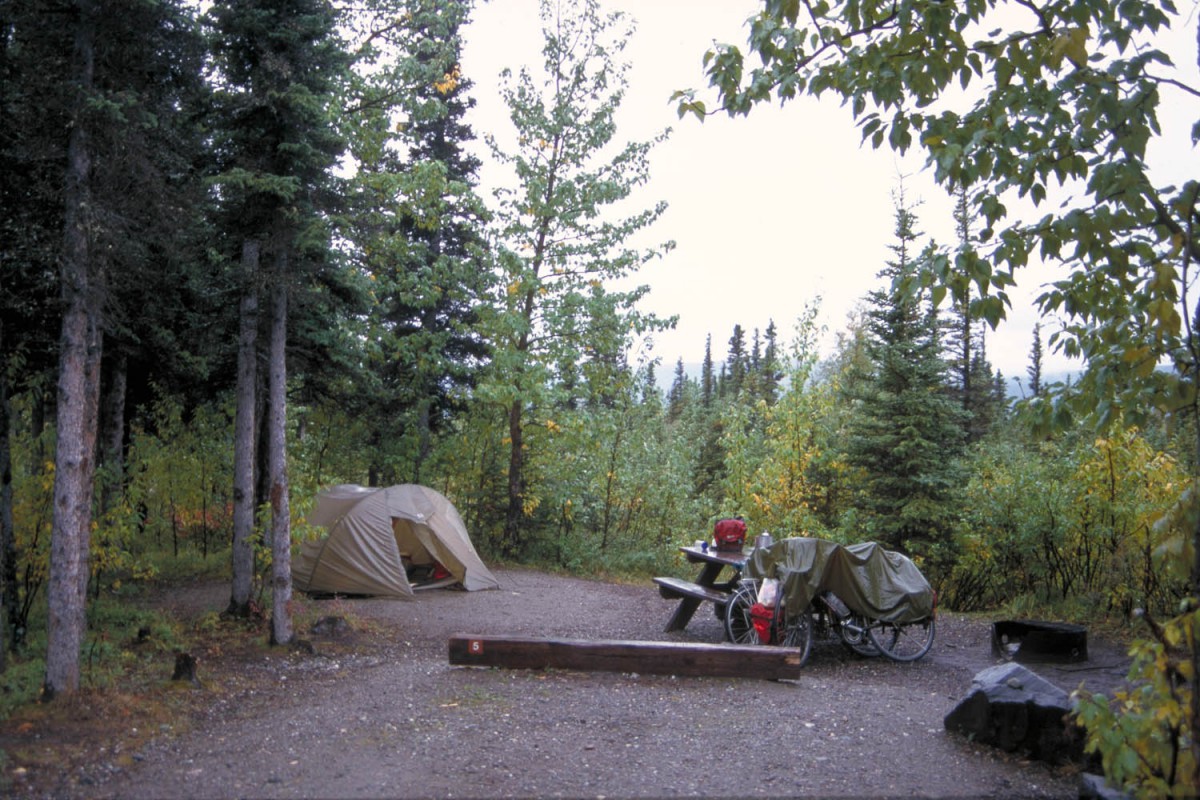
Typical State Park campground at Donelly Creek
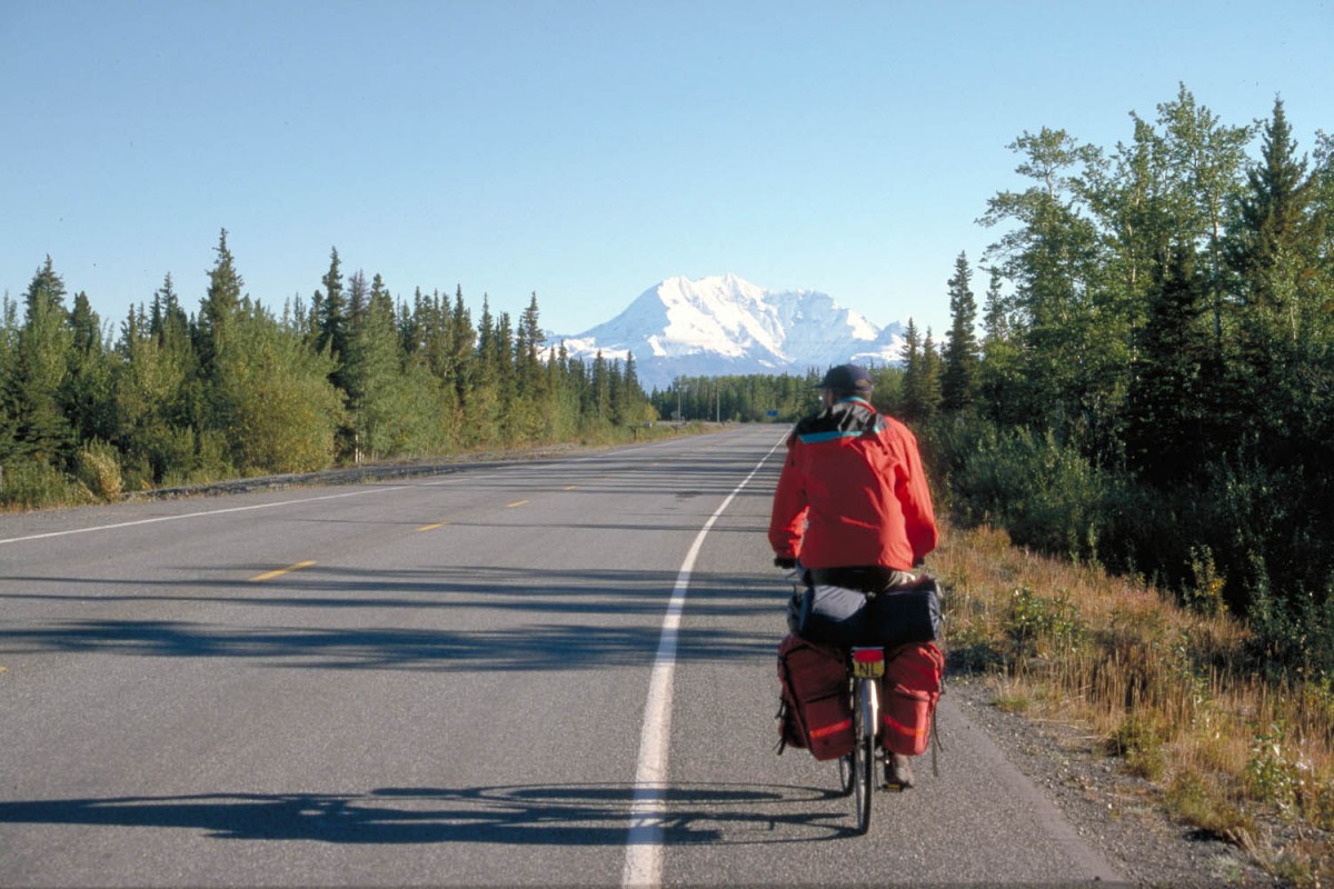
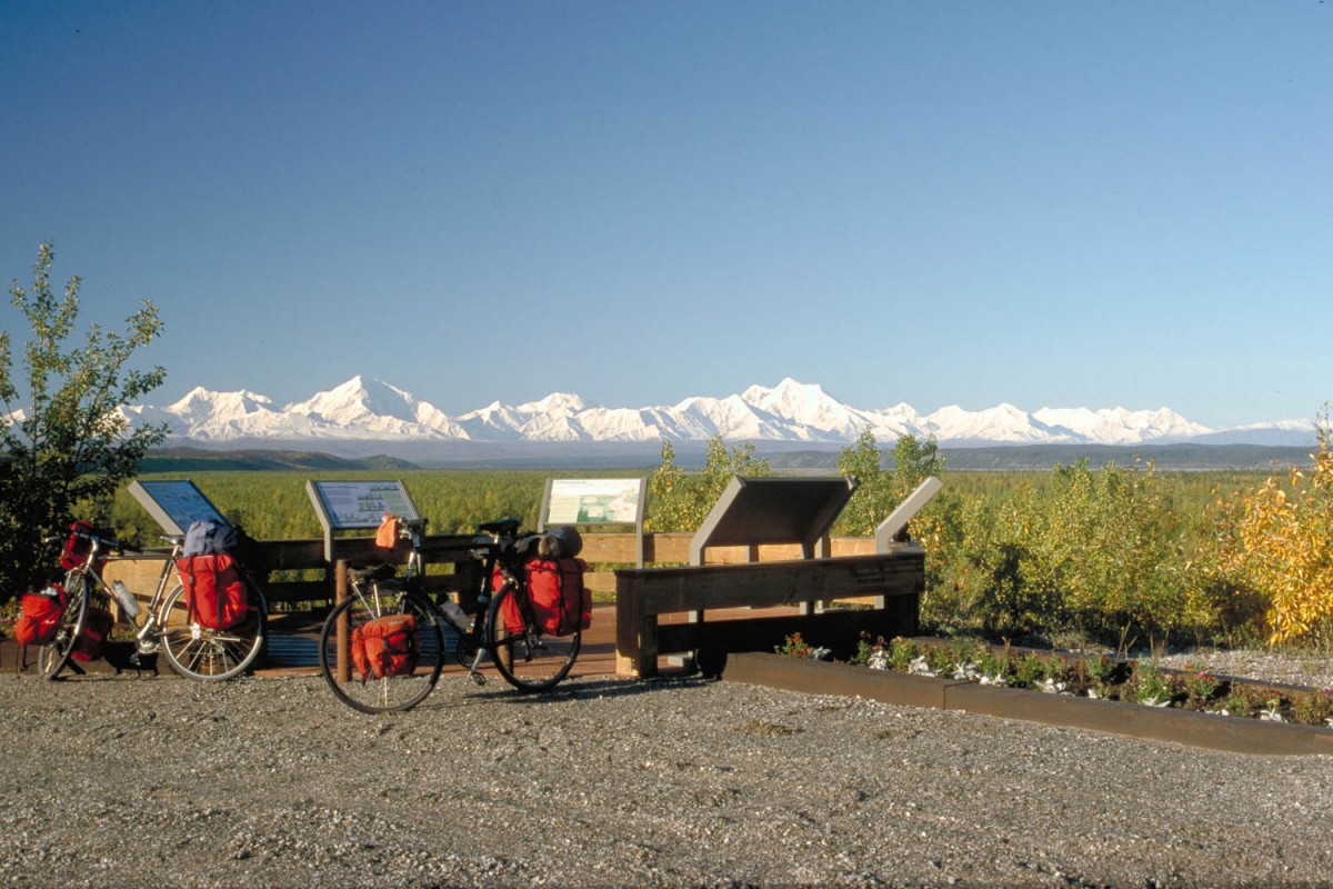
The remaining kms to Delta Junction are easy downhill and flat cycling. Delta Junction has all the facilities (shops, supermarkets, motels etc.) Just before Delta Junction (about 13 kms) there are several scenic viewpoints of the Alaska Range you’ve just crossed. Worth to stop and have a look (on a clear day). The most scenic view is from an unsignposted lookout about 500 m south of the official viewpoint.
Cycling further north along the Richardson Highway there are several places to stay. Including the Midway lodge, halfway between Delta Junction and Fairbanks. We camped at Harding Lake campground which can be reached on a paved road 2.5 kms off the Richardson Highway.
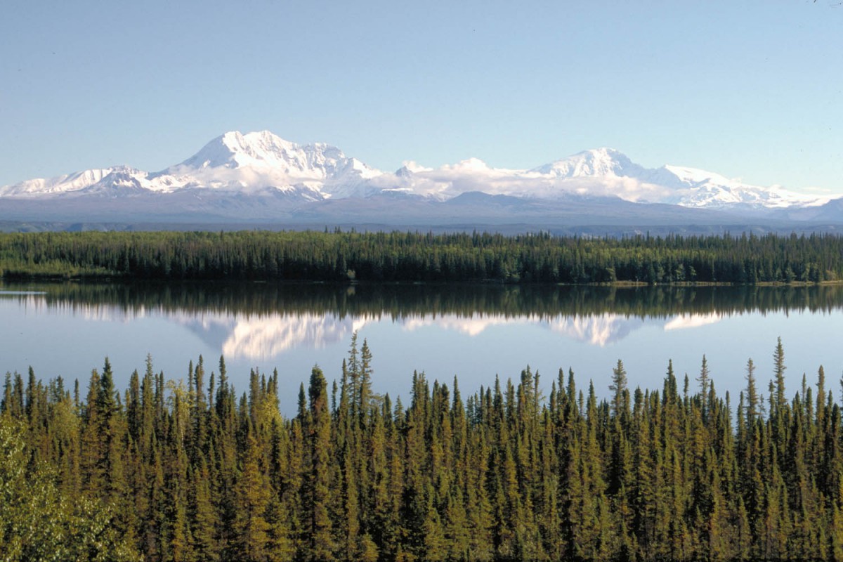
Wrangell Mountains reflecting in Willow Lake
Beyond Harding Lake you will be getting closer to civilization. More traffic here, especially after you’ve passed the large Eielson Airforce Base. Near the village of North Pole the highway is as busy as a freeway and cycling has become less enjoyable. An alternative is to follow the Old Richardson Highway (signposted). This old road finally turns back to the main highway. A few miles further is another possibility to exit the freeway which now has become off-limits to cyclists.
Just south of Fairbanks
Cycling in Fairbanks
Although Fairbanks itself is not a very exiting town it does have a network of bike lanes. The Tourist Information has a map. Most of the bike lanes are shared with pedestrians (and are actually only upgraded sidewalks) but it is still nicer than using the roads.
Fairbanks – Denali National Park
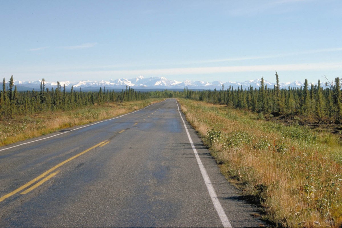
The Fairbanks – Nenana road winds through undulating hills with everchanging views of the surrounding hills and woods. It’s up and down all the time. Most of the hilly sections have wide trucklanes.
Nenana has a store and a campground, but the latter closes on Labour Day. We camped behind the Visitors Center (toilets and drinkingwater) that closed the day we camped there.
The first 30 kms south of Nenana are not very exciting. It’s flat with endless spruce and birch forests. The town of Anderson (located 10 kms off the highway!) has camping facilities.
The shoulder disappears just beyond the Anderson junction. Unpleasant because there is a lot of traffic on this road. 40 Kms to the south the shoulder appears again.
As Denali NP is coming closer more motels, campgrounds and other tourism-related facilities begin to appear along the road. At Healy there are motels and at least 2 campgrounds that accept tents. The rather rundown looking Healy Liquor and Groceries Store has almost anything you may want to buy. Stock up here, there is not much at the park entrance and nothing for sale inside the park.
At the McKinley tourist village (souvenirshops, souvenirshops and souvenirshops) shops sell a limited selections of groceries. Inside the park (near the VC) is one shop to get your last supplies.
 Cycling in Denali NP
Bikers in the park are privileged people. They are the only visitors that are allowed to travel the entire parkroad with their own vehicle. Cars are not allowed beyond Teklanika campground. Even better: you can put your bike on a parkbus anytime on a space available basis. See our separate page on Cycling in Denali NP.
Denali National Park – Anchorage
Leaving the park and traveling south you’ll pass through another conglomeration of tourist facilities. Most of them close after Labour Day. Until you reach Cantwell there are no services along the road. Cantwell has two stores (the one at the Chevron station is less well stocked) and a RV-park with a couple of tentsites. This RV-park has great hot showers and laundry facilities.
From Cantwell it’s 3 kms of moderate climbing 😉 to the lowest (!) pass on the continental Divide: Broad Pass at 690 m (2300 ft). Although we hardly noticed getting to the top there are a lot of hills to conquer from Broad Pass until 20 kms before the Byers Lake campground. You’ll pass a lodge and the Denali North View campground. The latter looks more like a parking lot and probably has no drinking water. At Byers Creek (south of the Lake along the highway) there is a lodge and general store. From Byers Lake the road descended very slowly to Montana Creek campground. You’ll pass through Trappers Creek (store) and the junction with the Talkeetna Road. Montana Creek is a privatised state campground with no extra facilities. The Chulitna rest area has drinking water from a well. Now we were getting closer and closer to the more densely populated part of Alaska.
Anchorage: the last miles
Traffic increased and the shoulder was rather narrow. 40 Km south of Montana Creek is Houston. The highway widens to 4 lanes just outside Houston and the good news is that a bikelane appears. This separate bikelane is new and can be followed all the way to Wasilla. At milepost 49 however you will have to cross the highway to continue your trip on this bikelane.
The George Parks highway now has become a wide multi-lane highway with wide shoulders. Just stay on that shoulder until you get to Birchwood where another bikelane (almost all the way to Anchorage) starts. The bikelane starts at the northbound side of the road just near the turnoff to the Birchwood Highschool and opposite the Birchwood Loop Rd.
Follow the bikelane until Eagle River. We lost the bikelane-signs here and crossed the Eagle River on the highway. Just beyond that bridge starts the Hiland Road and the remaining part of your trip to Anchorage can be done on a excellent paved bikelane.
Riding into Anchorage with it’s noise and busy roads was a big change after the natural beauty of the Alaskan interior. A day later we pushed our bikes along Anchorage network of bikepaths towards the airport.
Alaska: worth a visit
Although our 4 weeks and 1600 kms of biking were often cold and rainy, we still recommend this part of the world for cyclists seeking a trip with more than the usual share of natural beauty!
