Do you like cycling on old railway tracks? We also have reports about the Vennbahn (Belgium) and on cycling on the Via Verdes of Andalucia.
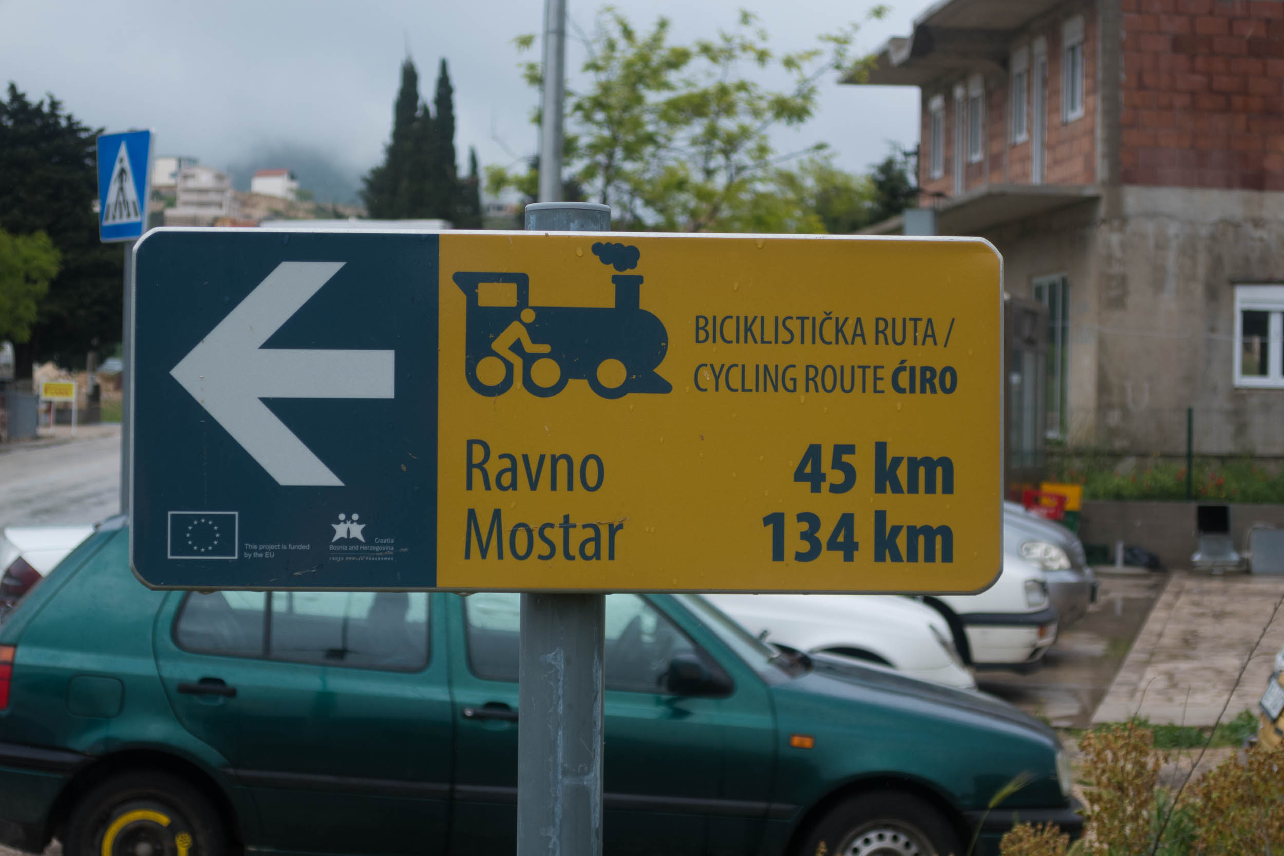
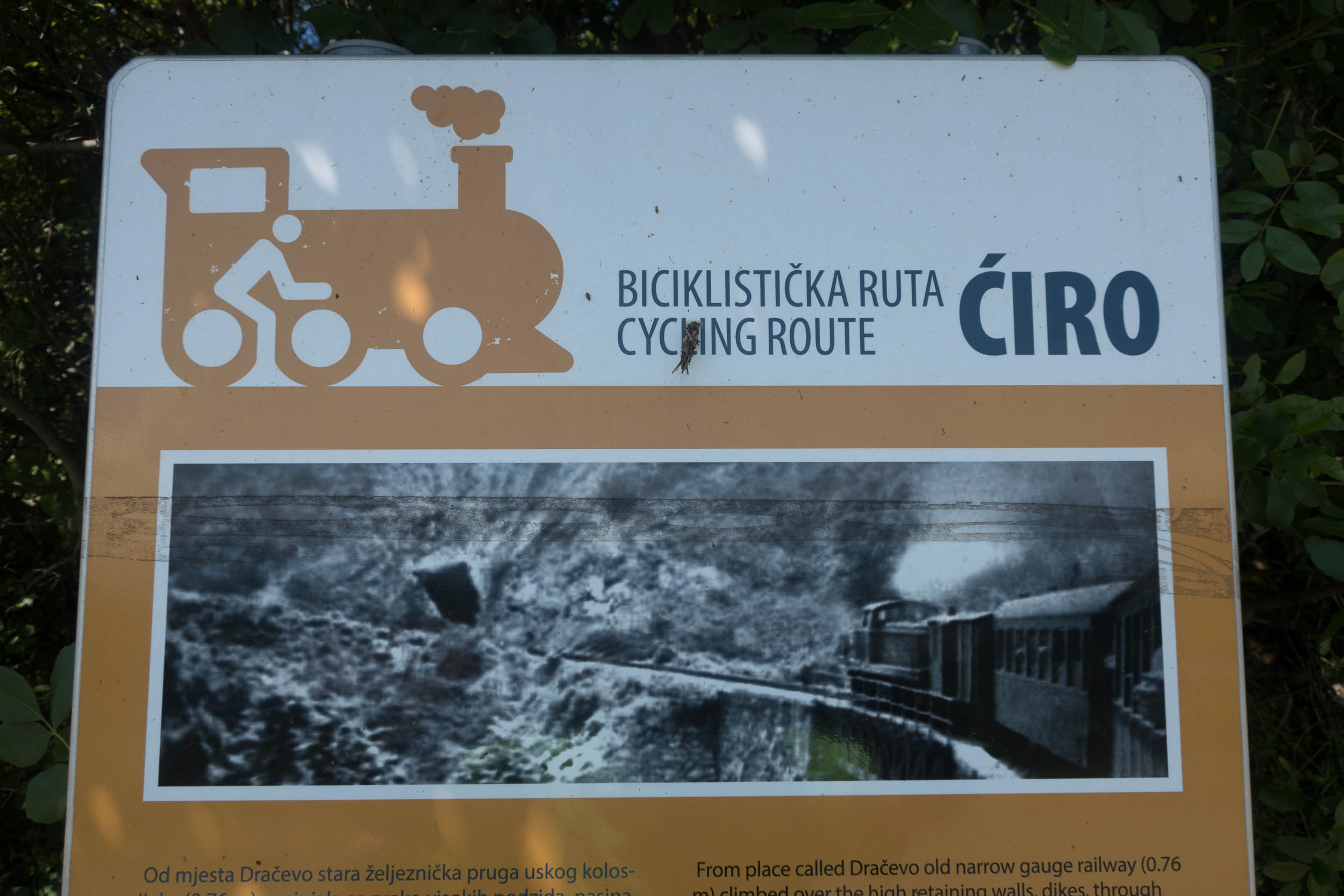
The Ciro trail is a 140 kilometer long bicycle route in Bosnia Herzegovina. It starts in Ivanica or Treblinje (and not as some sources mention in nearby Dubrovnik in Croatia). It follows the route of the old Dubrovnik to Mostar railway line (in use from 1906 to 1976). Cycling is for the major part on very quiet and almost traffic free narrow roads.
Some sections are bicycle only. These three sections are paved with 30 kms very rough gravel and will pass through twelve very dark tunnels (most of the tunnels are short). As this is an old railway line there are no steep grades. We cycled the Ciro from the south to the north in May 2019 as part of our Western Balkan bicycle tour. The entire route is clearly signposted.
There are reports of cyclists riding the old railway track from Dubrovnik to the border with Bosnia Herzegovina. It’s difficult to find and most of it is very rough and also partly overgrown. The road seems to be the better option here until things improve.
On the CIRO trail
Text continues below the map
Download this route from Ride with GPS in various formats
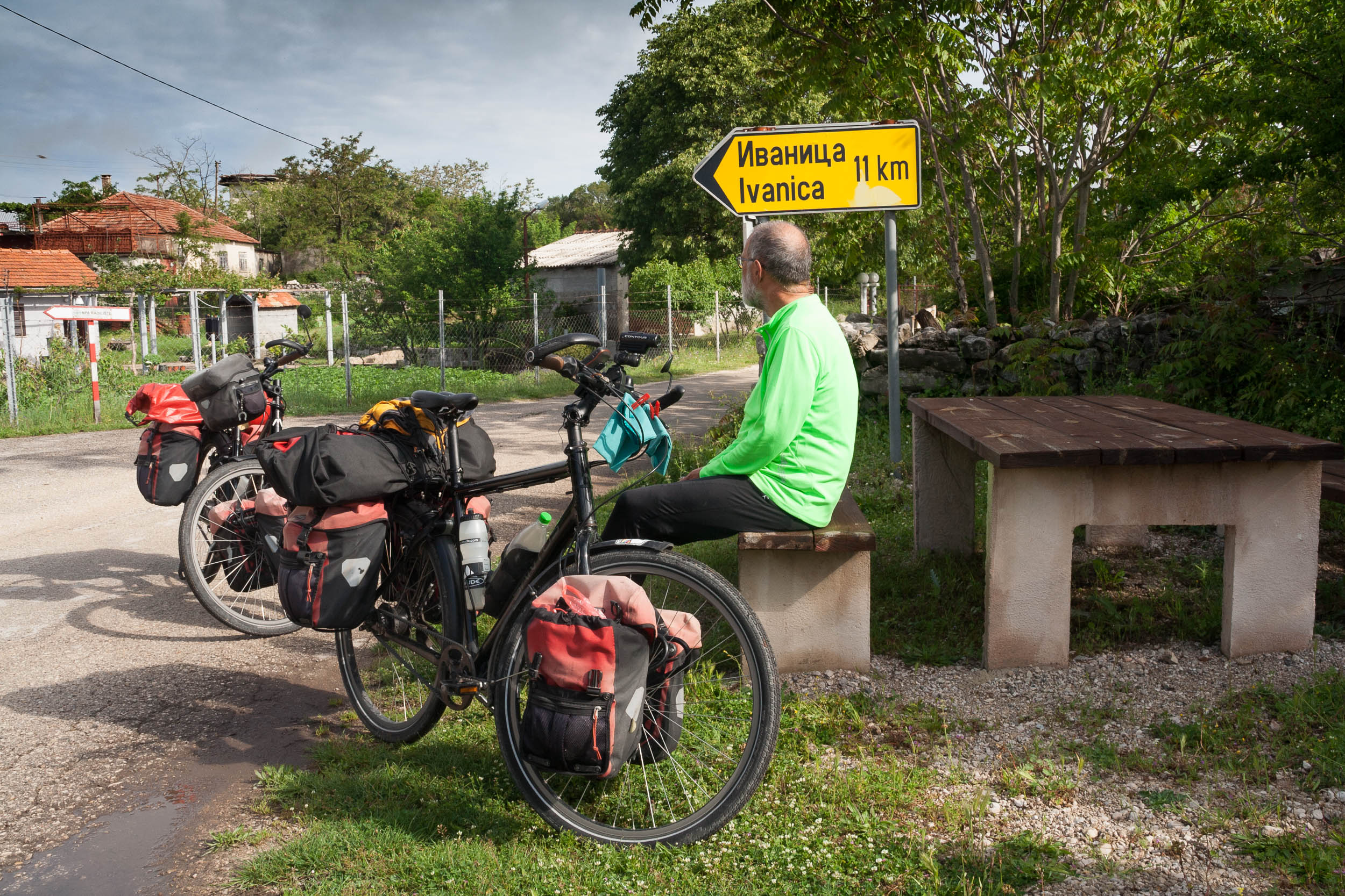
The first Ciro sign you’ll see coming from the south. It’s in Ivanica just across the border
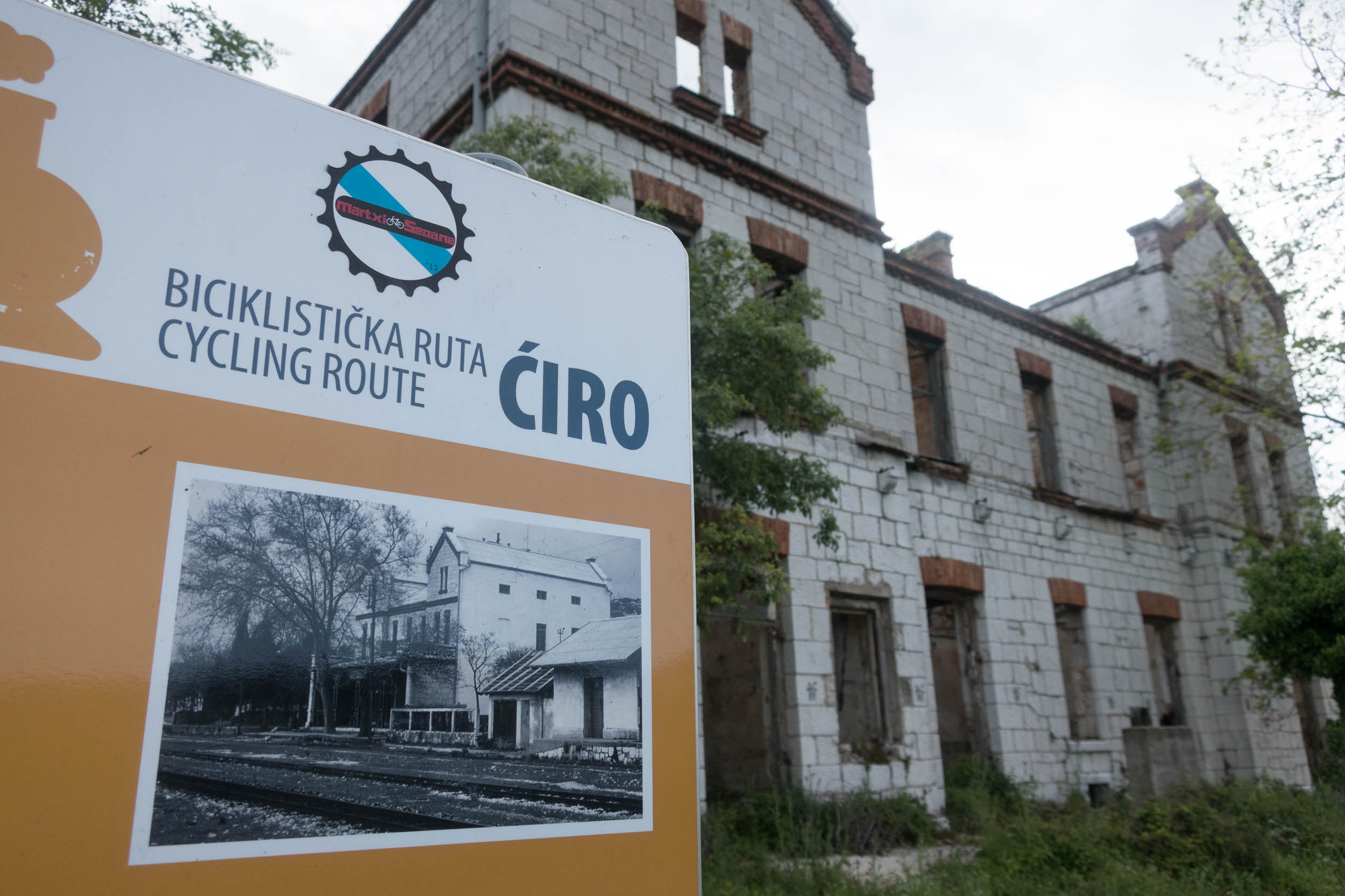
The Ciro follows an old railway line so you’ll see several stations 😉
Accommodation
Looking for a hotel or something similar on the Ciro Trail? There are several apartments for rent in Ivanica (we found one by asking in the local supermarket), and a hotel / apartments in the renovated railway stations of Zavala and Ravno. Besides that there is nothing until you get to the town of Capljina south of Mostar. There are many good spots to find a free camp. Particularly along the unpaved sections of the trail where there is no traffic other than the occasional other cyclists.
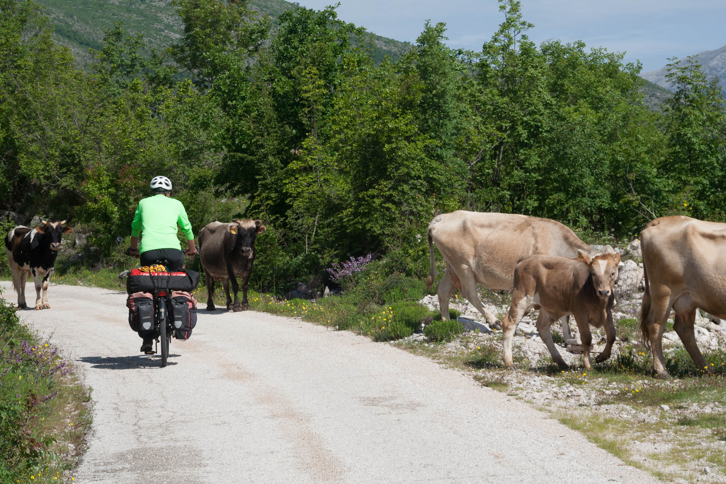
Not too much traffic…
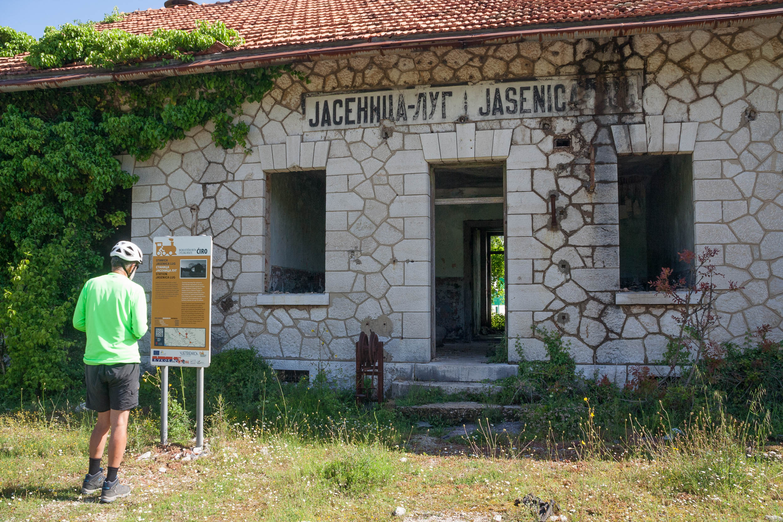
Most of the railway stations look like this
This used to be a busy narrow gauge railway line until 1976
Food and water
There is a small supermarket in Ivanica (see our map) but after this we did not see any shops before we got to Capljina. We found a watertap in Hutovo (see our map) or you could try the hotels in Zavala and Ravno.
Pavement and traffic
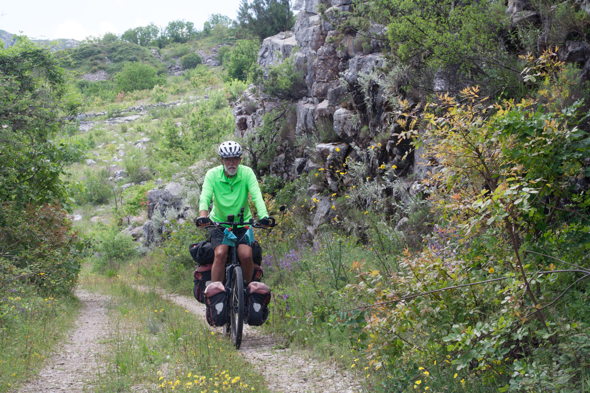
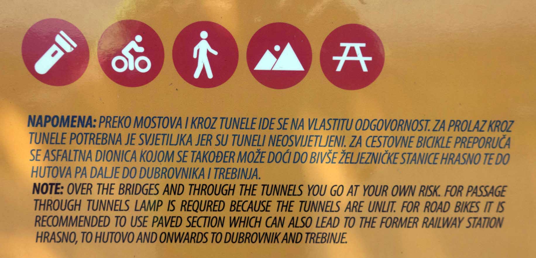
Most of the Ciro Trail from Invanica to Capljina follows a narrow paved road that once was the railway line. Three sections are unpaved and be prepared for some very rough gravel. At some places it looks like they removed the railway but left the track bed in place ;-). These sections are not suitable for road bikes with narrow tires. Our heavily loaded touring bikes have 50 mm tires (Schwalbe Allmotion) and that was just enough to get through. We walked through all the tunnels and some of the roughest parts, usually not more than 100 to 200 m. There are signposted detours for all the gravel sections.
Information sign at the northern end of the northern gravel section. All gravel sections can be avoided by taking a paved road
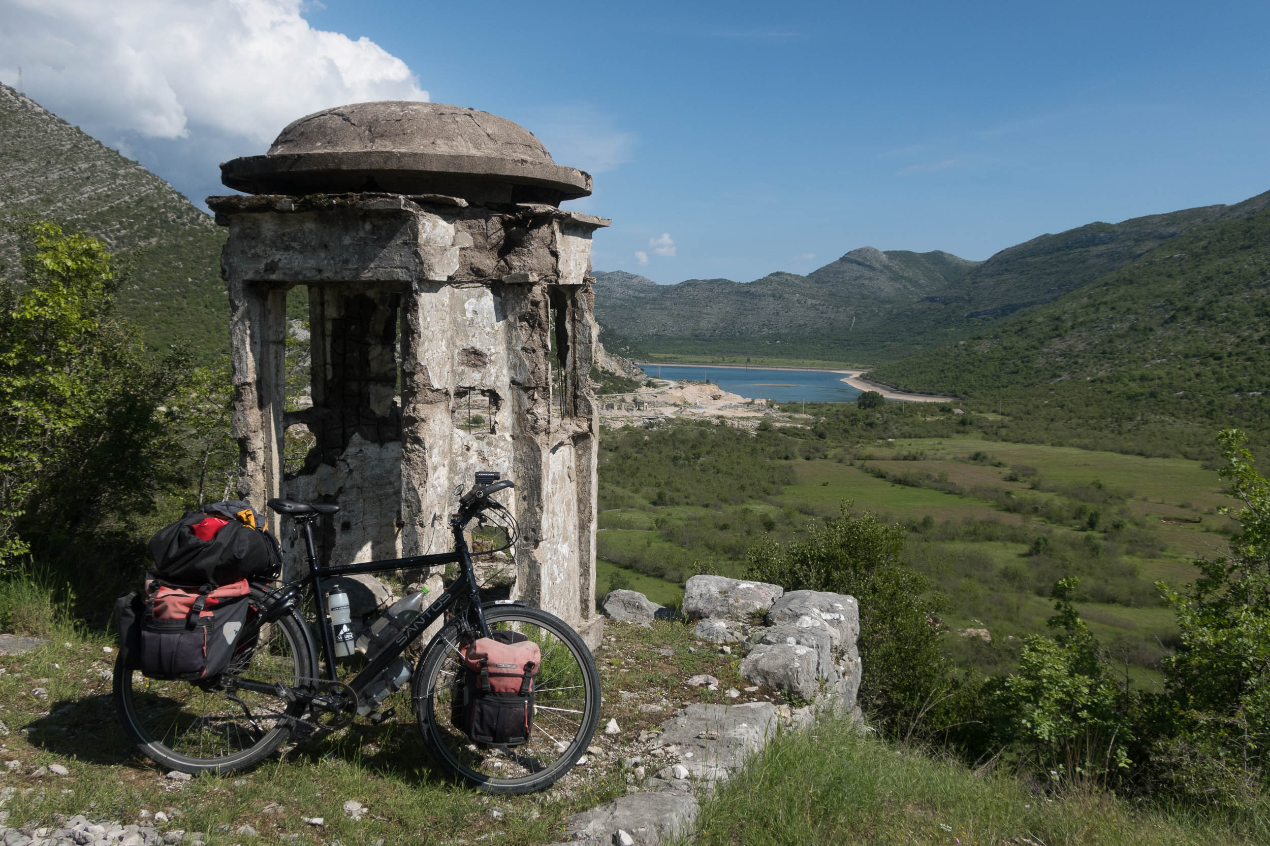
Crumbling guard house with a view
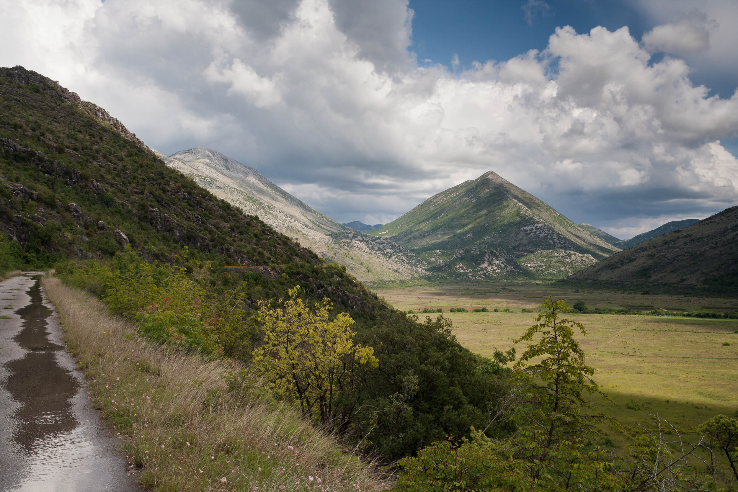
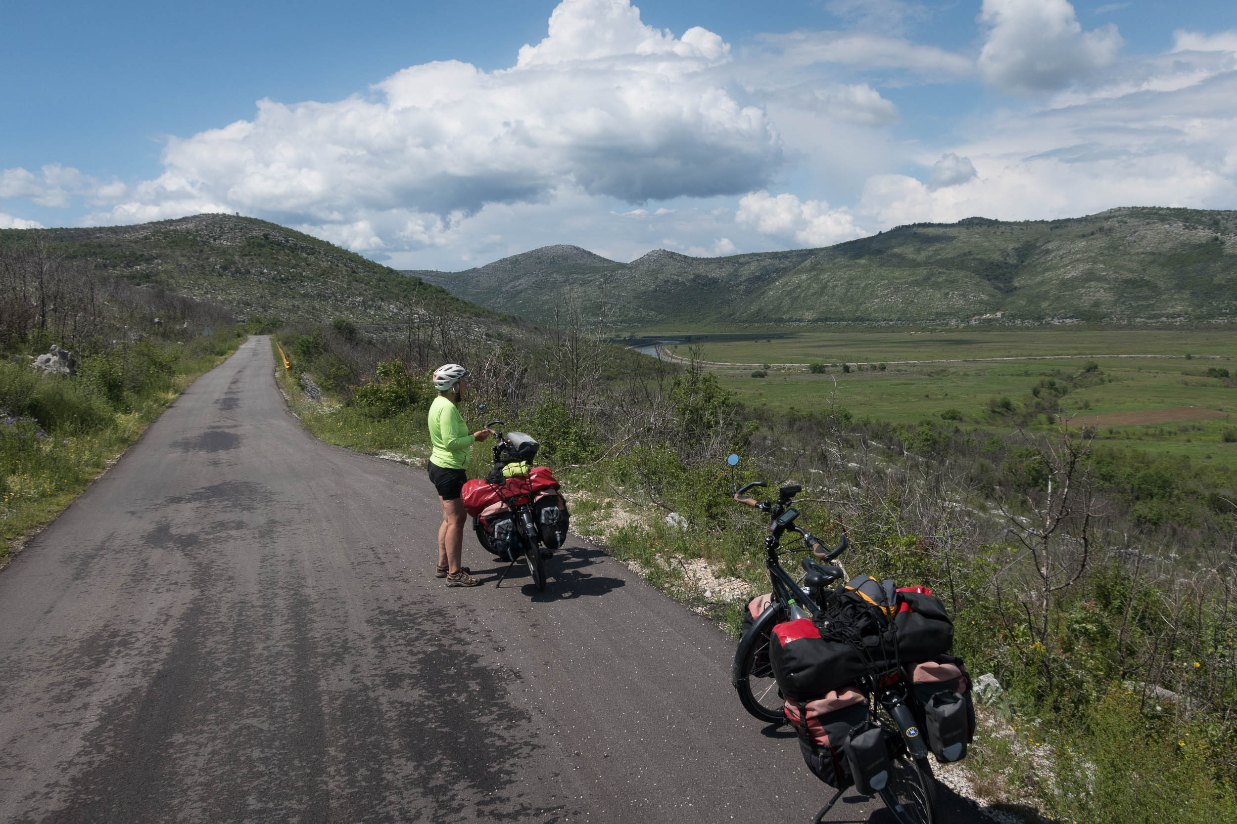
Lovely quiet roads and great views!
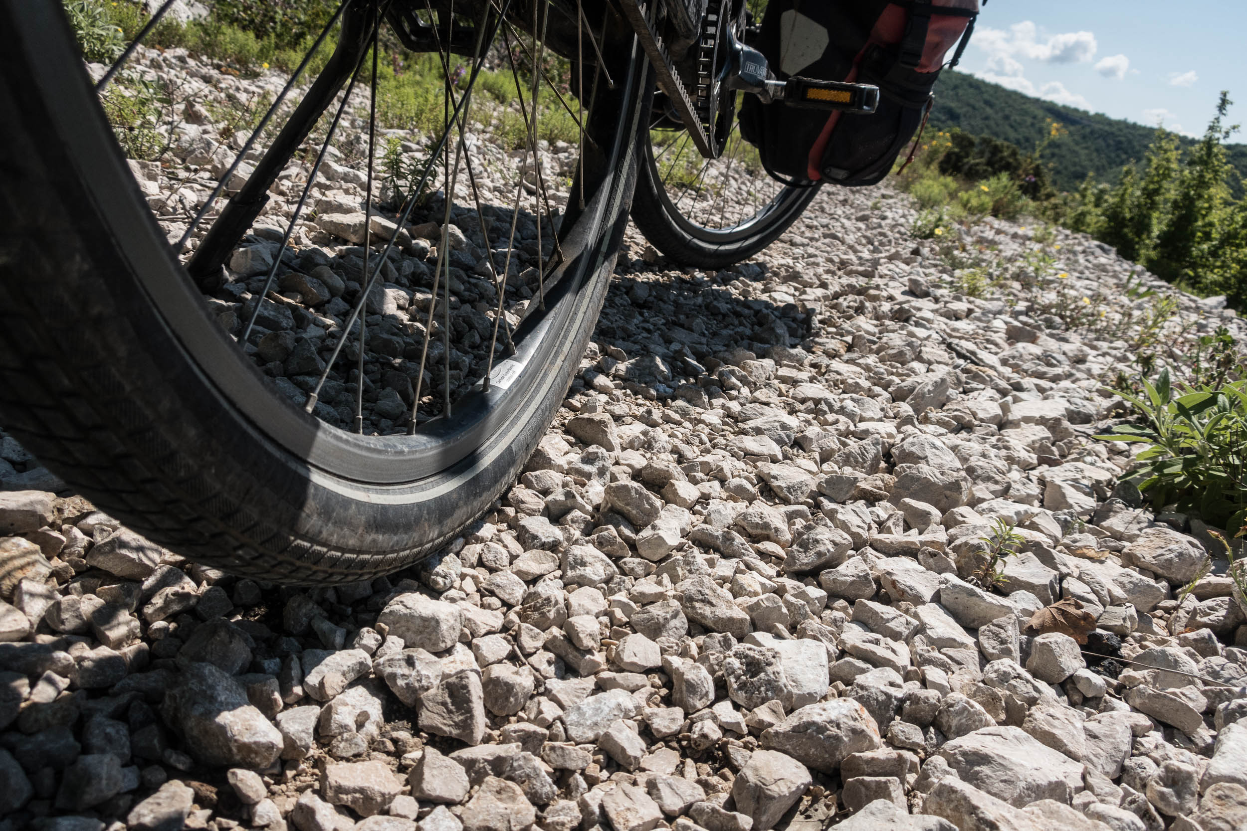
Typical gravel surface. It’s hard work…
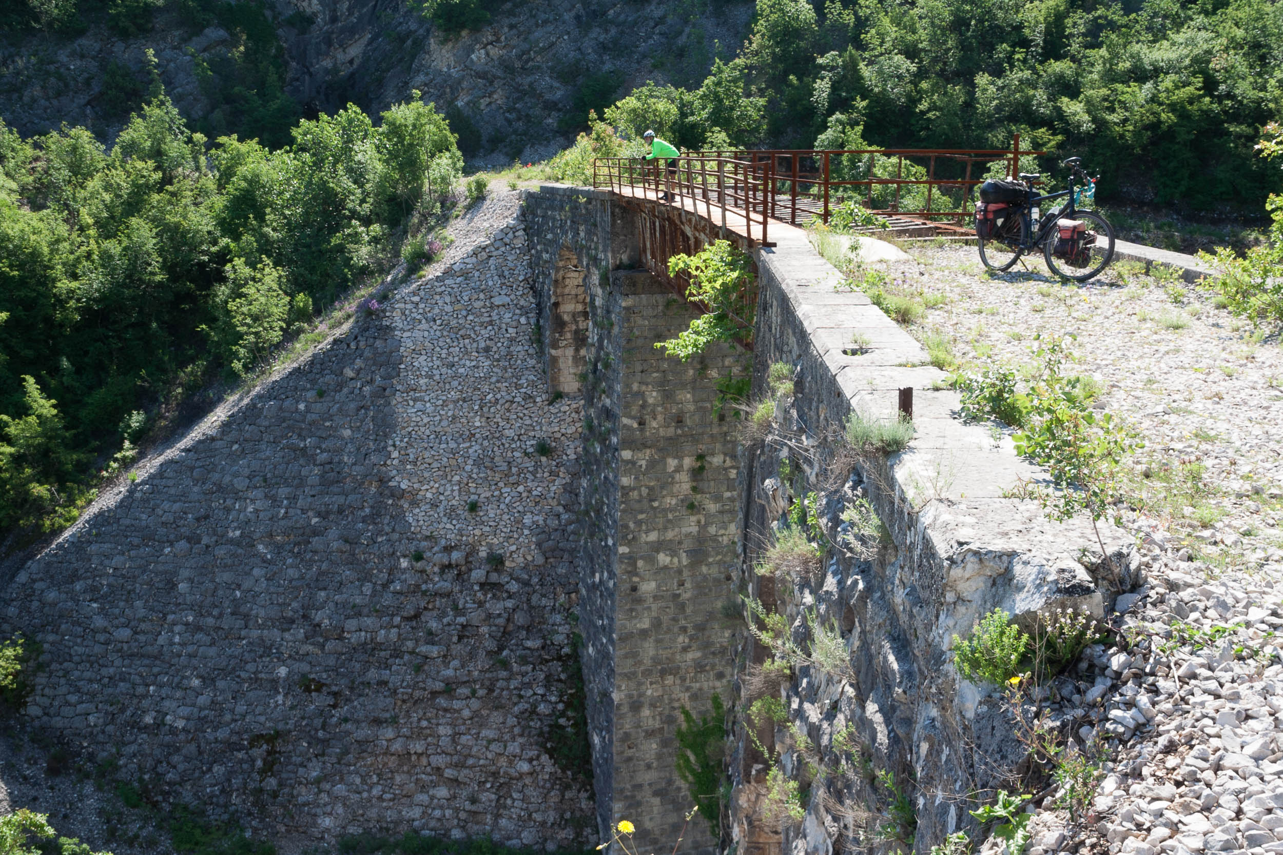
One of the many bridges
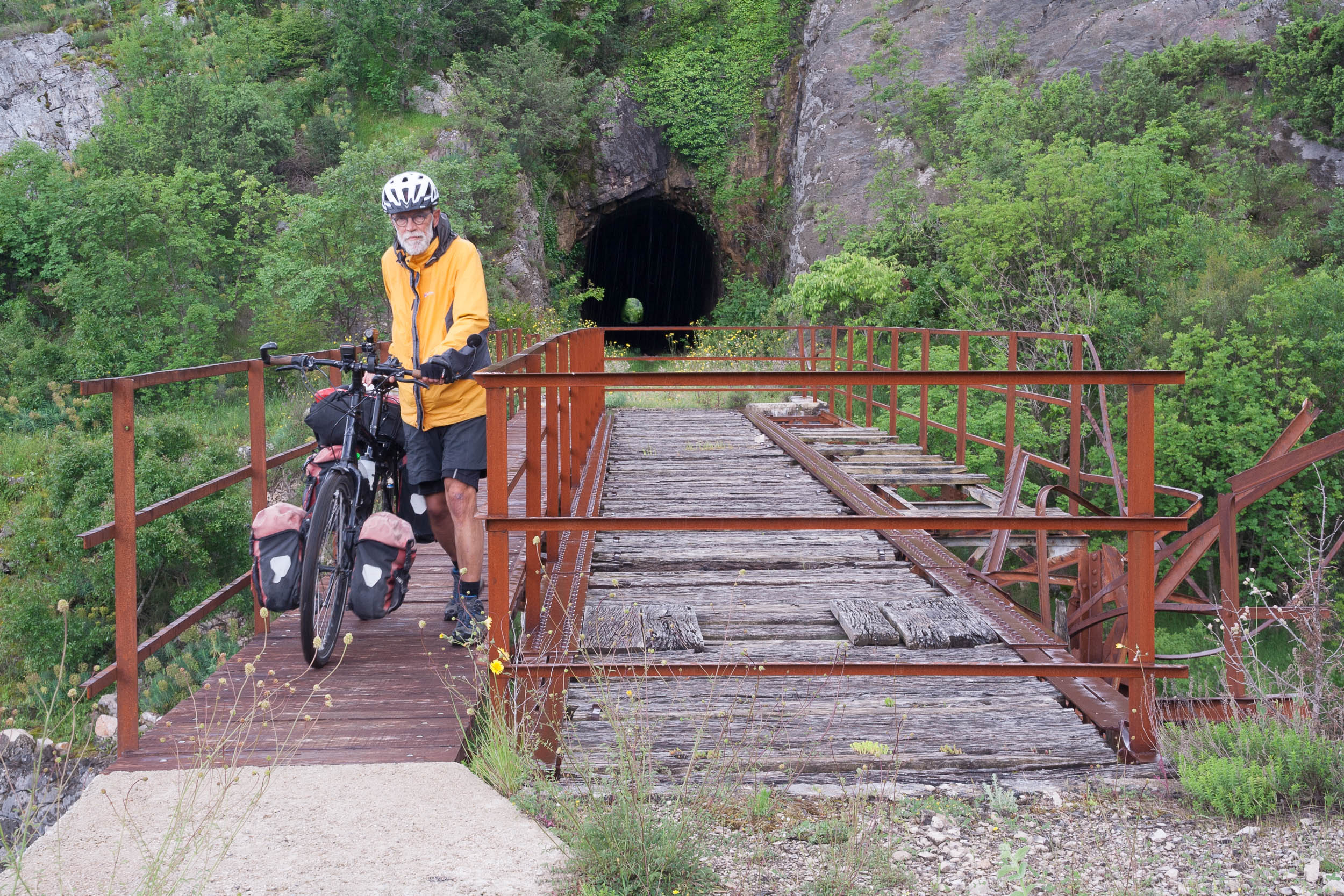
Tunnel and bridge
Most of the trail is like this. Flat and paved 🙂
Having a break on the gravel section between Zavala and Ravnor
From Capljina to Mostar you will follow quiet roads along the railroad which is still in use here. There is one unpaved section here but it is not a real challenge. Signposting is good here. Overall the traffic is very light. Between Invanica and Capljina we saw two cars in one and a half day.
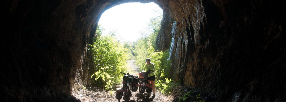
Tunnels?
There are twelve tunnels all on the unpaved sections. All of them are dark so a light is advised. Only a few of them are (very) long. Red and white reflectors are attached to the walls. The two or three longest tunnels have a lively bat population.
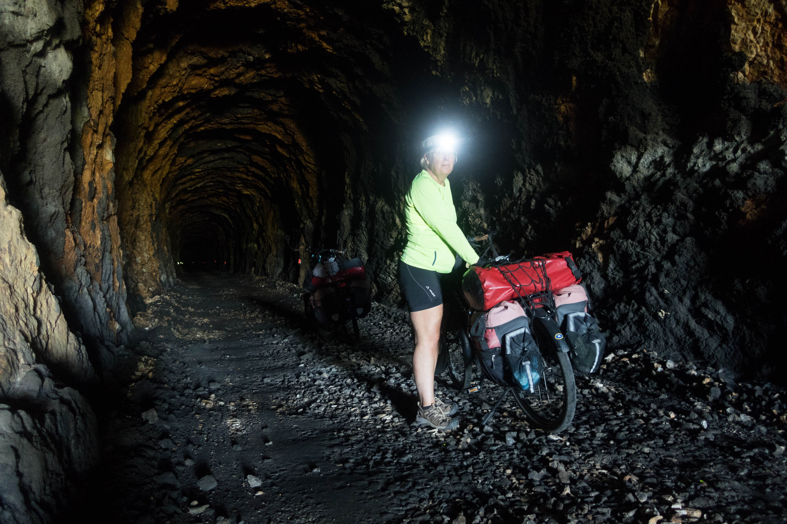
In long tunnels a light comes handy
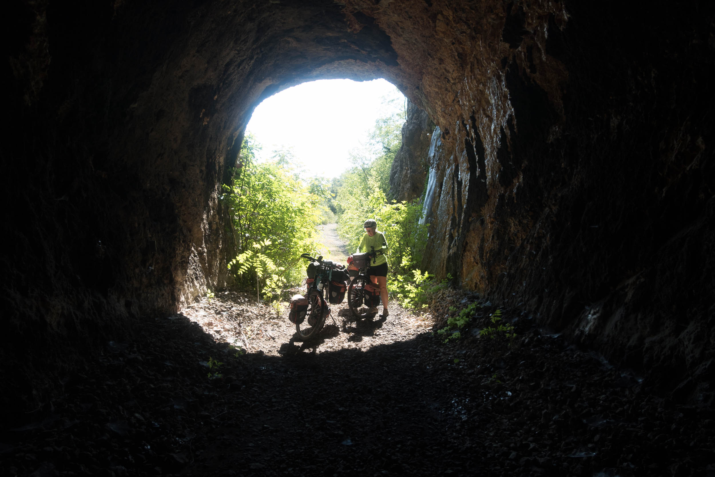
Entering a tunnel
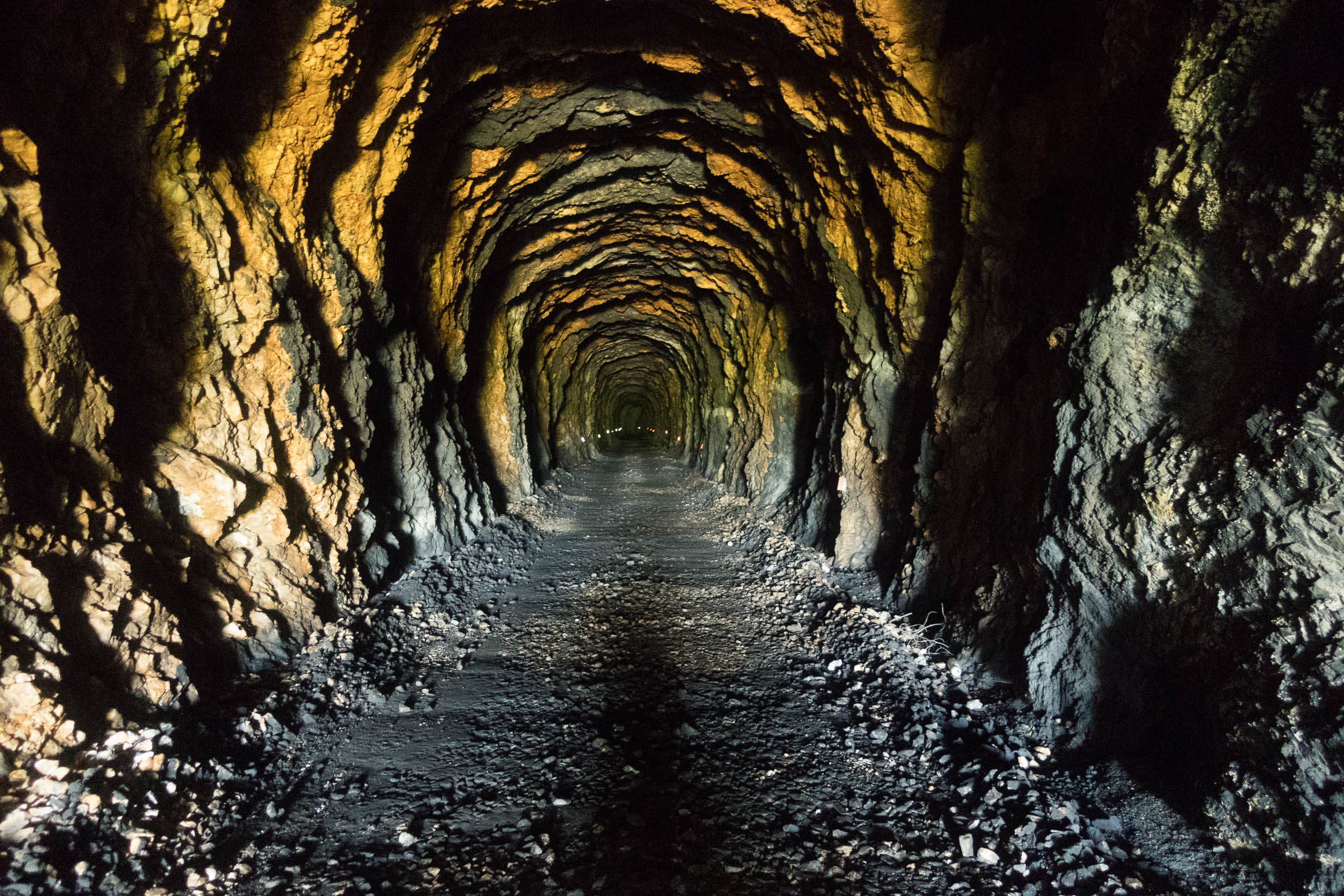
Only the longest tunnels are really dark halfway
Mines?
This used to be a war zone in the ’90s. All mines have (probably) been cleared but there are still some warning signs.
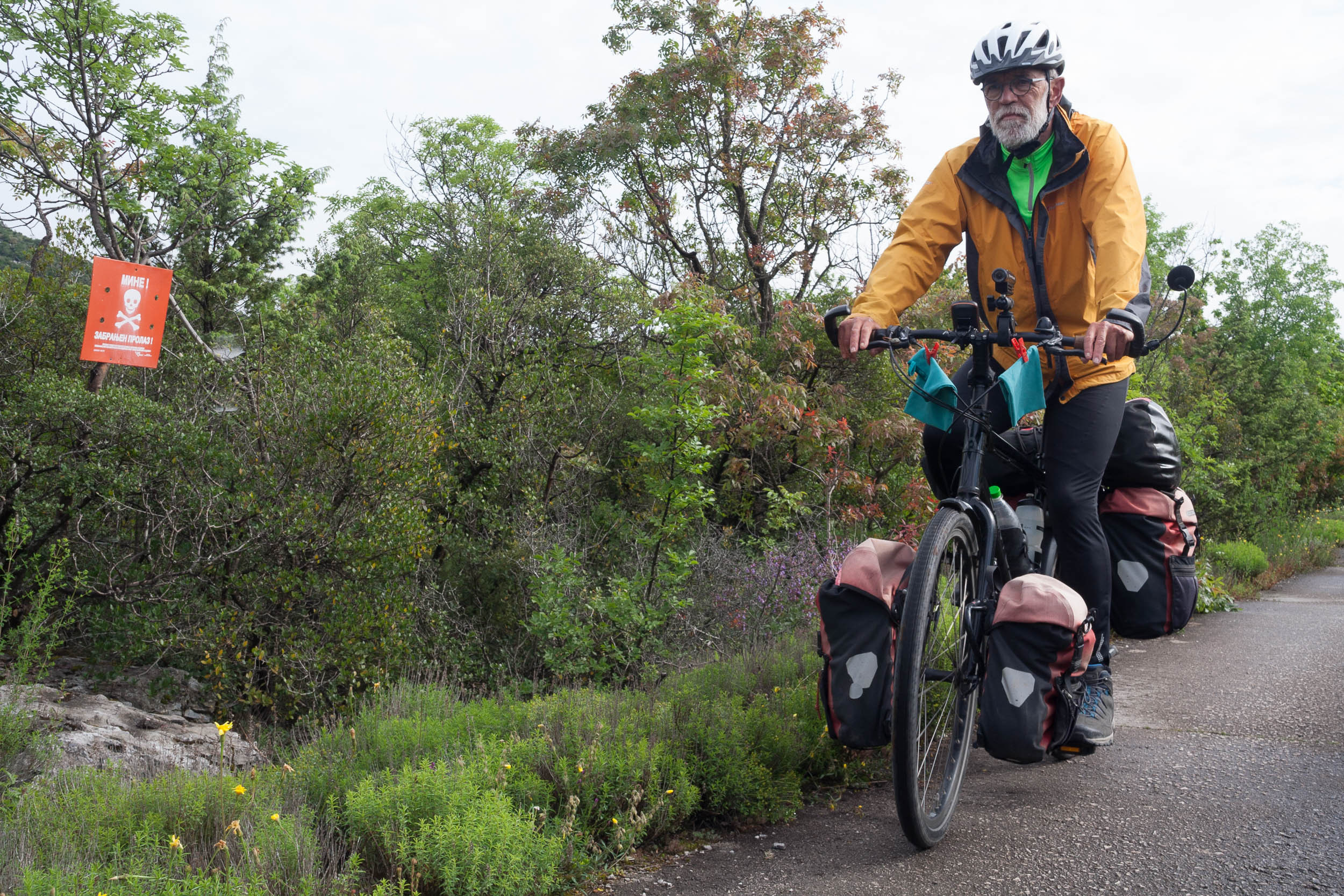
there may be some mines here…
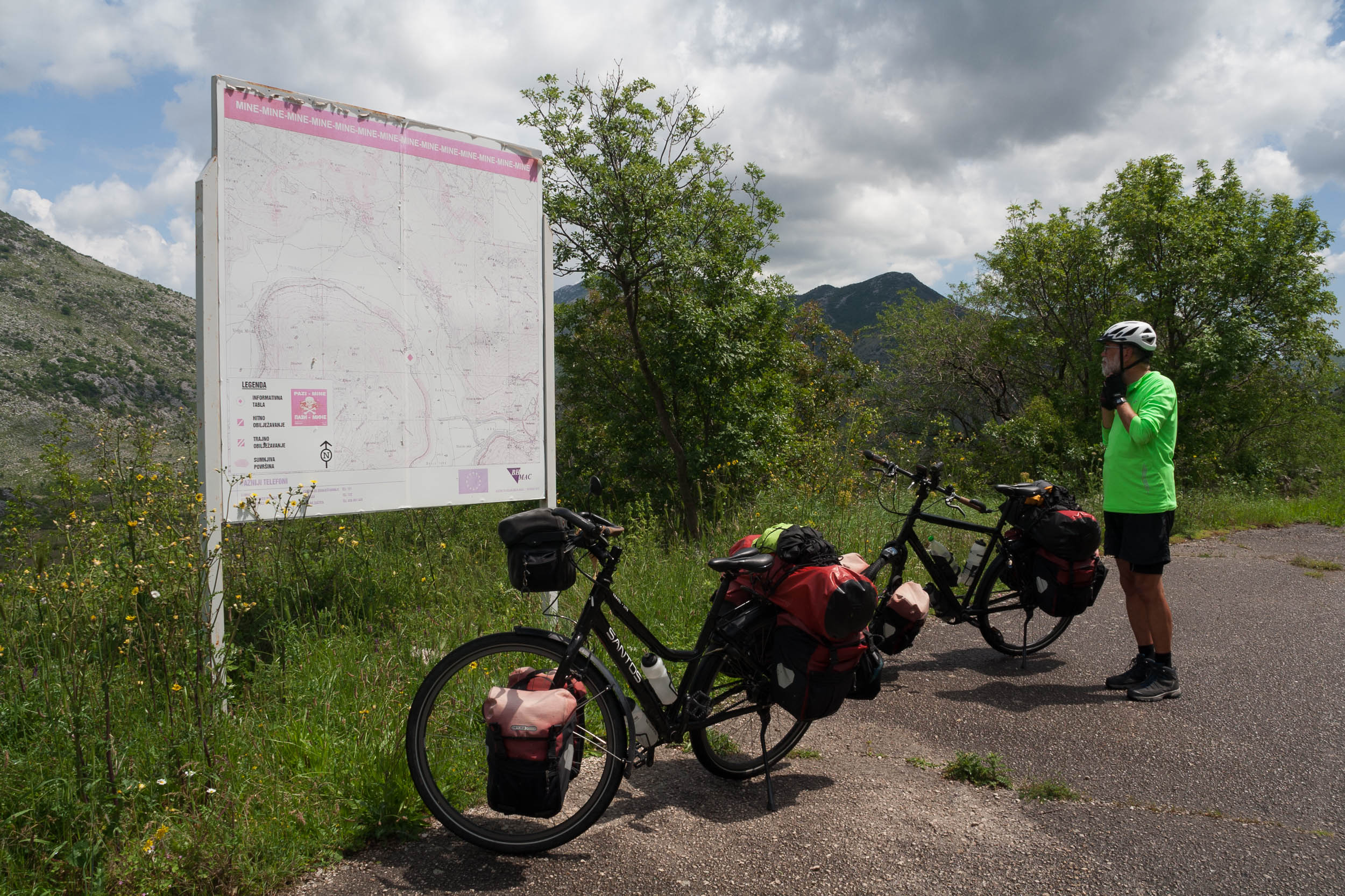
Map (the only one we saw) showing locations of mines.
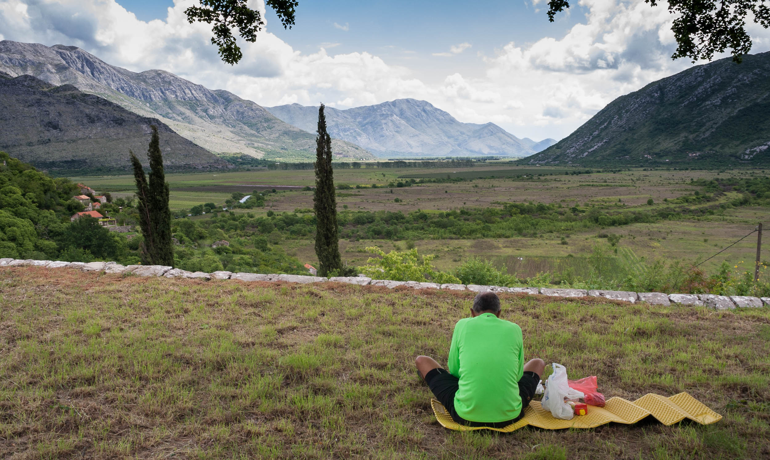
Rest areas?
The official maps and brochures may show pick-nick tables etc. but not all of these (still) exist.
There are a few pick nick tables along the route
Is it flat?
Yes, as trains cannot climb steep hills most of the Ciro is flat as a pancake or has a very subtle grade. Only the most northern gravel section (where we descended towards Capljina) has a noticeable grade. Trains going uphill here needed two locomotives to pull and one to push!
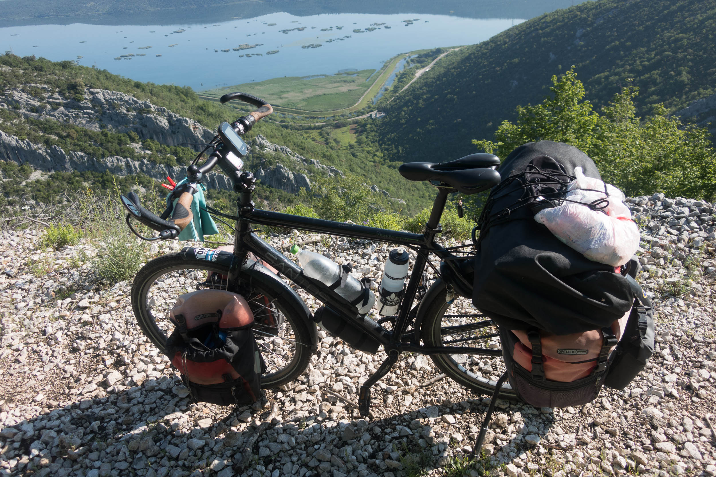
The paved alternative of the route is somewhere down there
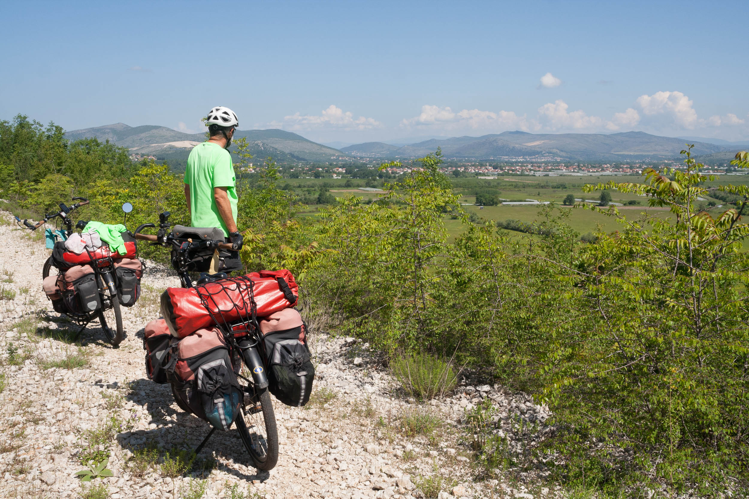
View of Capljina in the distance
A bit more on the official Ciro website with some brochures and maps (partly in English)
