On these pages you’ll find all the information you need for a bicycle-trip around the island of Sri Lanka. We’ve included information about maps, accommodation and routes. And a detailed description of the route we followed.
We’ve made this trip in September and October 2004. Starting in Negombo and traveling clock-wise around the island for 1200 kilometres.
Map with our route
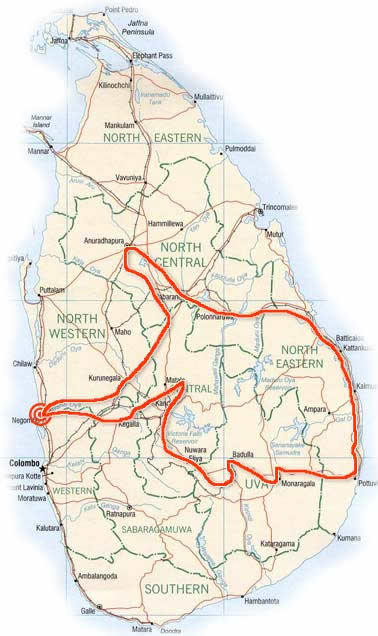
Total distance traveled 1200 km in 4 weeks. The route we followed is described below in detail.
Negombo – Dambulla (130 km)
From Negombo we took a secondary road through Badalagama and Narammala. This avoids most of the busy A6 from Colombo to Kurunegala. There is (like on many other roads) a constant flow of traffic. The second half has some hilly sections. Accommodation is available in Narammala.
From Kurunegala it’s only 60 km to Dambulla with plenty of accommodation and the famous rock temples.
Dambulla caves
Dambulla – Anuradhapura (70 km)
The A9 north to Anuradhapura is quiet and in good condition. At Kekirawa (Resthouse) we took a small detour travelling along the rural B64. This road is bumpy and narrow and winds through villages and rice fields. The B64 ends on the A28 leading directly to the Anuradhapura Ancient City area.
Getting around Anuradhapura by bike
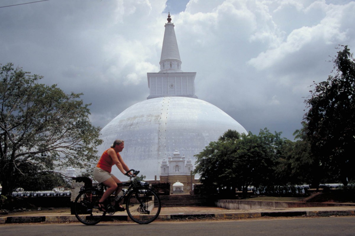
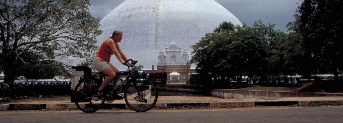
Anuradhapura
A bicycle is without doubt the best way to visit the sprawling temple complex. Distances between the various ruins are at least 3 kilometres. A good place to lunch is the Tissa Wewa Resthouse. Inside the ancient city area only cold drinks are available. Signposting can be erratic; we had difficulties locating some of the more remote sites. Some hotels and guesthouses have bikes for rent. Tip: It’s nice to ride around the Tissa Wewa tank on the traffic free gravel road.
Anuradhapura – Sigirya (80 km)
Highway A9 south is well paved and carries few traffic. There is accommodation at Galkulama and Tirappane. The A11 from Maradankadawala to Habarana is a narrow very bumpy rural road. Habarana has all facilities, including a Resthouse. About 2.5 km east of Habarana is the signposted turn-off to Sigiriya. This very narrow road leads directly to the Sigirya Rock (13 Km). The last kilometers are in bad shape. There is a chance to see elephants here.
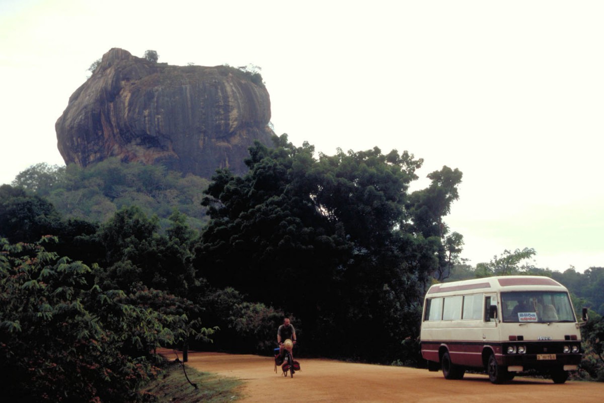
Cycling near Sigirya Rock
Sigirya – Polonnaruwa (55 km )
 Travel north again back to the A11. This part of the A11 was rather busy; we counted at least 35 busses per hour. You can find accommodation in Minneriya and Giritale. The roads passes through the Minneriya Giritale Sanctuary; you may see elephants right along the highway.
Getting around Polonnaruwa
A bicycle is without doubt the best way to visit the sprawling temple complex. To visit all major sites you’ll cover at least 15 km. Signposting is good; it’s easy to find everything without the help of a guide.
Polonnaruwa – Arugam Bay (the East Coast) (230 km)
Once you’ve crossed the large and well guarded Mahavelli bridge you enter a different Sri Lanka. There are numerous fortified military camps along the very narrow and quiet road, leading east. There are some well marked mine fields on this section. Beyond the busy village of Velachanai is the coast. Basic accommodation can be found at the villages of Kalkudah and Passekudah. This once was Sri Lanka number one beach resort. All that is left now are the burned out ruins of the hotels and guesthouses. The beach is white, lined with palm trees and completely deserted.
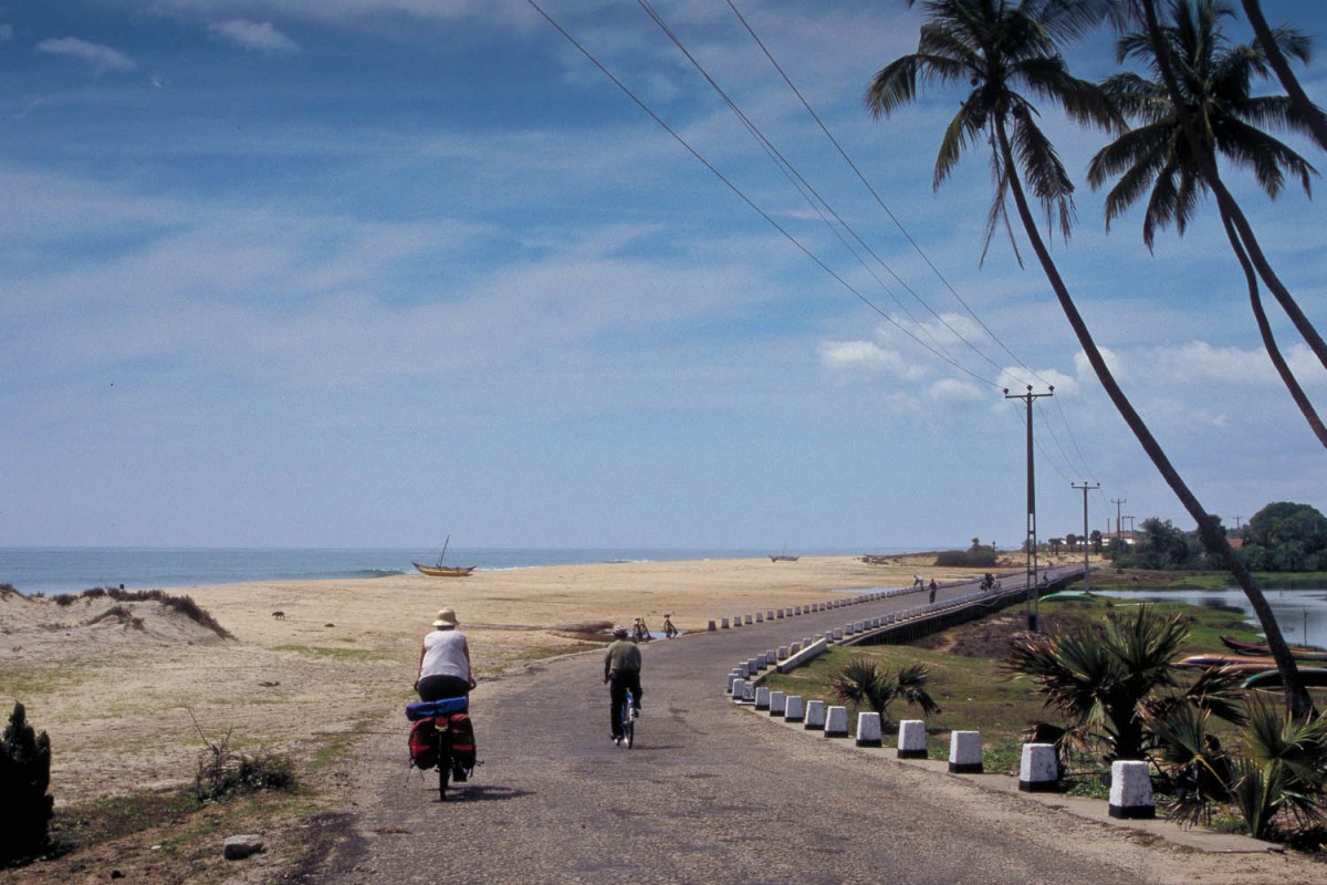
Riding along the west coast
Until Batticaloa military presence is strong. Every junction has a checkpoint surround by barbed wire and mine fields. Heavily armed soldiers patrol the streets. The 30 km road south to Tamil Tigers (LTTE) stronghold Batticaloa follows the coast but you won’t see much of the ocean.
South of Kattankudi the minefields disappear and the army is less visible. The road leads through endless villages. 80 km south of Kalkudah is Kalmunai. Kalmunai has a crumbling Resthouse and the highly recommended new London Guesthouse (on Resthouse Road) where we had the best rice and curry in Sri Lanka.
Another day cycling south are Pottuvil and Arugam Bay.
Unrest on the East coast
On our trip this road was extremely quiet because of unrest in the town of Akaraipattu. While cycling into this town we found the main road blocked by trees and smouldering car tyres. There obviously was something going on; few people were on the streets and all shops were closed. We were stopped by police and military but where able to continue without any problem. Read what happened on Tamil.net
The area south of Akaraipattu is even more remote. Only small villages and the remains of deserted ‘refugee camps’ line the road. South of Komari there is again a chance to see elephants along the road.
Arugam bay has a beautiful beach and a wide selection of accommodation.
Arugam Bay – Monaragala – Badulla – Ella (170 km)
The first 35 km are flat. Again you may see elephants here. in or near the Lahugala Kitulana NP. At the junction with the Ampara road are several shops and accommodation. Beyond this junction the road starts to climb slowly towards Monaragala. Few trucks and busses use this road. Monaragalla (70 km) has at least two hotels.
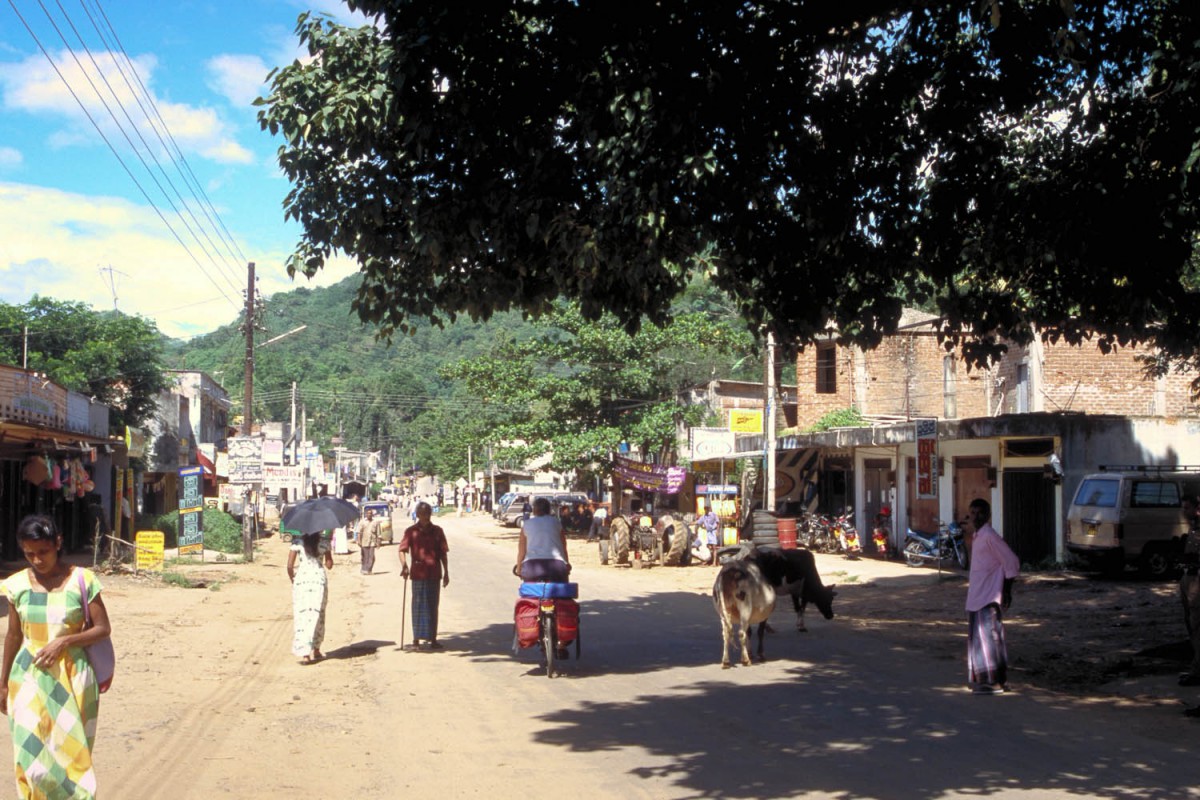
passing through a sri lankan village
The hilly A22 ascends steadily towards Passara at 875 m. Of the remaining 20 km to Badulla 10 are uphill and 10 downhill into town (alt. 670 m).
A side trip to the Duhinda falls
These beautiful falls are 5 km out of town. The last two km descend very steep to the falls. The actual falls are a 1.5 km walk along a well used track.
The Badulla – Ella trip is an easy one. The road closely follows a valley and slowly climbs to Demodara at 930 m. After short and steep climb you roll into Ella (1040 m) with it’s famous view.
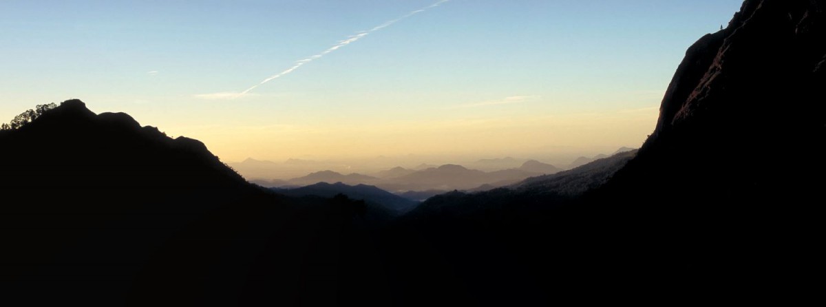
Ella Gap at sunset
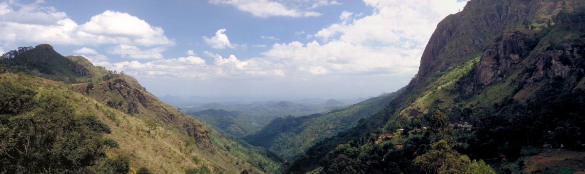
Ella Gap
Ella – Nuwara Eliya (60 km)
We traveled south to Bandarawela (alt. 1400 m) and then along a slowly descending rural B-road to Welimada (alt. 1200 m). From Welimada, Nuware Eliya is only 18 km away. Of these 18 km, the first 10 are however very steep. Nuwara Eliya is located at 2000 meter and probably the coolest town in Sri Lanka. There are numerous hotels up here.
Nuwara Eliya – Kandy (75 km)
What goes up must come down. The road to Kandy steadily descends all the way to 700 m above sea level. The first 20 km, until you reach the Ramboda Falls, are very steep and narrow. Winding through tea plantations.
The rest of the road is now (Oct. 2004) completely under reconstruction. When this is ready you’ll be able to descend in only a few hours on a excellent wide road. The Gampola – Kandy road is busy but wide with even a narrow shoulder.
Kandy – Matale – Pinnawela (105 km)
We took a detour through Wattegama to travel to Matale and the sights just north of it (the spice gardens and the colourful temple at Alu Vihara). Matala has a reasonable Resthouse.
From Matale we traveled south on rural roads to the Elephant Orphanage at Pinnawela. This was a very quiet but bumpy and hilly route winding through small villages. There is virtually no signposting here; you’ll have to rely on asking directions and your sense of direction or map.
On back roads from Matala to Pinnawela
From Matala we rode south to Alawatugada and from there asked for directions to Medawela and Hedeniya on the main Kandy-Kurunegala road. From here travel north and take the turnoff to Rambukana. From there the elephant orphanage is just a few km away.
There is plenty of accommodation for all budgets near the orphanage and on the road south to Kegalle.
Back to Negombo (75 km)
Follow the Kandy – Colombo A1 highway to Ambepossa. Locate or ask for the unsigned turnoff for Ambepossa Railway Station. From there find your way to Mirigama. From Mirigama a 30 km straight and increasingly busy road leads to downtown Negombo.
