Our route
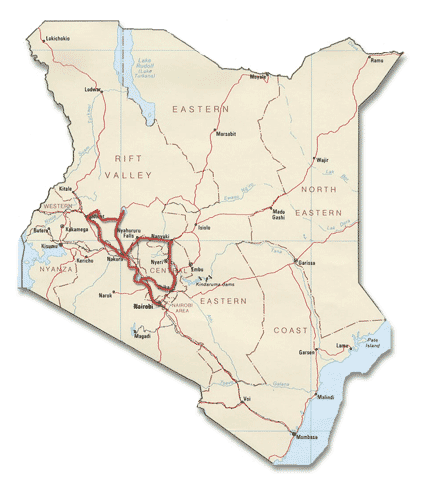
our route in kenya
Arriving at Nairobi
Nairobi International Airport is about 20 – 25 kilometers from downtown Nairobi. The main roads leading into the city are wide. We arrived on a Sunday; traffic was low.
To avoid the hassle of cycling through downtown Nairobi we stayed at campsites in the Karen suburb, permitting an easy exit towards Naivasha.
Nairobi – Naivasha (90 km)
Leaving Nairobi is easy; when in doubt ask for directions. The main highway (the A104) to Naivasha is busy but has a good shoulder all the way to the town of Limuru.
There you’ll have to choose: take the wider, newer but very busy (and partly without shoulder) new road or descend on the narrow old road directly into the Rift Valley. We took the old road and didn’t regret it. The main traffic here consists of heavy loaded trucks, slowly climbing out or descending into the valley.
to the right the old bumpy road; to the left the excellent new road (under construction)
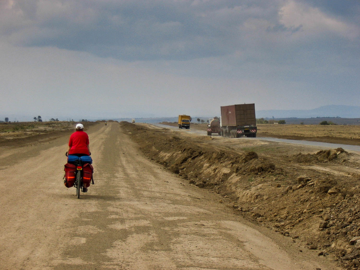
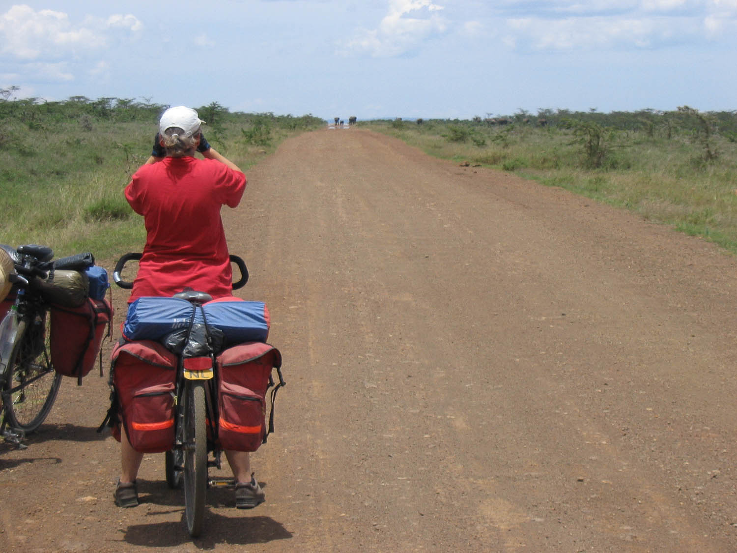
All the way to the Narok turn-off the road is reasonable, but detoriates quickly after this point. With plenty of monster potholes spiced up with bumpy tar.
A completely new road is under construction and cyclists can already use the hard packed dirt surface almost all the way to Naivasha town. It’s scheduled to be finished by 2008.
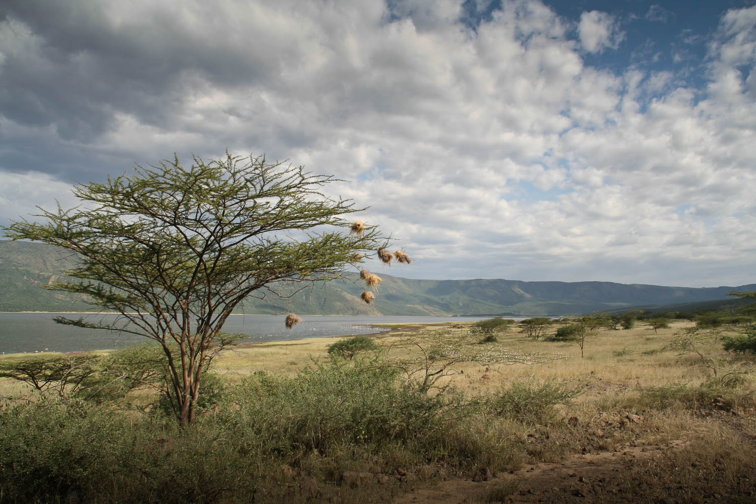
Around Lake Naivasha
The road south of Lake Naivasha is good (with some exceptions) until the village of Kongoni. Accommodation is plenty along the south shore of the lake.
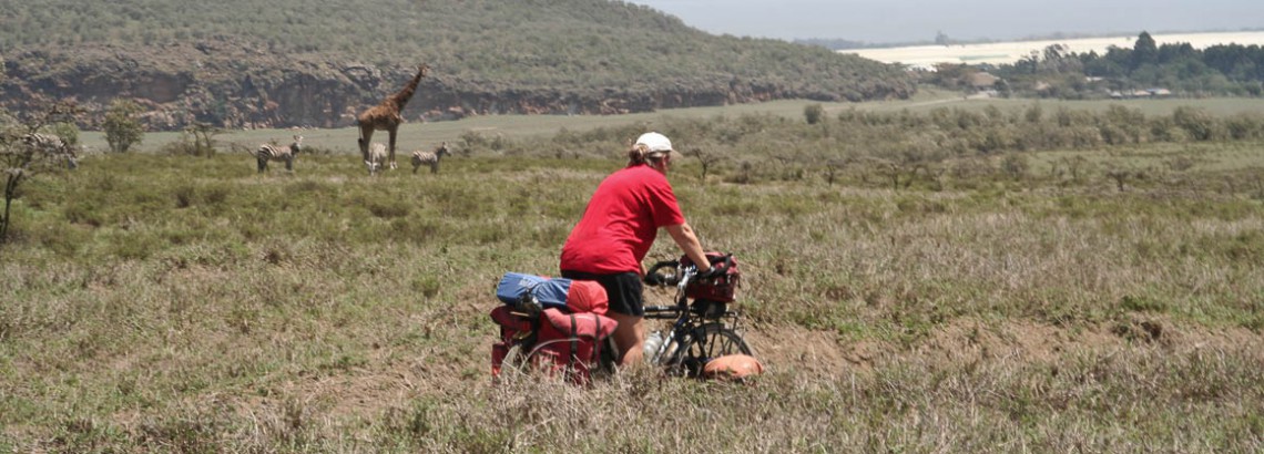
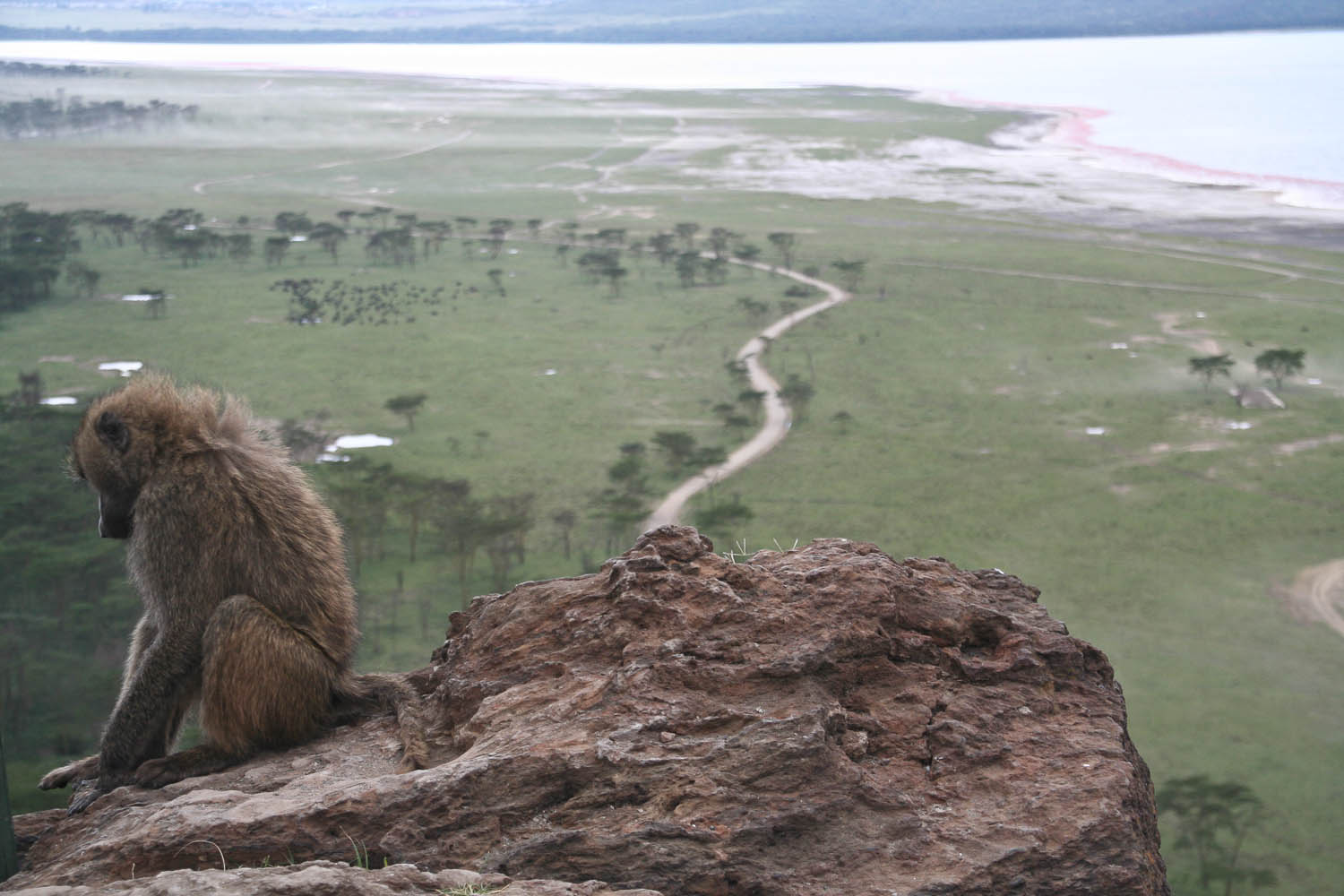
We cycled through Hells Gate NP. It’s one of the few National Parks that you can visit by bicycle. Bikes are for rent at several campsites and near the main gate.
The first two km to the main gate are rough and dusty. The main road through the park is unpaved but good. Some of the loops are 4WD only. You’ll see plenty of zebras, giraffe, gazelles etc. The ranger station sells cold drinks and offers a shaded picknick area.
Hells Gate NP
Just beyond the ranger station you enter the area of the geo thermal power station. The road is excellent but the downside of all this high-tech is that you’ll leave the tranquil surroundings of the park behind. The roads descends steeply to the Lake.
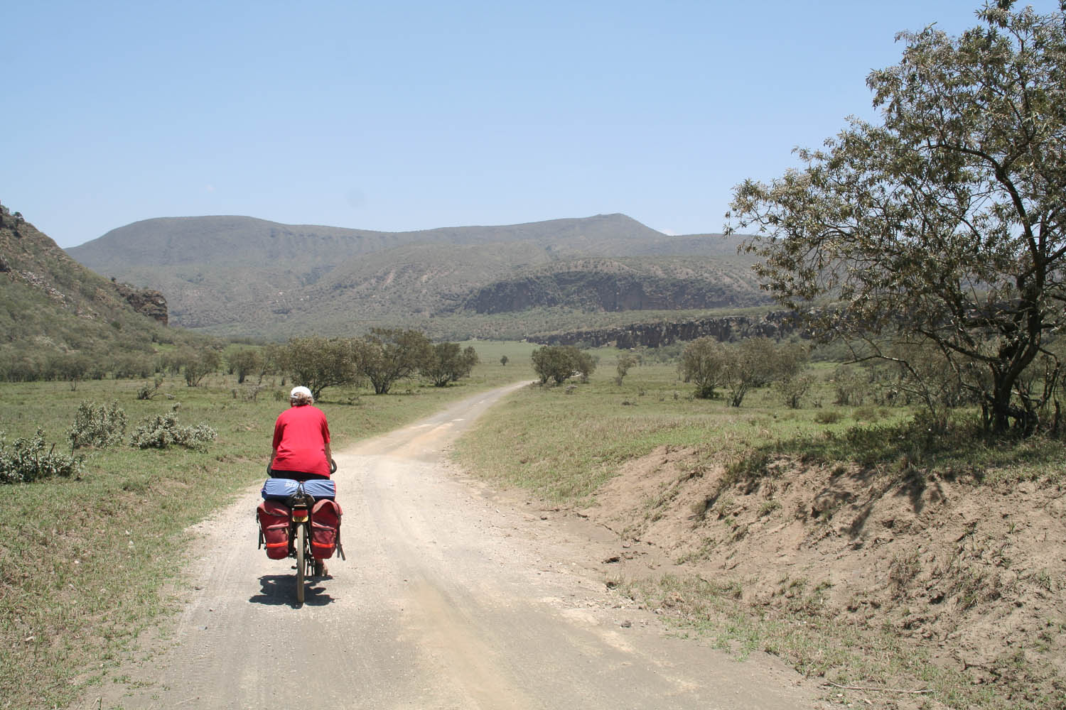
We travelled further to Crater Lake on the western shore of Lake Naivasha. The Crater Lake Game Sanctuary is 5 kilometres beyond the village of Kongoni; the road is very rough and dusty.
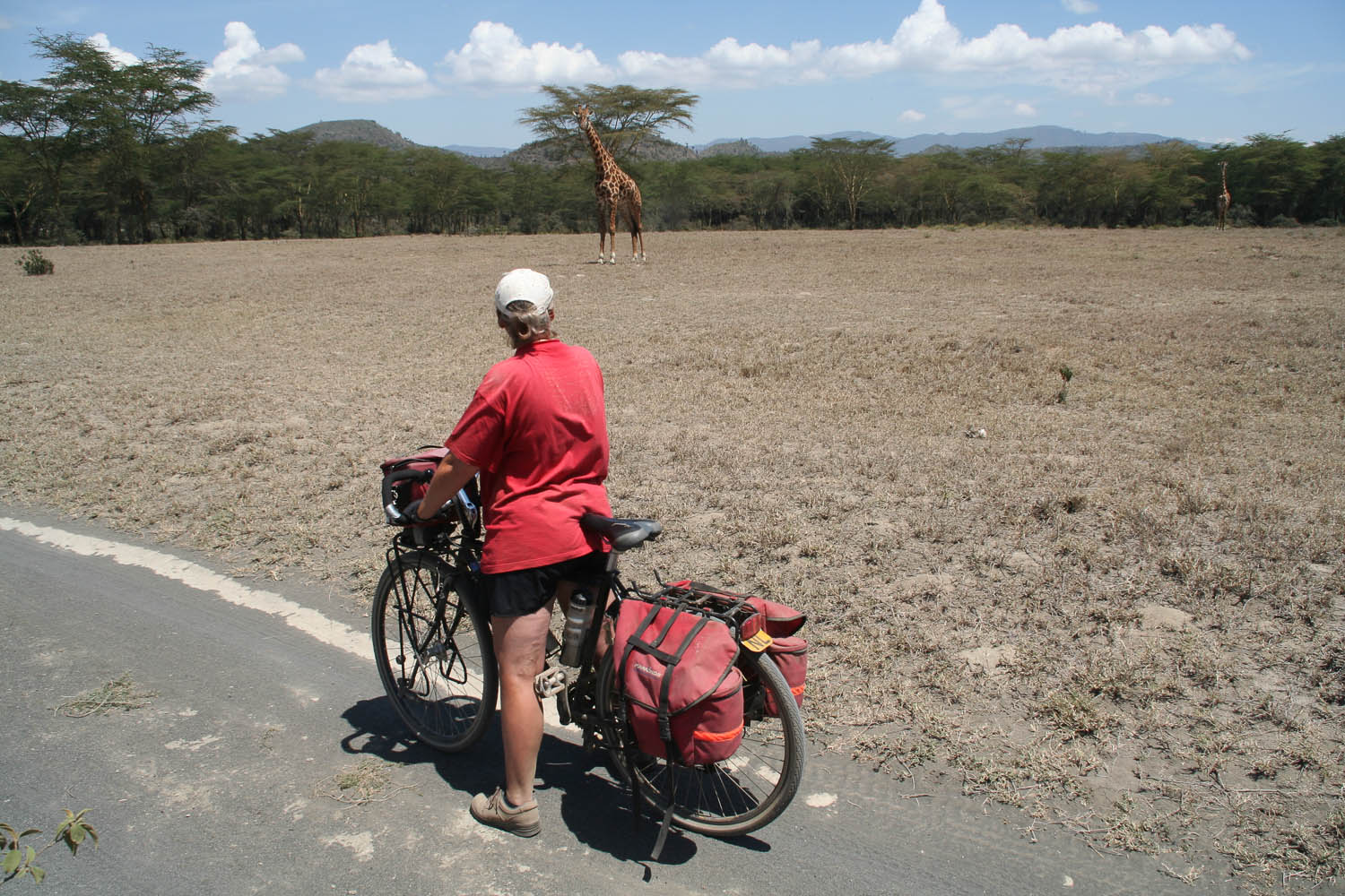
viewing giraffes at Crater Lake Game Sanctuary
In this area we saw wild animals near or crossing the road. Crater Lake offers accommodation (lodge and basic camping) and excellent meals. The sanctuary can be visited by bike and is much better value than the relatively expensive visit to nearby Hells Gate National Park. You’ll be able to see the same animals at a very close range. Entrance fee is only 100 Ks.
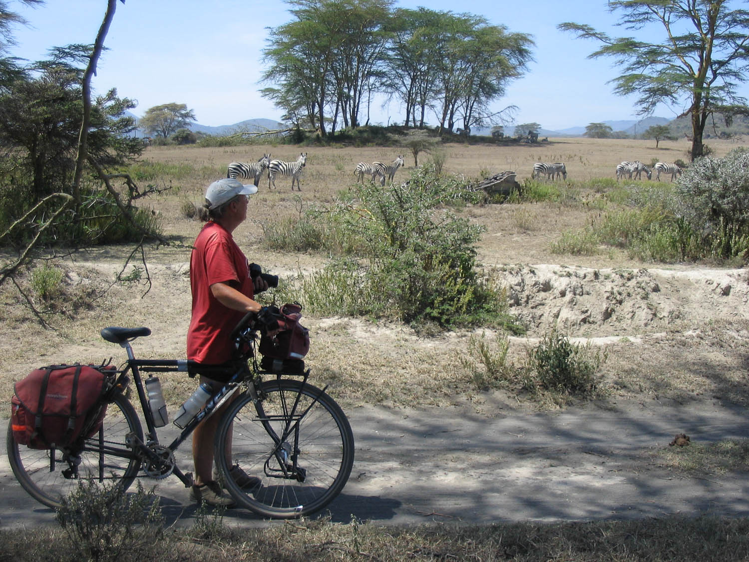
spotting zebras at Crater Lake Game Sanctuary
It’s possible to continue along the North Lake road and travel in the direction of Lake Elementeita and Lake Nakuru. Be prepared for rough roads and steep climbs. But the views are good and there’s almost no traffic out there. See the Nakuru – Naivasha section on this page for the details.
Naivasha town has a good supermarket and a shop selling some bicycle parts.
Naivasha – Thika – Maragu’a (165 km)
From Naivasha we climbed back to the edge of the escarpment following an unpaved road (good hard packed dirt) in the direction of South Kinangkop. All went OK until we reached a junction at the village of Gitioro. We asked directions to Thika but an hour or two later we saw Lake Naivasha appearing deep below us on our right hand side! It turned out we cycled on an excellent new road that was not on our map!
We finally reached the village of Kamea were we started continuing in eastern direction. The locals call this the forest road. And indeed, for a few hours we cycled through dense forest obviously inhabited by many elephants.
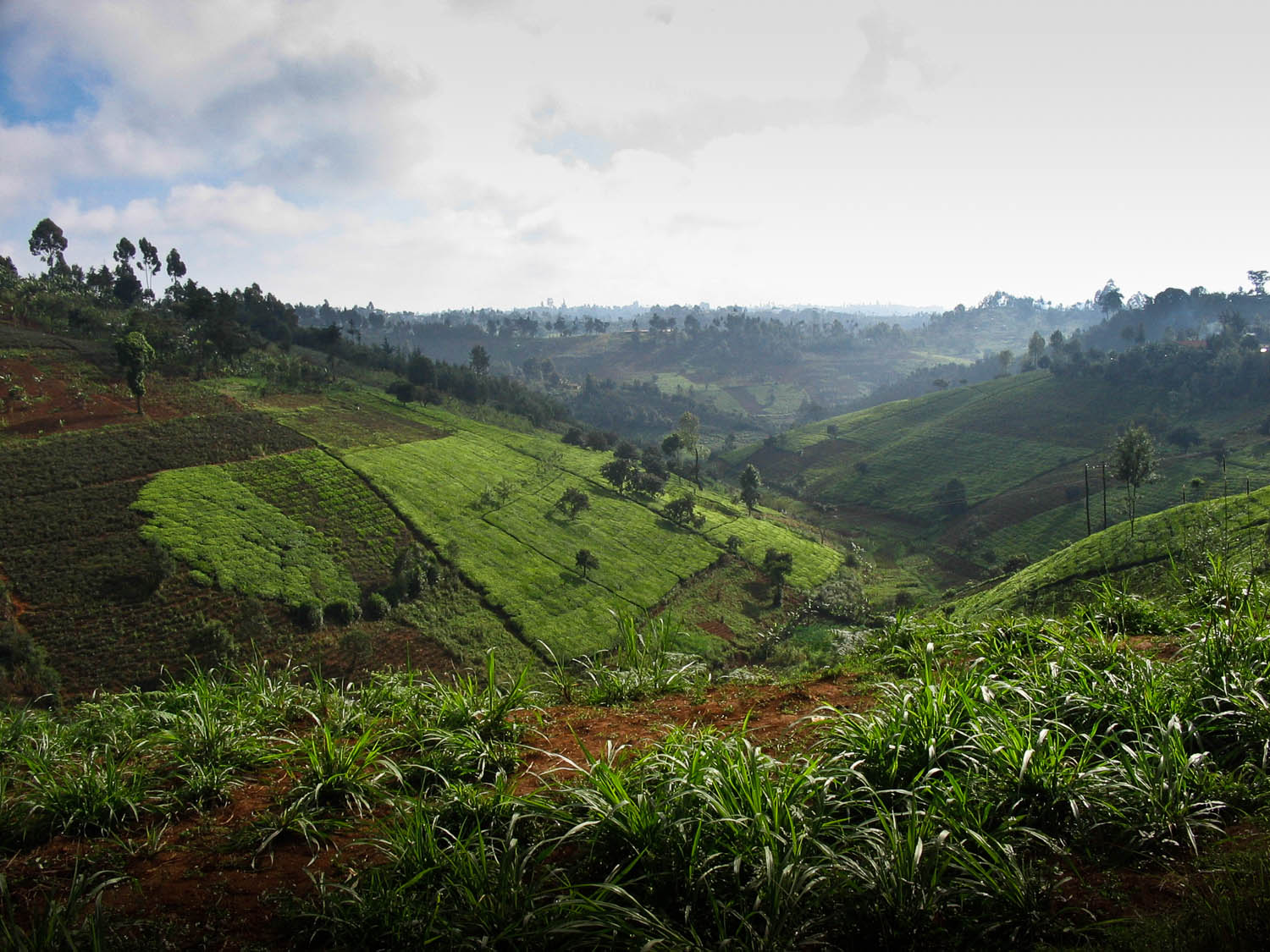
tea plantations north of Nairobi
At the other side of the forest we reached the village of Gakoe. It has some shops and a police station but no formal accommodation. We camped at an abandoned sawmill owned by the friendly mr. Muoro. This is a high altitude area; you’re amidst vast tea plantations.
It’s almost 35 km’s downhill to the town of Thika, biking through tea and coffee plantations. Thika has all services.
We traveled further north following the busy A2 highway for a while. Fortunately the road is dual-carriage and has a shoulder. A quiet roller-coaster local road continues to Maragua and Murang’a.
Maragu’a – Wajee – Nanyuki (150 km)
To get to the remote nature reserve of Wajee we had to survive a few more kilometres on the ever busy A2. Some parts here are narrow and hilly with a never ending stream of cars, trucks and tourist vehicles heading north to Mt. Kenya. Here the A2 no longer has a shoulder, nor is it dual carriage.
Just beyond the town of Karatina (large supermarket) is the signposted turn-off to Wajee Nature Camp. This road is excellent and quiet. The last 4 km to Wajee are on a rough dry weather road. Signposting to the camp is good.
Traveling north from Wajee the Nyeri – Kiganjo road is 30 km away. North of the junction of the Nyeri road and the A2 the landscape changes: it widens and the area seems to be much dryer.
The A2 here is surprisingly quiet, mostly flat and in good condition. At the village of Naro Moru is a good choice of accommodation. The Naro Moru River Lodge offers very expensive camping for 10 US$ per person.
north of Naro Moru
The remaining 30 km to Nanyuki are easy. The highlight is the crossing of the equator about 1.5 kilometres before the Nanyuki city limits. There is the obvious sign and dozens of souvenir stalls. This is Kenya’s most famous equator crossing with more than 100 tourist vehicles visiting on a busy day! Watch out: in other parts of Kenya creative souvenir sellers have created multiple equators within short distance from each other 😉 On this trip we crossed the official equator four times.
Nanyuki has a wide selection of accommodation; the most eccentric of these is without doubt the Nanyuki River Camel Camp a few kilometres west of town. It offers very basic camping and the rare possibility to spend a night in original Somali huts.
Nanyuki – Nyahururu – Nakuru (165 km)
From Nanyuki a lonely and rough road leads west to Nyahururu (aka Thompson Falls). The first 5 kilometres until a signposted junction are good tar. The following 48 km to the junction with the Rumuruti road are reasonable. This area is very remote and we had a close encounter with wild elephants here.
elephants crossing
Follow the Rumuruti road north for a few kilometres and turn west again to Nyahururu (there is a faded signpost post saying: “T Falls 26“)
This road quickly detoriates with deep eroded tracks and a very rough surface. We had to walk several kilometres here. At some parts alternative tracks have been created by local cars and cyclists. This road ends 15 kilometres south of Nyahururu and a few meters south of another equator crossing. Nyahururu has all services.
About 15 kilometres beyond Nyahururu is the edge of the Rift Valley with the Subukia Viewpoint.
From here it’s 6 km downhill to the village of Subukia itself. The roads continues to descend but becomes increasingly busy. It ends on a very busy and narrow part of the Nairobi – Nakuru highway. Get off this road asap!
Baboon at Nakuru National Park
From Nyahururu it is possible to take back roads to Lake Bogoria and further to Lake Baringo. Roberts Camp at Lake Baringo sells a leaflet on this track.
Nakuru – Lake Baringo (125 km)
This is a approx. 125 km ride, but it can be done in a single day. Once you have left busy Nakuru behind it’s downhill most of the way.
The initial direction to follow is the road to Eldama Ravine. At Ravine Junction continue north to Mogotio. The road is in excellent shape here.
Beyond Mogotio the quality varies with large potholed sections every now and then. There are few villages and hardly any traffic. Already 45 km before you get to Lake Baringo you’ll see the lake in the far distance. At 20 km before Lake Baringo is the village of Marigat (not much to do here) and the turn off to Lake Bogoria.
To Lake Bogoria
From the Nakuru – Baringo junction the road descends very steep towards the lake for only a few kilometres The rest of the 20 km trip is through flat rural countryside.
The lake Bogoria National Reserve is now little visited as most of the famous flamingos are now (back) at Lake Nakuru. It’s a quiet spot with some great scenery.
Lake Bogoria
We continued along the park road until the well known hot springs. It’s allowed to camp there although there are no facilities at all. In weekends cold drinks may be for sale here.
Lake Baringo – Eldoret (150 km)
From the Lake Bogoria junction it’s approx. 40 km to Kabarnet. Kabarnet is located on a ridge high in the Tugen Hills so this is a long steep climb up all the way. The road is good. It climbs steadily with great views of Lake Baringo deep below. Kabarnet has some hotels, an ATM and an interesting national museum.
As Kabarnet is perched high in the hills you’ll start with a 15 km descend to the Kerio Valley. Followed by another 15 km of mild ascent through the valley itself. Only the last 10 kilometres to the town of Iten are steep.
Iten is situated on the edge of the escarpment. Looking for a room with a view? Stay a night at the upmarket Kerio View Hotel. The rooms have stunning views across and down into the valley. On a clear day you can see the houses of Kabarnet. Those traveling on a budget: 5 km before Iten we saw a sign to an “overland campsite..”
Iten is 2300 m above sea level and a popular high altitude training area for many athletes.
To big town Eldoret it’s only 30 km downhill. The town has all services including an excellent bikeshop were we purchased extra tubes and patches. About 15 kilometres from Eldoret, on the C54 towards Kaptagat is the Naiberi River Camp; a nice camp site mainly catering for the so called overland trucks.
Eldoret – N’joro – Nakuru (185 km)
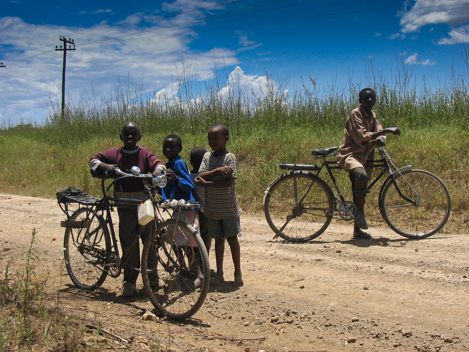
fellow cyclists on the road
We followed the C54 to Eldama Ravine and south to Nakaru. An alternative is to take the more direct route but this involves a long stretch along the busy A104 Nairobi – Uganda highway.
The C54 is generally in good condition; after 30 km’s from Naiberie River Camp you’re back at the edge of the escarpment with some good views at two viewpoints. After these viewpoints there is a 5 km steep descent followed by an equally steep ascent (2 km). The road now deteriorates with many potholes and rough sections.
Once you’ve passed through a large forest it’s downhill all the way the small town of Eldama Ravine (several hotels).
From Eldama Ravine we headed south towards Nakuru. The first 30 km to Eldama are mainly downhill. The rest is relatively flat. We traveled through the village of Menengai towards Njoro. A few km west of Njoro is another typical overland style campsite (Kembu Camp).
Nakuru is approx. 30 km’s away.
Nakuru – Lake Elementeita – Naivasha (90 km)
Those traveling from the Nakuru area to Lake Naivasha have two options.
One is to take the C75 from Njoro to Narok and on the edge of the escarpment turn east to Elementeita. We were told that this involves a steep climb up the escarpment followed by a steep descent; this last one on a rough road.
We choose the easy option. Going through busy Nakuru and then travel south along the eastern border of Lake Nakuru National Park. The first 7 km of this road are in a advanced state of disrepair. The good news is that local cyclists have created a network of reasonable bike tracks.
Surprisingly after these 7 km the pavement is excellent all the way the village of Elementeita. You could continue further south here traveling on dirt roads east along Mt. Eburu (a.k.a. Mt. Opuru) and down to Lake Naivasha.
We turned east to spend a night at Lake Elementeita. This dirt road is, although very quiet and scenic, not recommended for those in a hurry. There are some very soft and dusty sections. Most of the road is rather rough. This track exits on the extremely busy Nakuru – Naivasha highway. The highway itself is in bad shape and cyclists are generally better off of using the unpaved shoulders.
After a night at the lake we left the highway as soon as possible. Near the village of Gilgil we headed east on the so-called Eburu road. This rough road has virtually no traffic and many unnamed junctions. You may have to ask directions several times.
The track winds through corn fields and small villages up the eastern slope of Mount Eburu. Once you see a large unfinished house (several stories) you are close to the top. A much rougher track descends steeply to Lake Naivasha where you’ll finally hit the Northern Lake road. We continued south to camp another night at the Crater Lake Game Sanctuary. The restaurant here is highly recommended.
Naivasha – Nairobi (90 km)
On our way back to Nairobi we took the newer upper road. This road is very busy with speeding cars and even faster busses. There are no trucks here; they have to take the lower old road. Fortunately there is a good paved shoulder to escape most of the traffic. The bad news is that after 40 km this shoulder is gone and the traffic still very heavy. We really did not enjoy this part and strongly advise other cyclists to take the quieter and more scenic old road. Beyond Limuru the outskirts of Nairobi come into view.
An alternative to Nairobi : Travel straight south from Lake Naivasha, cross the B3 to Narok and continue passed Mt Susua to the Ngong Hills. We did not do this but it probably is very scenic and quiet.
