All information on these pages is based in our personal experiences while cycling through Zimbabwe in September and October 1999. We cycled from Harare to Mutare and continued to Masvingo and Bulawayo. From Bulawayo we traveled to Hwange NP and Victoria Falls , mainly using public transport.
Overview of our route
The total distance we cycled was about 1400 kilometres.
Harare – Marondera
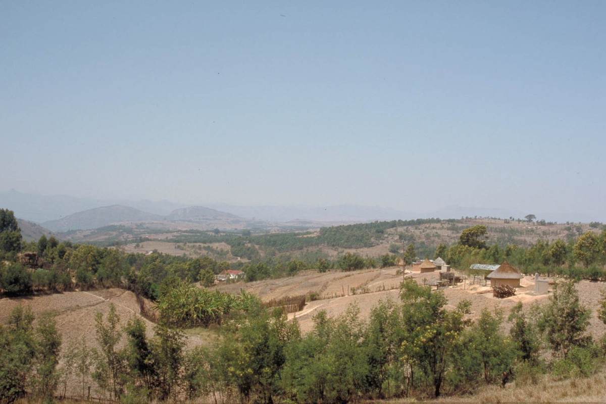
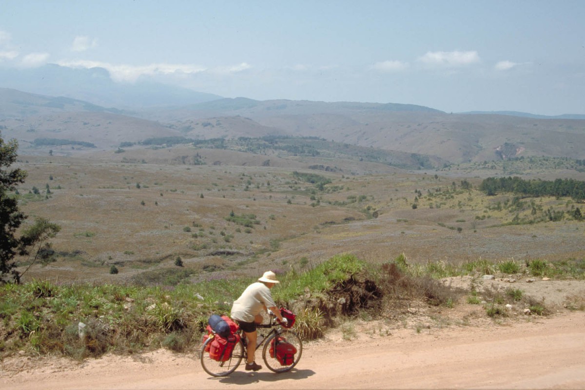
Zimbabwe: countryside
The wide A3 (with shoulder) is one of the main highways of Zimbabwe. The first 20 km out of Harare are busy but traffic thins after Ruwa. The road follows gentle slopes all the way to Marondera.
Marondera has plenty of shops including a well stocked supermarket on the main street. 10 kilometres beyond Marondera is Malwatte Farm which offers camping and other accommodation.
Marondera – Rusape (15 km)
after Marondera you enter the so called Eastern Highlands. This doesn’t mean you’ll have to switch to low gear immediately but from here on it’s more uphill. There are shops at Macheke. A mildly ascending road continues until you reach Eagles Nest (no services) where you reach a plateau. A bit further but off the road is Headlands, and another 34 km south-east and downhill is Rusape.
The Rusape Dam Campsite is way out along dirt roads at the eastern side of the dam. There should be signs on the Rusape – Mutare Highway for the right turnoff. We were told that the caretaker locks the gates and goes home at 16.00 hours when no campers show up. Unable to locate the campsite and uncertain whether it would be open we returned to Rusape and stayed at the friendly Crocodile Motel at the western entrance of town.
Rusape – Juliasdale – Nyanga
This is where the real highlands start. Just outside Rusape the road starts climbing steadily. The excellent and quiet road follows a ridge; you’ll have wide views to the east and west. The distance to Juliasdale is about 80 km of which 70 are uphill. At 52 km after Rusape is a turnoff pointing to the Hidden Rock Campsite and another 6 km further is the Brondsbury Hotel.
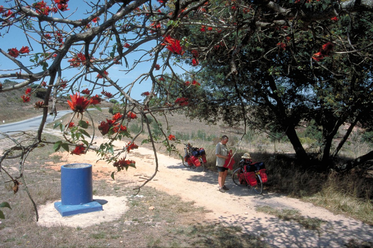
rest-areas (signposted as “Lay By’s”) with rubbish-bins and picnic tables are available along all highways.
As soon as you see the sign ‘sharp curves and steep gradients’ the steady climbing is over. After a steep descent with great views you climb again to the village of Juliasdale. The only accommodation at that moment was a expensive hotel. The campsite had closed.
The national parks campsite 13 km further north and downhill all the way on the road to Nyanga was also closed. Another 7 km further is Nyanga where the Village Inn offers excellent value accommodation and food.
Juliasdale – Mutare
Just 3 km north of Juliasdale is a junction for the Rhodes Nyanga National Park. No gates or entry fees here. This dirt road ( Placefell Rd.) brings you after about 6 km to the Scenic Road through the park. This scenic road is surfaced every here and there with ‘pre colonial asphalt’. After a few km’s there is a spectacular descent into the Park proper. You will pass the sign posted turnoffs to Pungwe Drift and Pungwe View. Pungwe View is 500 m up a steep bumpy road and offers a great view, pick-nick tables and a rubbish bin.
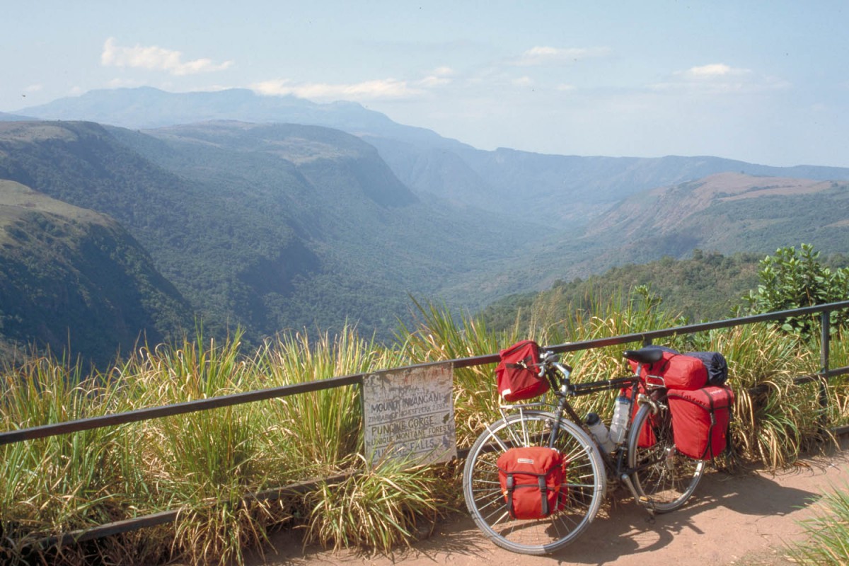
Pungwe gorge
From here it’s another 11 km to Mtarazi Falls. The last 4 km follow a very narrow and eroded dirt road past Honde View and ends at the Mtarazi Falls car park. There is a hefty entrance fee of 10 US$ for foreigners and those who plan to stay at the campground will have to pay the overnight entrance fee of 20 US$ per head.
entering Nyanga National Park
It’s cheaper to camp or stay at other places. Just before Honde View car park. we passed the Far and Wide cottages. Not sure that this place is still offering accommodation as they call themselves a outdoor education centre.
The dirt-road back to the Honde Valley road is rough and corrugated most of the time. It’s only 17 kms but although it’s mainly downhill a lot of hard work.
On the main Nyanga – Juliasdale – Mutare road it’s downhill all the way until you reach Manyika Bridge. This road is relatively busy and has no shoulder. Once you get to the Harare – Mutare highway the only challenge is to climb up the Christmas Pass. It’s only a few kms and when you see the sigh ‘3 kms sharp curves and steep gradients’ you’re almost at the top. Excellent views of Mutare from the top. The municipal campsite is on this road. The only other possibility to camp at the moment of writing is at the Border Home Hostel. The Tiger Kloof campsite has closed…
Mutare – Birchenough Bridge
This road is mostly downhill all the way. In fact you are descending from a high part of the country to a lower part. Vegetation will change along the way; e.g. the remarkable baobab tree will start to appear along the road.
Once you have left Mutare traffic on this road is sparse. There is no shoulder and road quality is good. About 40 km’s north of Birchenough Bridge and almost 90 km south of Mutare is the recommended Nyanyadzi Hot Springs Resort. There is only a small sign along the road so don’t miss it. Accommodation is available on a small dusty campsite or in chalets. The pools (hot, medium and cold) are great and so is the buffet style dinner!
The road to Birchenough Bridge continues to descend through a wide valley. Services in Birchenough Bridge are very limited. There is a hotel and a lot of small shops that all seem to sell the same. Birchenough Bridge was the lowest point of our trip.
Birchenough Bridge – Nyika
Twelve km beyond Birchenough Bridge is the Mapari Rest Resort. Chalets, camping and meals are available. This is the last possibility to get ‘luxury’ accommodation before Masvingo. For the following 25 km the main view along this very slowly climbing road is the fence of the Mapari Ranch. When the fence stops there is a small shop for cold drinks etc. a few kms later followed by the village of Chikuku. Not much available there. The landscape becomes more hilly but there is no serious climbing here. Not many shops along this part of the road.
Nyika is a small town and has not much to offer. On the unpaved main street is a very basic hotel (Z$ 100 per night). We were advised to stay at the Bikita District Training Centre. It’s just outside Nyika 1 km south on the Bikita road. Simple hostel style rooms cost Z$200,- Facilities are a bit run down but much better than in the Nyika hotel!
Nyika – Masvingo
Nyika is situated at about 1000 m above sea-level. The road to Masvingo, 85 km further west, remains at that altitude most of the time.
About 10 kms beyond Nyika is the mining settlement of Glenclova. There is a police station but not much more. After 44 kms there is a shop, take away and petrol station at the turn-off to Chiredzi.
Plenty of places to stay in Masvingo. A new one is Sundowners just outside town (turn left at the Flamboyant Hotel and follow signs). It’s a typical backpackers place but they also offer camping in the garden.
Masvingo – Great Zimbabwe v.v.
The cycling to Great Zimbabwe is easy. The road is good and traffic is light. There is a campsite in the park (watch out for the monkeys) and well kept rondavels with shared facilities for Z$800 per night. Fast-food (chips, pizza, cold drinks etc.) is available from the curioshop.
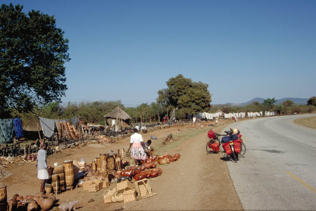
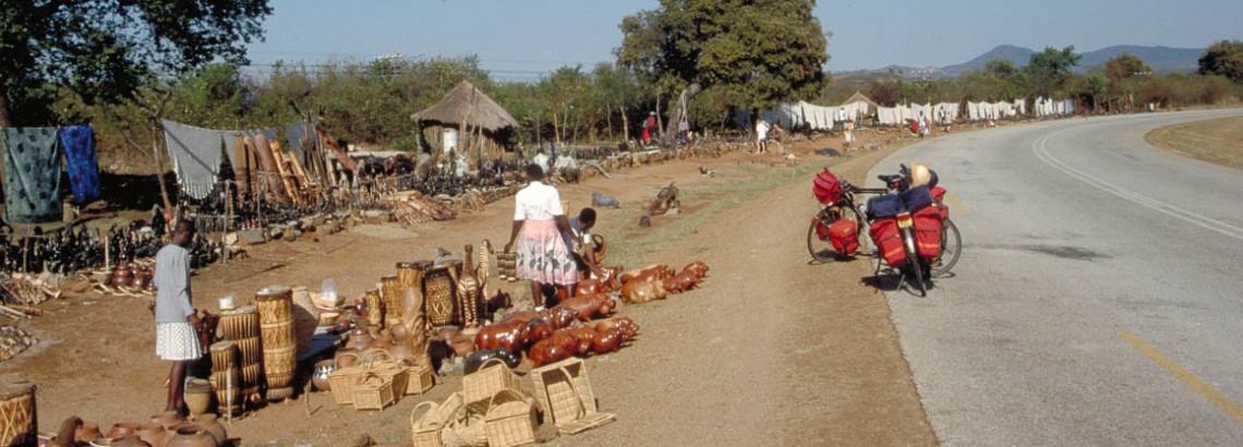
souvenir stalls near Great Zimbabwe ruins
Masvingo – Zvishavane – Filabusi – Bulawayo
From Masvingo the road slowly descends to the river Tokwe. A bit further is the turnoff to Gweru and the village of Mandanbwe. We saw a sign pointing to the ‘Sunrise Hotel’ , so it may be possible to stay there.
This road mainly goes through communal lands. Not many shops along the road though. The town of Svishavane has a very rundown caravan park ( 60 Z$ per night ) and a hotel (the Nilton Hotel) in the town centre. There is a large TM supermarket on the Masvingo road.
After Zvishavane there is even less traffic on this road. Again not much available along this road to eat or drink. The settlement of Filabusi is 5 km off the road and can be reached on a excellent road. Some maps shows two road leading towards F.; in fact there is only one road in and out.
Filabusi is a government-centre; consisting mainly of government offices and the houses of the people who work here. We camped at the police station. They even have showers and toilets for visitors. A week before us a Japanese cyclist had camped there and a month earlier a group of hitchhikers stayed there.
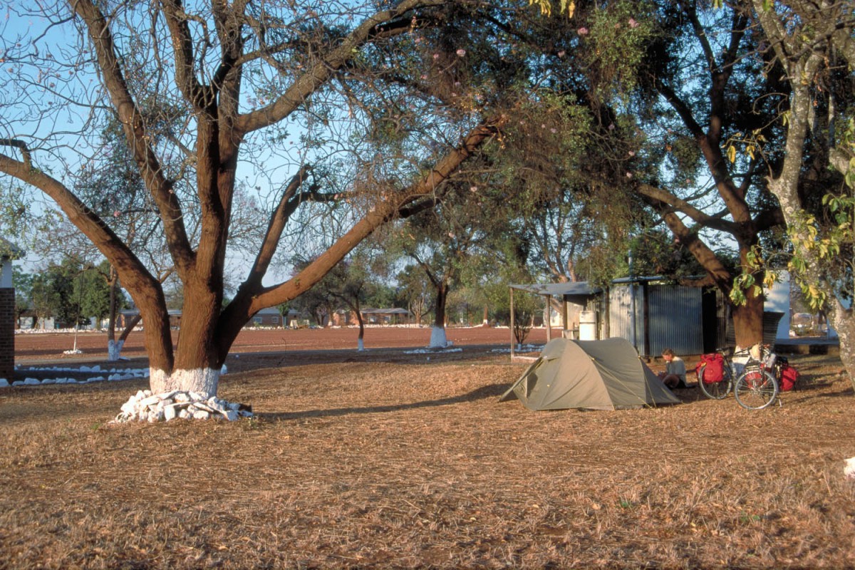
camping at Filabusi Police Station
From Filabusi it’s another 25 km to the Beitbridge – Bulawayo road. The military settlement of Mbalabala on the junction has not much to offer. The Beitbridge – Bulawayo road is fairly busy with highspeed traffic from South Africa and narrow (no shoulder) making cycling unpleasant at times. Once you reach the village of Esigodini (accommodation and shops) most of the traffic is gone and even better the road widens. Fifteen kms after Esigodini there are two steep climbs which bring you to an altitude of about 1400 m above sea level. The rest of the way to Bulawayo you will cycle on a mountain ridge with wide views right and left. At 20 km before B. you will see the first sign to lodges and campgrounds. This side of B. doesn’t give the impression that you are cycling into a seconds largest city in the country ( one million inhabitants).
A return trip to Matopos National Park
This beautiful and interesting park cam easily be reached and visited from Bulawayo. The Tshabalala Wildlife Sanctuary (just 10 kms south of Bulawayo on the Matopos Road) offers a unique opportunity to cycle amids wild animals such as giraffe, kudu and zebra without the risk of encountering dangerous animals as elephant, lion and rhino. Your Matopos NP entrance ticket is valid for this reserve and v.v.
In the Matopos National Park are various campsites. We stayed at Malene Dam. There a small shop (kiosk) at the Malene Dam Rest Camp just before you get to the Malene Dam campsite. All drinking water must be boiled! The unpaved roads in the park are suitable for cycling; even without a mountain bike.
Note: not al parts of the Matopos NP are open to cyclists but you have a good chance of seeing wildlife outside these parts.
The rest of our trip to Victoria Falls
We took a bus from the Bulawayo bus station. Putting your bike on a bus is pretty straightforward. You pay a bit extra and your bike is strapped on top of the bus with numerous other large size items such as furniture, freezers, etc.
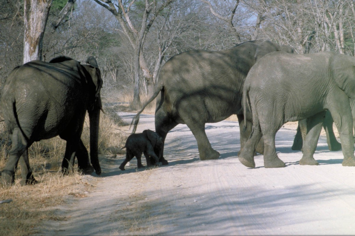
in Hwange National Park
We got off at Dete Crossroads but it’s also possible to get off a bit earlier at Safari Crossroads which is the actual junction to Hwange National Park. From there you could cycle directly to Main Camp.
Officially cycling in the national park is forbidden so we cycled just to Dete and got a ride all the way to Main Camp in a pickup truck. Enquire at the petrol station for transport; the people there are very helpful. As there is no checkpoint or gate until you get to Main Camp itself it’s also possible to cycle all the way to Main Camp. In this case the direct road from Safari Crossroads is 12 kilometres shorter. Be aware of the fact that elephants and lions are often seen along this road!
Apart from camping it’s very difficult to get a chalet or other accommodation in Main Camp. Because of a weird reservation-system everything seems to be fully booked for months and only available for those on a waiting-list from 17:30 hour on. Getting a room for two nights is impossible without checking out at 10.00 and putting yourself on the waiting-list again. Putting yourself on the waiting list will almost always guarantee you a room for one night!
For the self catering there is a good shop and the restaurant serves good value meals.
We hitchhiked back to the main road and waited for the next bus to Victoria Falls. Not many busses seem do the Bulawayo – Vic Falls route. Some faster busses (no roof racks) may only take a bicycle if they have sufficient place.
From Vic Falls we flew back to Harare on a domestic Air Zimbabwe flight. Taking the bicycles was no problem. The direct flight takes about one hour.
