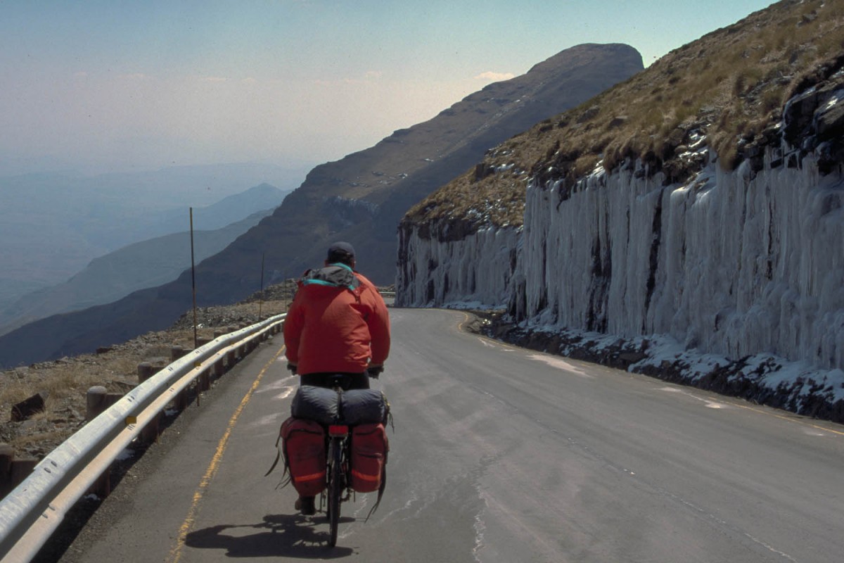
Sani Pass – Mulomong (Lesotho)
The first 7 kms you’ll cross the Sani Flats. Probably the last flat country you’ll see for a long time in Lesotho. The road then climbs steeply another 3-4 kms to the first summit of Black Mt, 2 km further uphill is the actual pass (3240 m).
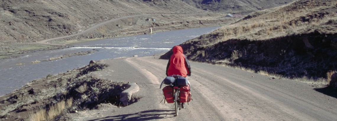
crossing Sani Flats with a storm quickly moving in from Sani Pass in the far distance
On a clear day you will enjoy splendid views of the 3482 m high Thabana Ntlenyana; the highest point south of Mount Kilimanjaro.
A rocky, bumpy and narrow road descends steeply for 6 kms. Down in the valley are 3 small rivers to cross. We had to take off our shoes and walk across all three of them. Just beyond the last ford is civilisation. Small villages with no facilities. This road is a fair weather road so it can become impassable in and after wet or snowy conditions. Those who want to go to Mulomong Guesthouse and Thaba Tseka are warned. There is river to cross! In Lesotho this means that you’ll ride into a deep and narrow valley hanging on to your brakes, cross a low bridge and then at the other side climb out as steeply as you came down.
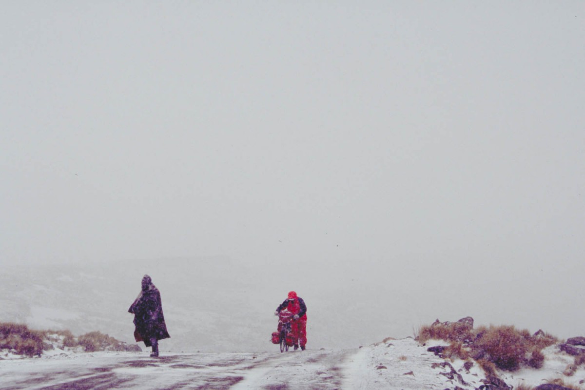
walking uphill in a blizzard
It’s uphill all the way to Rafolatsane village where Mulomong Guesthouse (signposted with small sign) offers basic but good accommodation.
A shorter road to Rafolatsane that we did not take, branches off miles before the bridge and joins the Thaba Tseka road near Rafolatsane. We have no information on the condition of this road. It’s on some maps and there is a sign pointing to Thaba Tseka..
Mulomong – Thaba Tseka
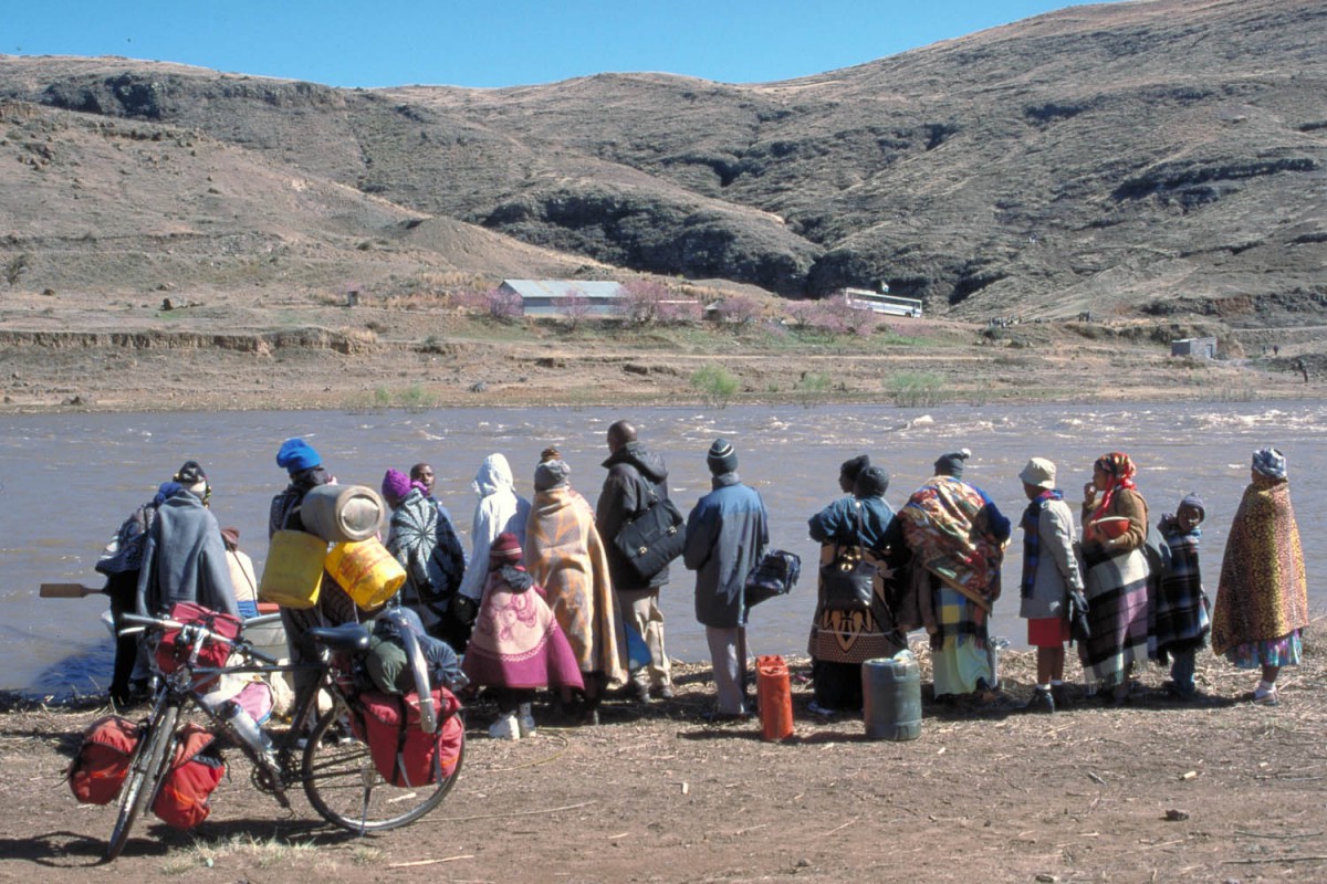
queuing up for the rowing boat ferry
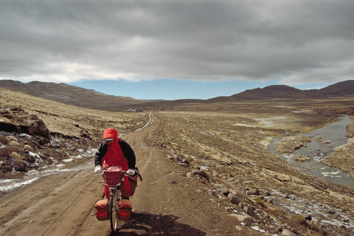
This is remote and extremely mountainous country. We hitchhiked most of this stretch. For us, with our heavy loaded touring bikes, these mountains were just too steep to ride. Not much traffic on this road goes all the way. Most taxis, busses and other public transport will stay at one side of a high pass.
After another steep climb, a tortuous descent follows from Menoaneng Pass (3250 m) down to the the small village of Taung (we camped here next to the rondavel of the village chief). From here the road descends steeply for 4 km to the Senqu River.
The low-level causeway across the river is easily flooded whenever the Katse dam further north is opened to let out water (mostly after heavy rainfall). If that happens all traffic stops here. For pedestrians and cyclists only a solution is offered. The government of Lesotho provides a free ferry service at these days. A small rowing boat leaves from a spot a few hundred meters upstream from the bridge. It took us 3 hours to get across as many people were waiting fot this “ferry”.
From the river the road climbs seemingly without end. The next place with some facilities is Thaba Tseka. It now has a good hotel; ask for the Mountain Star Hotel as it was not (yet) signposted in September 2002.
Thaba Tseka – Leribe
The road from Thaba Tseka to Katse is ‘flat’ compared to the roller-coaster ride on previous sections. The mountains here are further apart; the landscape looks wide and more open.
descending from Mafika Lisiu, at 3090 m
At Katse the pavement starts. This road is in an excellent condition. On the first section to Lejone you cross 2 passes (2510m and 2650 m). From Lejone (accommodation, shops) the road follows the dam (lake) and then climbs very steep for approximate 15 km to the first summit. The real pass (Mafikia Lisiu at 3090 m) is still a few more kms uphill. From the viewpoint you’ll have sweeping vistas of the many hairpins at the other side. The first 10 km downhill are very very steep. From the top of this pass Leribe with all facilities is only 55 km away. Most of these are downhill!
