Introduction to our route
From mid September 2017 to mid December 2017 we cycled for three months in Argentina and Paraguay. Our trip started by flying to the Iguazu Falls in the north east of Argentina. From there we cycled to the south and crossed into Paraguay. We crossed Paraguay from the east to the west and entered Argentina again. From the town of Resistencia we took a long distance bus to Salta in the West. From Salta we traveled to the end point of this trip, big city Mendoza. The whole trip was 3000 kms.
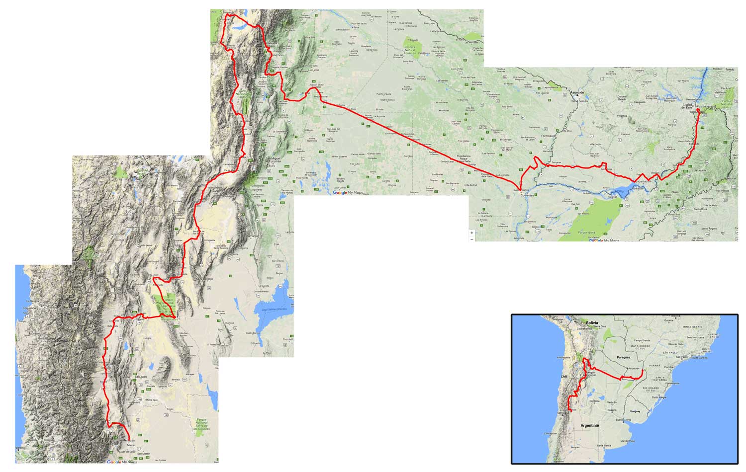
Iguazu – Salta – Mendoza
There is a fully annotated map of our route on Google Maps
Foz do Iguacu to San Ignacio
We flew into Brasil via Sao Paolo as this was a convenient flight for us (from Amsterdam) and this also gave us the possibility to start at the Brasilian side of the Iguazu waterfalls.
The Brasilian Foz Iguacu National Park offers a 9 kilometer bicycle route through the forest. Unfortunately this is group activity you’ll have to book (and pay for) and you cannot use your own bike. A good alternative is the public bicycle trail that leads right from the ticket offices all the way to the falls.
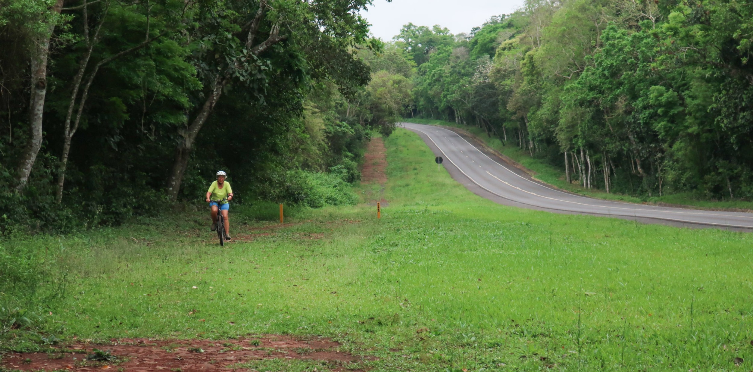
The bike lane 😉 to the Iguazu falls in Brasil
We stayed in Brasil for four days and then cycled across the border to continue our trip in Argentina. The border crossing was easy with few formalities.
Highway nr 12 south from Puerto Iguazu is mostly a very busy road with plenty of cars, busses and trucks. Fortunately there is a (narrow) shoulder for the first 125 kilometers or so. The shoulder ends south of the village of El Alcazar. For the rest of the trip along RN 12 we often had to use the unpaved shoulder to get away from the speeding traffic.
There is plenty of accommodation of all types along this road. The road is like a continuous roller coaster ride with endless short and steep hills. The weather here is mostly hot and humid.
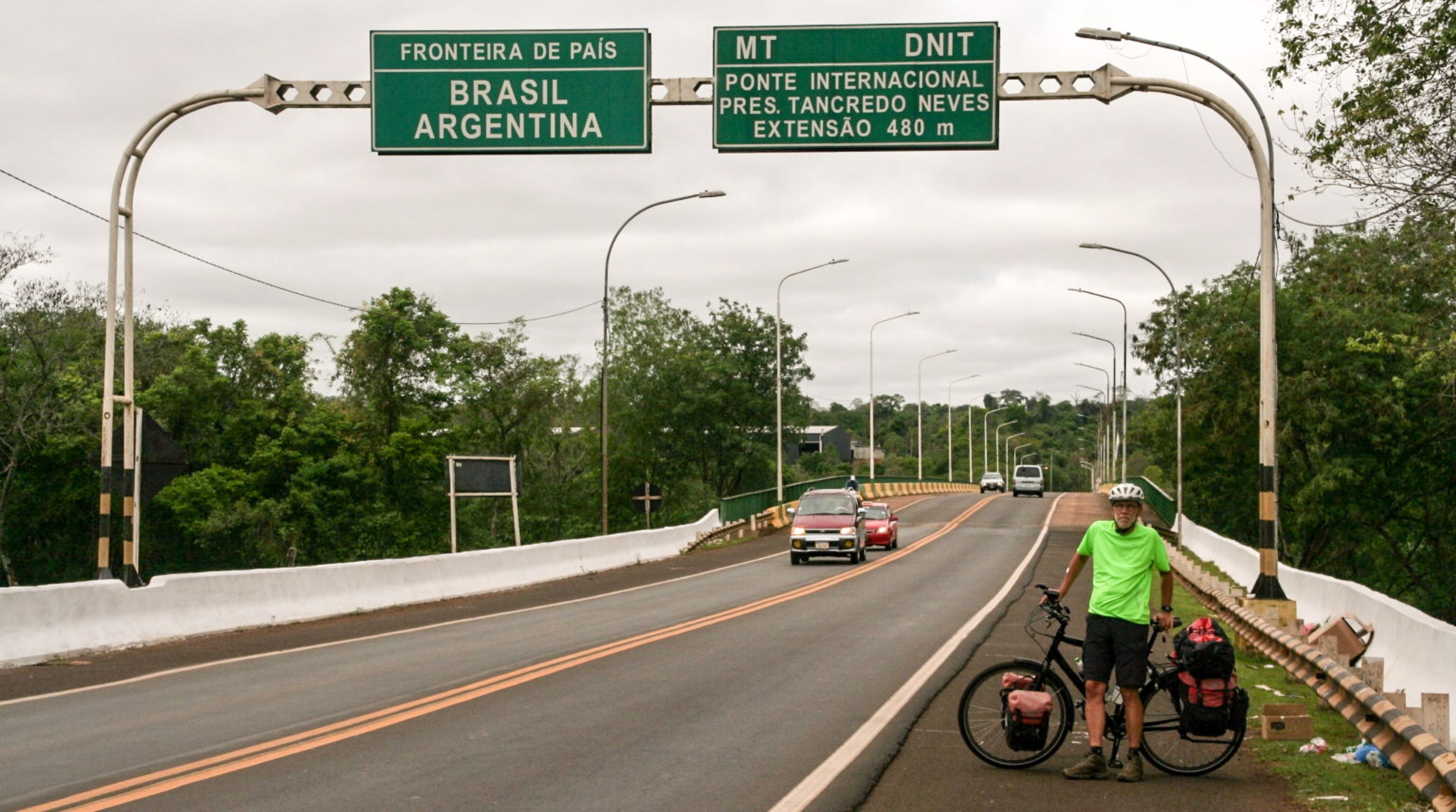
From Brasil into Argentina
Through Paraguay: from Bella Vista to Pilar
As you can see on the map page we entered and exited Paraguay by ferry. This proved to be a relaxed and hassle free experience. On the Paraguayan side the first town on our route was Bella Vista. There is an excellent hotel and restaurant here and banks where you can get your Guaranis from an ATM. The highway south to Encarnacion is busy but has a good shoulder. We avoided Encarnacion by taking a quiet road via rural Fram.
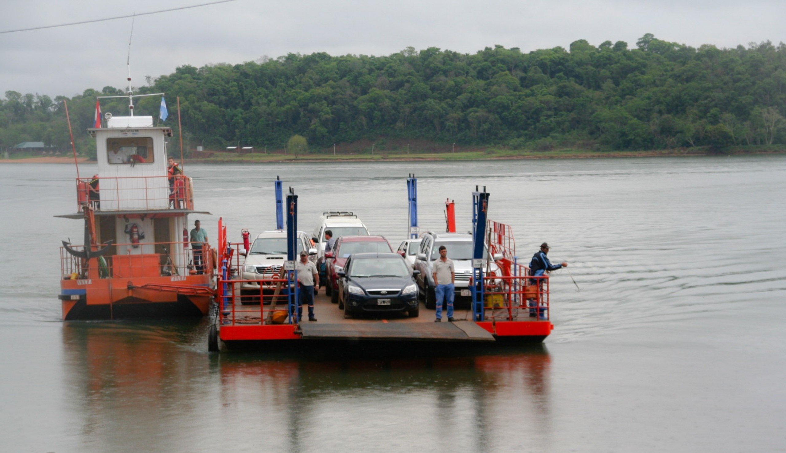
The ferry from Corpus (ARG) to Bella Vista (PY)
As long as it doesn’t rain this Paraguayan road is fine.
We continued on Ruta Nacional 1, again with a good shoulder. The countryside is green and there are few hills. After visiting several ‘Missiones’ we arrived in San Ignacio. As we were unsure about the condition of the road to Pilar we took a taxi to get there. The highway number 4 to Pilar looked in good condition (most of it) but there are absolutely no villages or restaurants along it. About halfway is a police station.
Pilar has all services and a ferry to Argentina. Cyclists are not allowed on the car ferry (don’t ask why 😉 and have to take the smaller ‘lancha’ just like the pedestrians. The inspection by Argentinian customs here took a long time. Be sure to change any Guaranis at the office on the Paraguayan side as there are no possibilities to do so after this point.
Argentina: to Resistencia
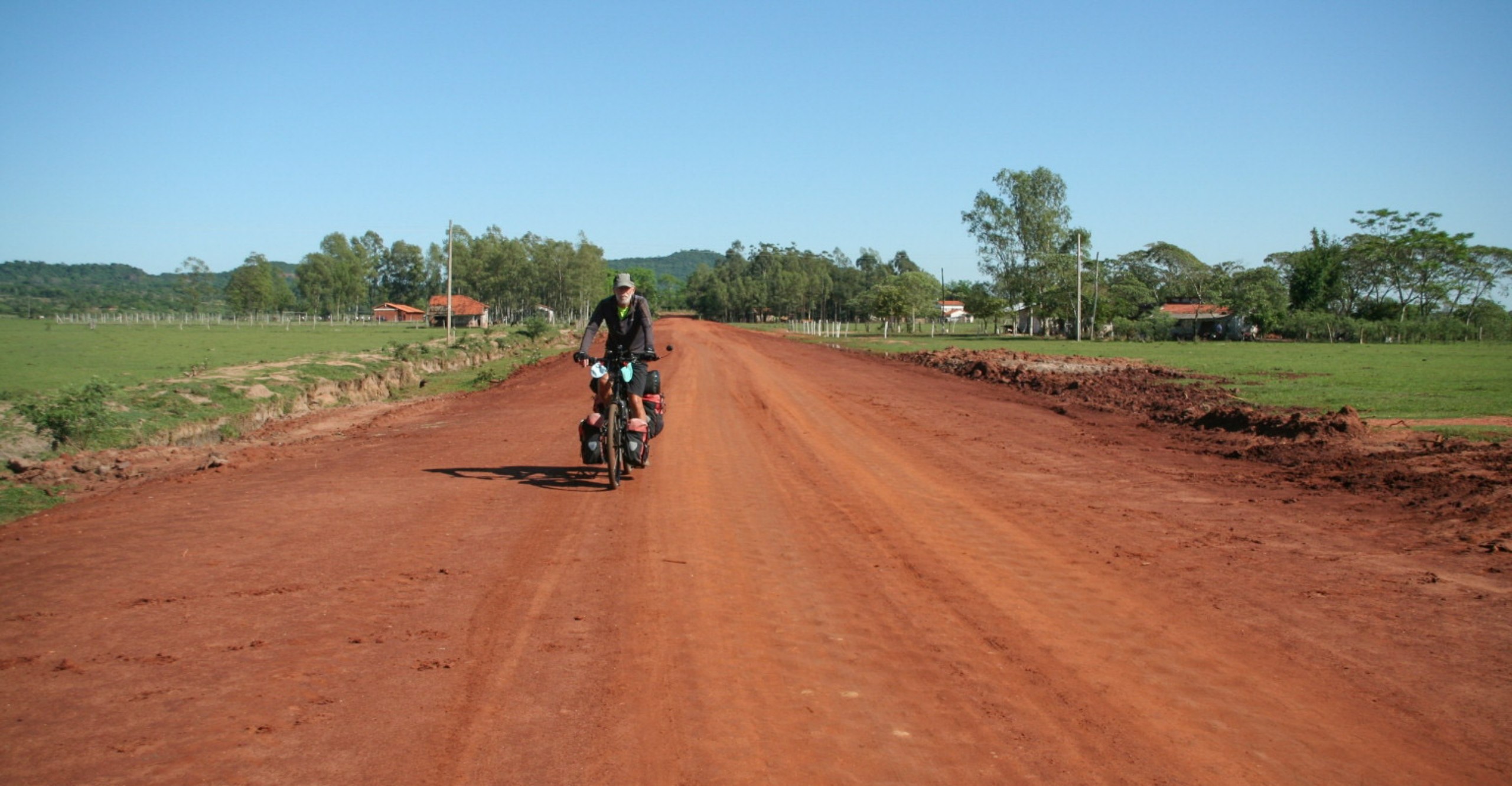
Until you reach Gral. Mansilla and the RN 11 there is nothing along the road for 40 kms. We soon discovered that cycling along the busy RN 11 was extremely unpleasant as there is no shoulder. So we opted for backcountry roads via Gral. Vedia and La Leonesa to reach Resistencia. These roads are all unpaved but easily ridable. After a night camping at the Gral. Vedia local park we had some very light rain and discovered that even a bit of precipitation can make these roads very muddy and completely impassable. We decided to go back to RN 11 and hitchhike to Resistencia.
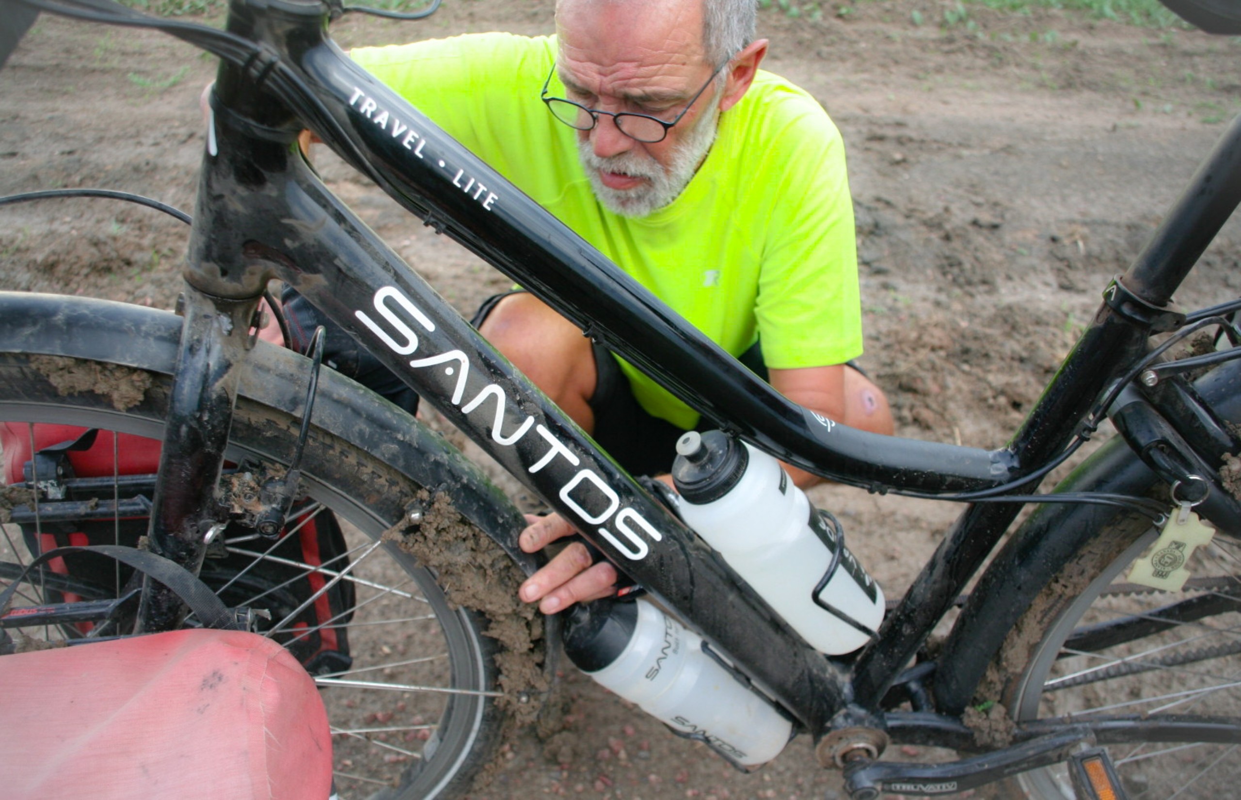
We needed a screwdriver to remove the mud we had collected after only a few meters.
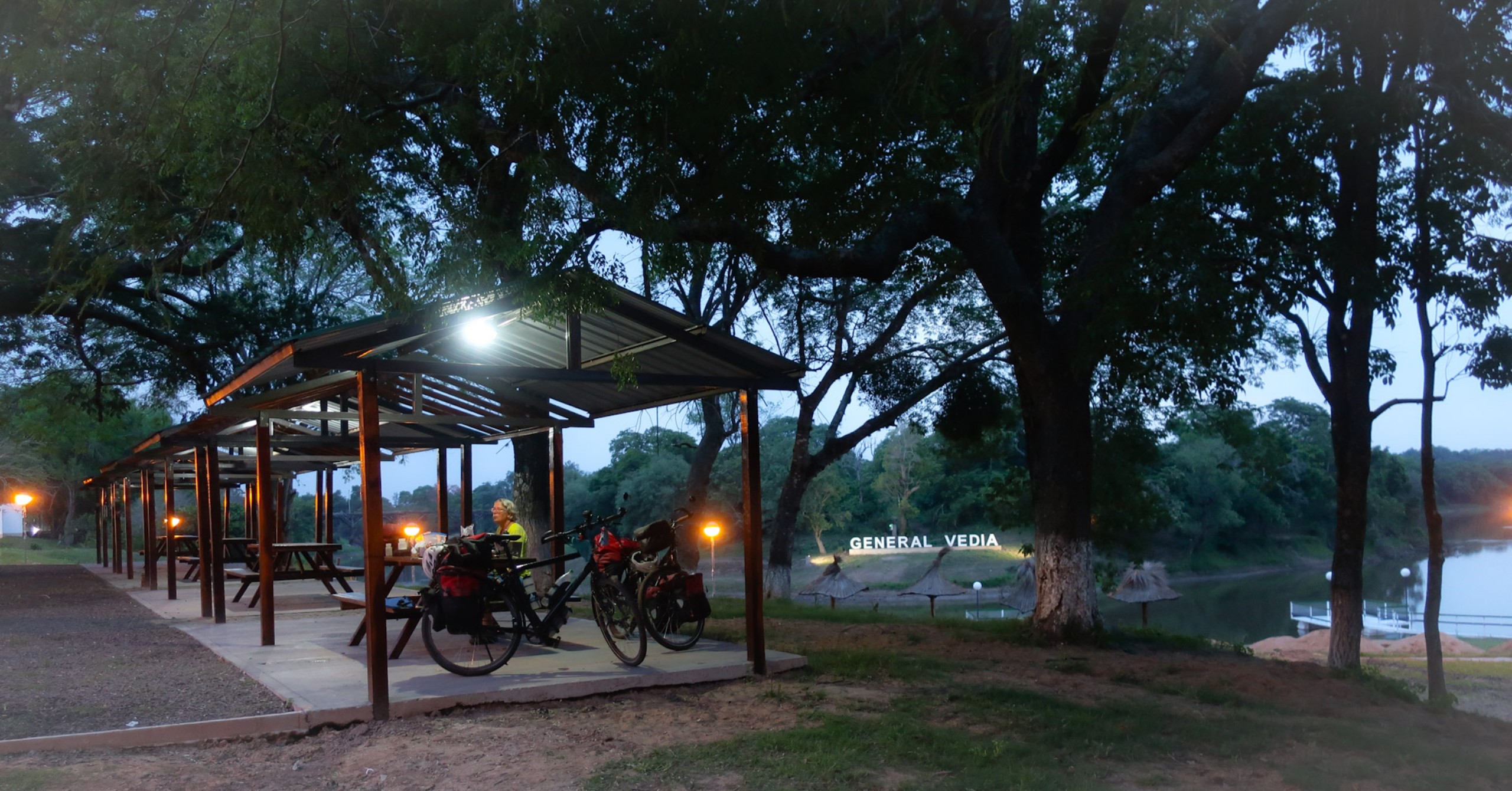
The first night we camped: the local swimming area at General Vedia
By bus from Resistencia to Salta
Argentina is a huge country and not all parts are interesting enough to traverse by bicycle. The Chaco region east of Salta is one of those regions. Instead of cycling more than 800 kilometers along a straight, shoulderless and probably busy road we decided to take a long distance bus. Buying two tickets was no problem, getting our bikes on board was another story. When we purchased the tickets we were told that if the bikes were packed and a bit smaller it would be absolutely no problem ;-). The night of our departure we were told that we could only take one piece of luggage with a maximum weight of 15 kilos. Including our bikes (wrapped in cardboard) we had 5 pieces each! We just had to wait and see. The moment the bus arrived our bikes were pushed in and we only had to ‘pay’ 400 pesos (about 20 euros).
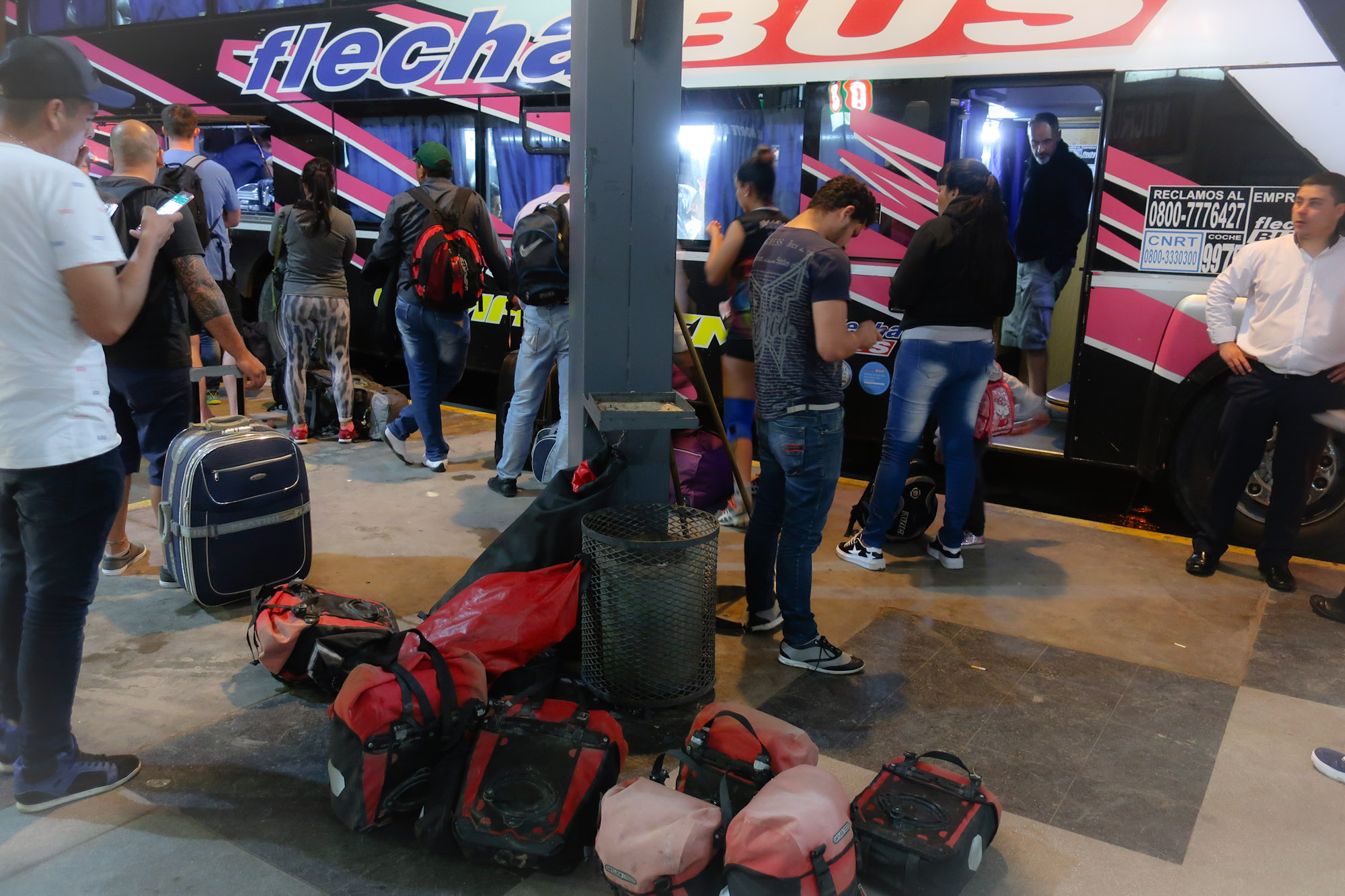
Flechabus to Salta: we had more than one piece of luggage 😉
But we read also stories from cyclists who were allowed to carry their bikes without any packing and stories of those whose bikes were simply refused as luggage. An alternative may be to send your bike as cargo on a separate bus.
Salta to San Antonio de las Cobres
After some pleasant days in Salta we left for the north. The nicest option for cyclists going north is to follow the bike lane that runs parallel to highway 9. At the Armadillo roundabout this lane ends and you’ll have to follow the main road here. North of La Caldera the road narrows dramatically and winds through a lush green mountain range. There isn’t a lot of traffic here as the road often is just a bike lane wide. Big town Jujuy is rather uninspiring and we had some problems finding our way around the busy highways South of Jujuy. There is accommodation in La Dique de Cienega and El Carmen. By taking the road through Villa Jardin de Reyes you can bike on quiet service roads for some time north of Jujuy. There is a steep climb south of Volcan but for the rest the climbs here are very gradual.
After a return trip to touristy Tilcara we continued into the direction of Susques. To get to the 4171 m high top of the Cuesta de Lipan we hired a taxi. Along the salt lake at the other side are some tourist facilities but you’ll have to be self sufficient until the village of Susques. The Pastos Chicos Hotel just south of Susques is recommended.
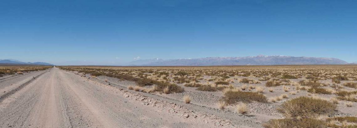
It took us three days to cycle to San Antonio via Puesto Sey along Ruta 40. Except for the first 7 kms the road has few hills but the quality of the surface varies from not very good to very bad. The tiny villages of Huancar and Puesto Sey are right on this road, Pastos Chicos requires a short detour. There are small shops in the villages for water and basic foods.
The road ascents very gradually to 4400 meter. From there it’s downhill to the La Polvarilla railway viaduct (4200 m) and further down to the junction with highway 51. There is only a souvenir shop at La Polvarilla. The rest of the descent to road 51 is very heavily corrugated.
San Antonio at 3750 m has several hotels and restaurants.
San Antonio de las Cobres to Cafayate
To get to Cafayate along Ruta 40 we needed to climb the highest pass in South America: the Abre de Acay with 4995 m altitude. A bit too much for us, so we chartered a taxi to get us to the top :-). From the top a narrow road winds down for hours and hours. We met two or three cars on the way down. The road quality is reasonable but you’ll have to ford a river six times. The water was mostly 10-15 cm deep. Just before the village of La Poma the valley widens. The first possibility to get water after the top is after 18 kms. The first village is La Poma.
Road quality slowly get’s worse, probably because there is a bit more traffic. At Payogasta you’ll be back on the pavement again all the way to Cachi. It’s a very nice ride down a beautiful valley. After Cachi the pavement ends again. Unfortunately south of Molinos the road is rather bad. Lots of soft sections and corrugation as well. From San Carlos you can pedal downhill on smooth tarmac.
Cafayate has all the services a tired cyclist needs.
Cafayate to Belèn and Londres
Our trip continued south along a perfectly paved Ruta 40. There is surprisingly few traffic along this road. In fact we didn’t cycle along busy roads until we reached our final destination Mendoza, many weeks later. The pavement is smooth and wide, every 15-30 minutes a car passes by.
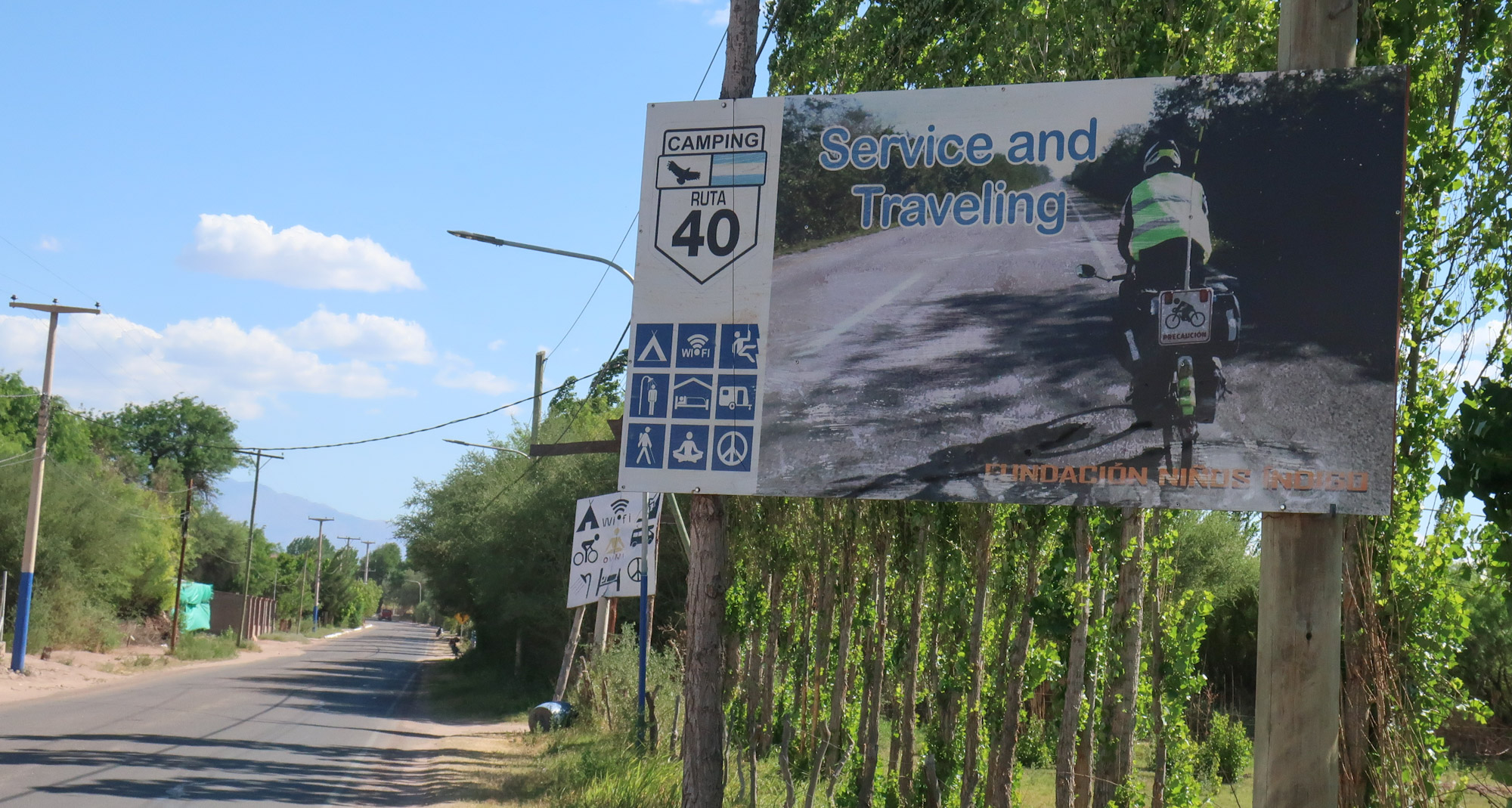
Punta de Ballista: Cyclists welcome!
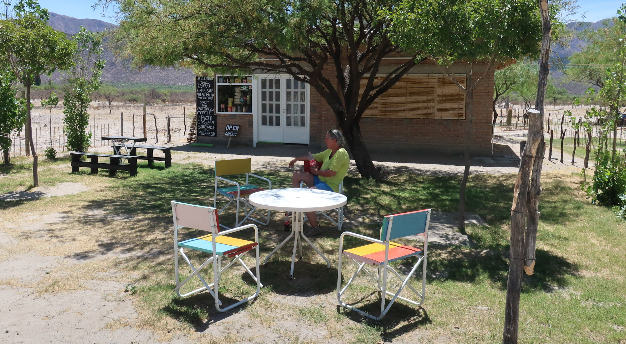
At Punta de Balista there is a small shop and campsite aimed at Ruta 40 cyclists. A few kilometers south of Punta de Balista starts a long and very flat stretch with no shelter. No nice spots to camp here until you get to the airport of a nearby mine. The road slowly keeps descending towards Belèn and passes through Hualfin (at least one shop and a hosteria). This is a major advantage of travelling from north to south. Combine this with prevailing winds from the northwest and we discovered that generally we had an easy ride 😉 most days.
The final miles to Belèn are scenic, following a winding road through a canyon. B. has all services. Londres, a few miles further is much smaller.
Londres to San Jose de Jachal
From Londres we continued cycling along Ruta 40. The next settlement along this road is San Blas de los Sauces. Actually it is a whole string of small villages located in a fertile valley. At Salicas there is a campground and hostel near the road. This place has grassy shady sites and hot showers. There are two other campgrounds further south, both signposted.
Clearly signposted campsite at San Blas de los Sauces
We continued to Pituil (a few shops, a shady plaza but not much else) and Chilecito. From Chilecito the highway becomes four lanes wide and descends nicely to Nonogasta. Virtually no traffic here despite the impressive width of the highway plus shoulder.
From Nonogasta it’s a nice and scenic climb now paved all the way to the top of the Cuesta de Miranda and an equally nice long descent into Villa Union. Villa Union is the gateway to the Talampaya National Park and has numerous hotels, hostels and campsites.
Talampaya National Park offers a reasonable (paid) campsite with hot showers and toilets (70 pesos per person per night in 2017). There is not much protection from sun and wind here but the visitors center has a nice air-co area where we spend most of the day waiting for our tour to leave. The restaurant serves meals and sells drinks. A visit to the park is recommended. The park offers a guided bike tour. You cannot use your own bike and there is a minimal group size of 6 persons.
Ishigualasto Provincial Park was the next scenic spot along our route. At the moment we visited the park there were no options to camp (the campsite was under reconstruction) nor any other accommodation. We stayed one night in a simple hostel in Los Baldecitos and another night (illegally) along the main road through the park. The park itself can only be visited by car or motorbike, in convoy and escorted by a park ranger. You can get water at the park office (toilets).
Nice downhill to Huaco
The road to the west descends steeply with numerous hairpins and through multiple tunnels. Still almost no traffic here. We took the road via Huaco and the Area Protegida de la Cienega. La Cienega is a very scenic range of mountains and valleys. Several campsites here. The sleepy town of Jachal has all services.
San José de Jachal to Mendoza
As we had plenty of time we decided to take the presumably more attractive route via Las Flores and Calingasta to Mendoza. Highway 150 leads west through a mountain range to a large lake and the nearby village of Rodeo. Plenty of accommodation (mostly ‘cabana style’) to Las Flores. The 150 continues to the Chilean border, we traveled south to Bella Vista where the less used road to Tocota starts.
Road 412 is mostly in very bad shape: sandy, rocky and corrugated. It took us all day to cover the 50 kilometers to the hamlet of Tocota. Tocota is not much more than a small police station (Gendarmeria Nacional) and a few (probably) abandoned farms. We were allowed to camp on the police premises and even invited to take a hot shower! Nearby is the giant statue of Christo Redentor standing on a mountaintop. The next day the road descends all the way to Villa Nueva. Road quality is generally very bad. With numerous dry river beds to cross we often had to push our bikes for large stretches. The pavement is back at Villa Nueva. There are almost no shops or any other services from here to Calingasta. We purchased water at a small shop (see our map), nearby is a nice free camping spot close to the river.
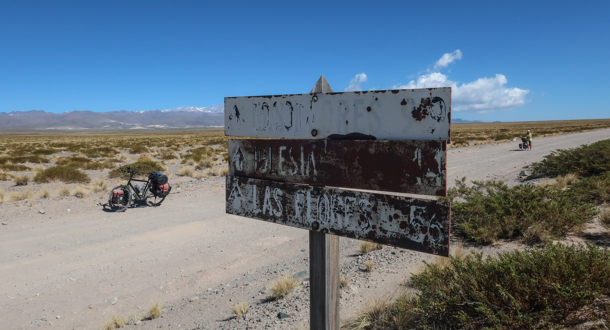
Signposting on the way to Tocota
Calingasta and Bareal are ‘touristy’ villages with a lot of hostels and cabanas. From Bareal we took the road south to Uspallata. From the junction with the (now closed) road 153 this road is unpaved. The pavement returns just south of a spot with old Inca ruins (junction to Tambillos). The remainder of the ride is on smooth asphalt and downhill.
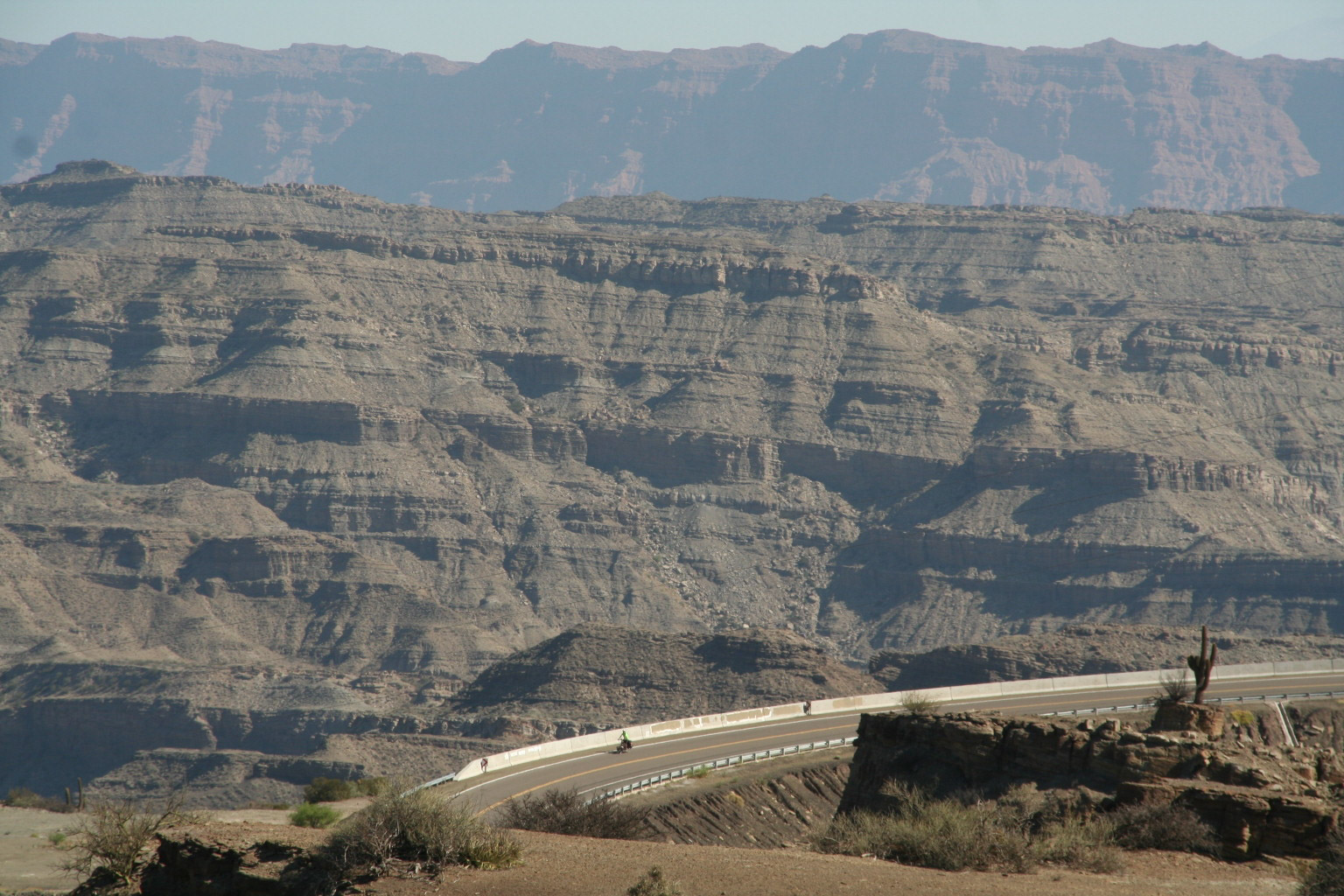
From Uspallata there are two option to get to Mendoza. Following busy highway 7 (many trucks here) or the deserted and rather difficult but very scenic ‘track’ via Villavicencio over a 3000 m high pass. We decided to take the scenic way. The road is paved for the first 15 kilometers and the climb moderate. As often on this trip we had to battle a strong afternoon wind that forced us to walk the last kilometers to the top. The descent through the clouds and winding down the presumably 365 hairpins was breathtaking. The views superb, the road bad beyond repair with giant rocks, and more or less repaired landslides all the way.
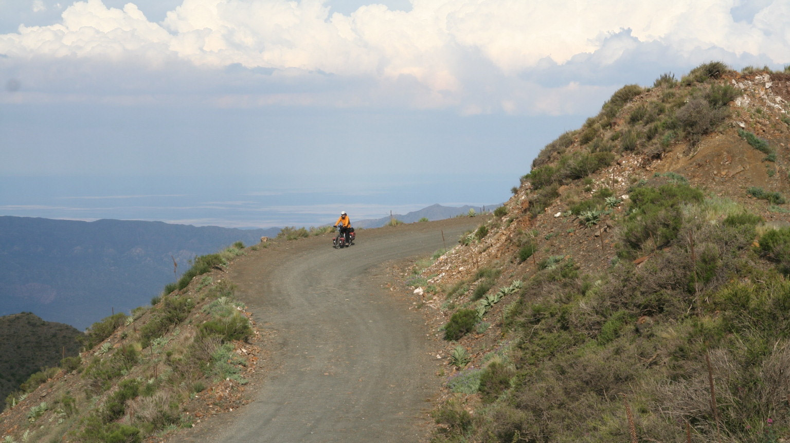
Paso de Villavicencio: downhill all the way
After the now closed Hotel Villavicencio the pavement returns and it’s downhill all the way to busy Mendoza. The end of this trip!
