In September and October 2007 we cycled in the southern part of Uganda. This page contains the tour report from this trip.
Our route
We started from Entebbe and bikes to Fort Portal in the west, continued south to Kibale Forest NP and Queen Elisabeth NP and then turned east again to Mbarara, Lake Mburo NP, Masaka and the Sesse Islands. The trip took four weeks to complete. The total distance cycled was around 900 kms.
Entebbe
Entebbe is where the international airport is. The airport itself is only 3 km’s from town, so you could easily cycle that distance.
Entebbe is a quiet small town with two supermarkets, an ATM at the local Stanbic Bank and plenty of hotels.
Entebbe – Mityana (67 km)
We decided to avoid cycling through chaotic Kampala by taking a shortcut to the Kampala – Fort Portal road. The road described here not only avoids Kampala, but also is much shorter.
First bike down the 3 km to the Sesse Islands ferry harbour. From here another ferry (schedule unknown) crosses to the village of Lulongo. You could also charter one of the many fishing boats here for the 10 minute trip. From Lulongo a good dirt road (even after rain) leads through Kansanje, to Mpigi on the main Kampala – Masaka road.
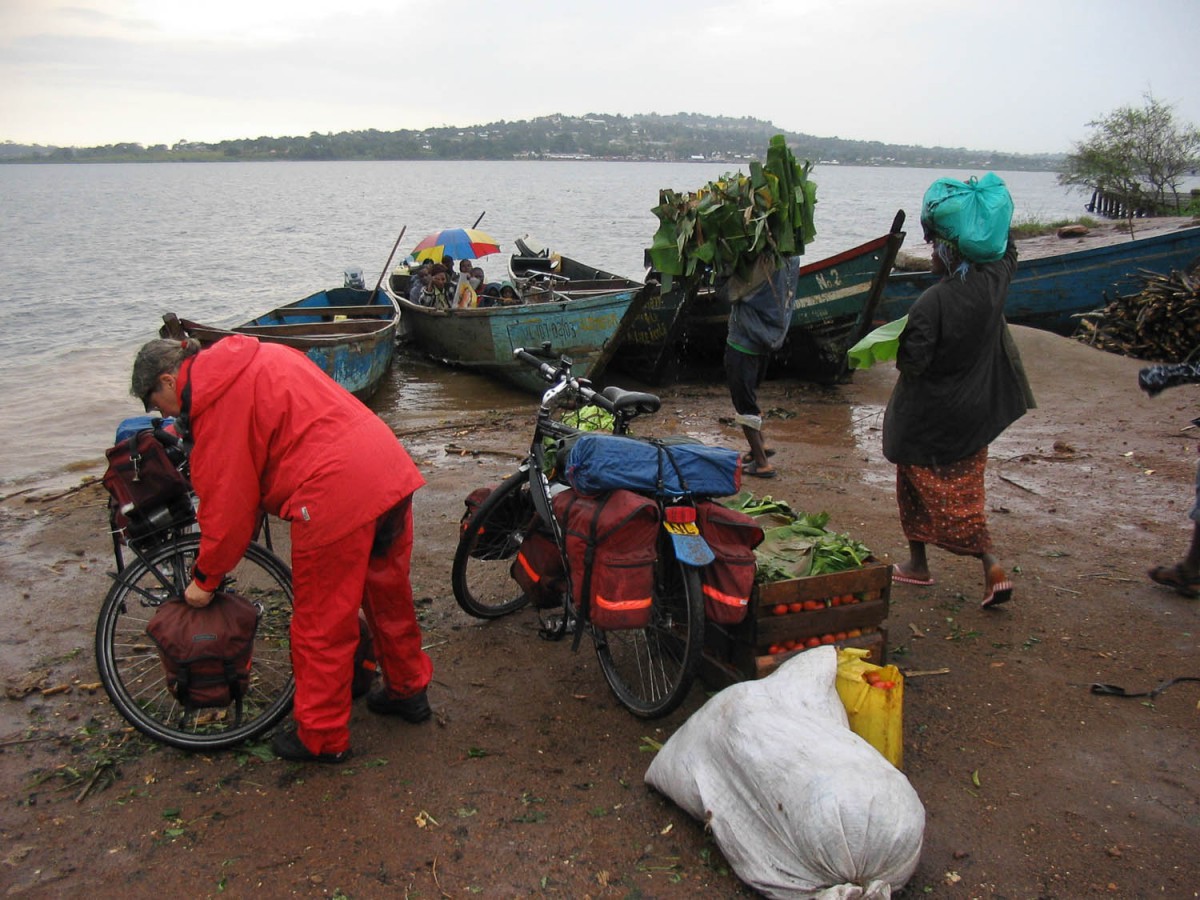
crossing the river by fishing boat near Entebbe
From Mpigi an unsigposted narrow dirt road leads 12 km to Muduma on the main Kampala – Fort Portal highway. This road has a short but extremely muddy section where we got stuck after rainfall. The mud was everywhere! Almost no traffic here.
At the tiny village of Muduma you reach the pavement again. The highway is not too busy and in good condition. Mityana (all services) is 32 km away.
Mityana – Mubende (78 km)
Beyond Mityana the highway improved significantly. The road is wider and has even has wide shoulder. We noticed a significant decrease in traffic after Mityana.
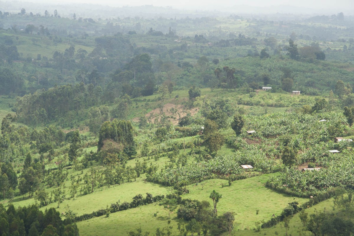
The roads leads over green rolling hills dotted with banana fields; it’s up and down all the time although the climbs are not that steep (max 7%). Mubende is one of the larger towns with all facilities.
Mubende – Kyenjojo (90 km)
The green rolling hills continue while you cycle further west. The roads is still in in excellent condition and traffic is sparse.
After 40 km is the village of Kyegegwa with the Gilman Valley Resort where you camp or stay in a strange pink coloured hotel.
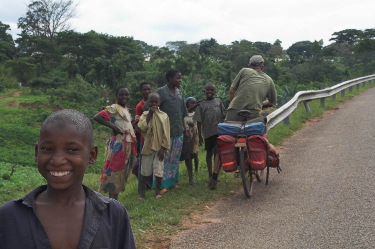
Meet the locals
There are only tiny villages along the road with hardly any services or shops. Many long uphills, with an average grade of 7%.
Kyenjo is a crossroads town with at least two cheap hotels. During our stay here a luxury hotel was under construction but planned to open later in 2007. Kyenjo is on the junction with the road north to Hoima and Murchinson Falls NP.
During this part of our trip we saw few alternative possibilities to spend a night such as: mission posts, churches, police station, hospitals or teacher training centers.
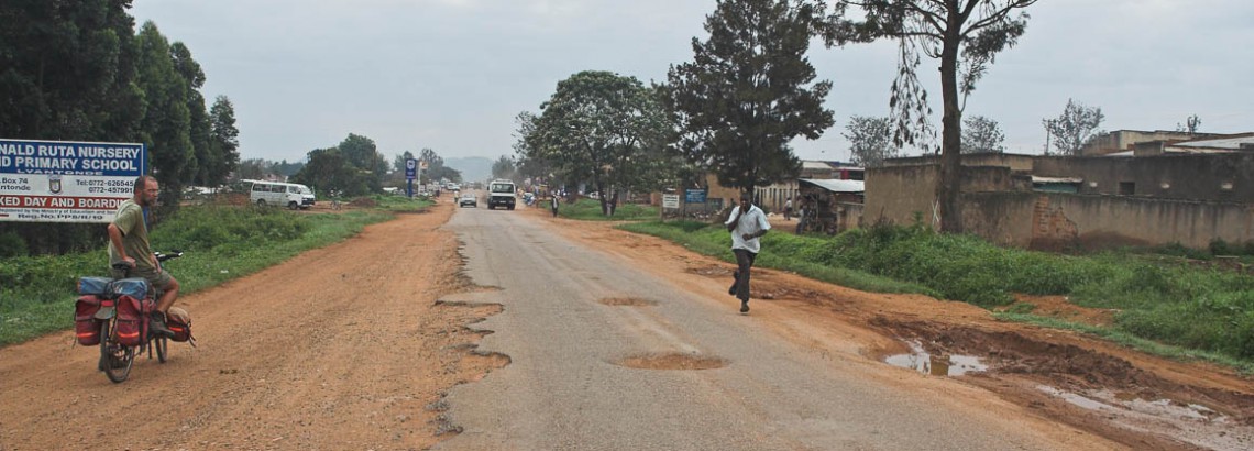
Kyenjo – Fort Portal (50 km)
Beyond Kyenjo you’ll be cycling through endless tea plantations. The roads narrow a bit and when you get closer to big city Fort Portal traffic increases.
There are many more villages here, with small shops. Fort a short distance the road passes through the Kibale Forest National Park.
Fort Portal is a busy little town with all services and plenty of accommodation.
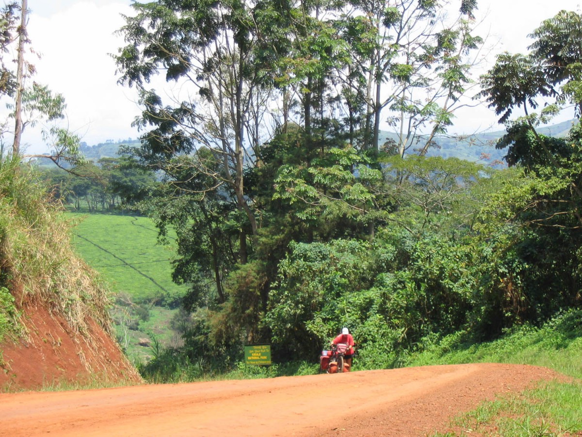
Fort Portal – Kibale Forest NP (35 km)
A good dirt road leads south from Fort Portal. There are some pretty steep hills on the section. But also good views of the nearby Ruwenzori Mountains. You’ll cycle mostly through tea plantations until the border of the National Park.
The NP road is less smooth but winds through a very nice forest. Plenty of birds and butterflies along the shaded road. We experienced that the roads here can become dangerously slippery after even short rainfall.
steep road to Kibale Forest NP
The Primate Lodge (now privatised) has a very basic campsite; for a bit more you can get a room at the lodge. Meals available. The Lodge and campsite are next to the Visitors Centre where the chimp tracking tours start.
Around the Crater Lake area to Kasese (70 km)
The area near Kibale Forest NP is dotted with ancient crater lakes. Many of these lakes offer accommodation; both camping and rooms.
Because we wanted to continue south to Kasese and the Queen Elisabeth NP we took a short cut on a rough dirt road to Lake Nkuruba where we camped two nights.
views around Lake Nkuruba
To get to Lake Nkuruba bike north from the Visitors Centre to a junction just outside the park borders. There is a signpost to the NP Park HQ here. A muddy and narrow track leads towards the village Isunga.
After a km or so the track becomes a narrow but rough road and leads over steep hills through a very rural area. At the end of the road is Rwaihamba just 2 km south from Lake Nkuruba. You may have to ask directions one or two times.
Be aware of the fact that at this lake there are two (competing!) community campsites. By staying at the northern one you support a school, the southern one (called “Enfuzi”) supports an orphanage. We stayed at the Enfuzi site where both the views and food are great.
Enfuzi camping site
From Lake Nkuruba we took another dirt road short cutting (20 km’s) to the main Fort Portal – Kasese highway. The road conditions very; some parts are very bumpy and may become difficult to bike after rain. Again you may have to ask for directions a few times; as in most of Uganda signposts are unknown.
Back on the pavement the riding is smooth. The road is excellent with a wide shoulder. You will be slowly descending all the way into the Rift Valley to Kasese town. Only to be slowed down by the thousands of speed bumps in every village.
Kasese is a dusty and run down town with all the facilities.
Kasese – Mweya (55 km)
It’s an easy ride to the junction with the Katwe road that leads into the park and towards the main gate. Queen Elizabeth NP already starts just outside Kasese and you may see impala’s, buffaloes etc. to your left side. This is also where you´ll cross the equator. There is not much to be seen at this virtual line around the globe. A small concrete monument marks the spot.
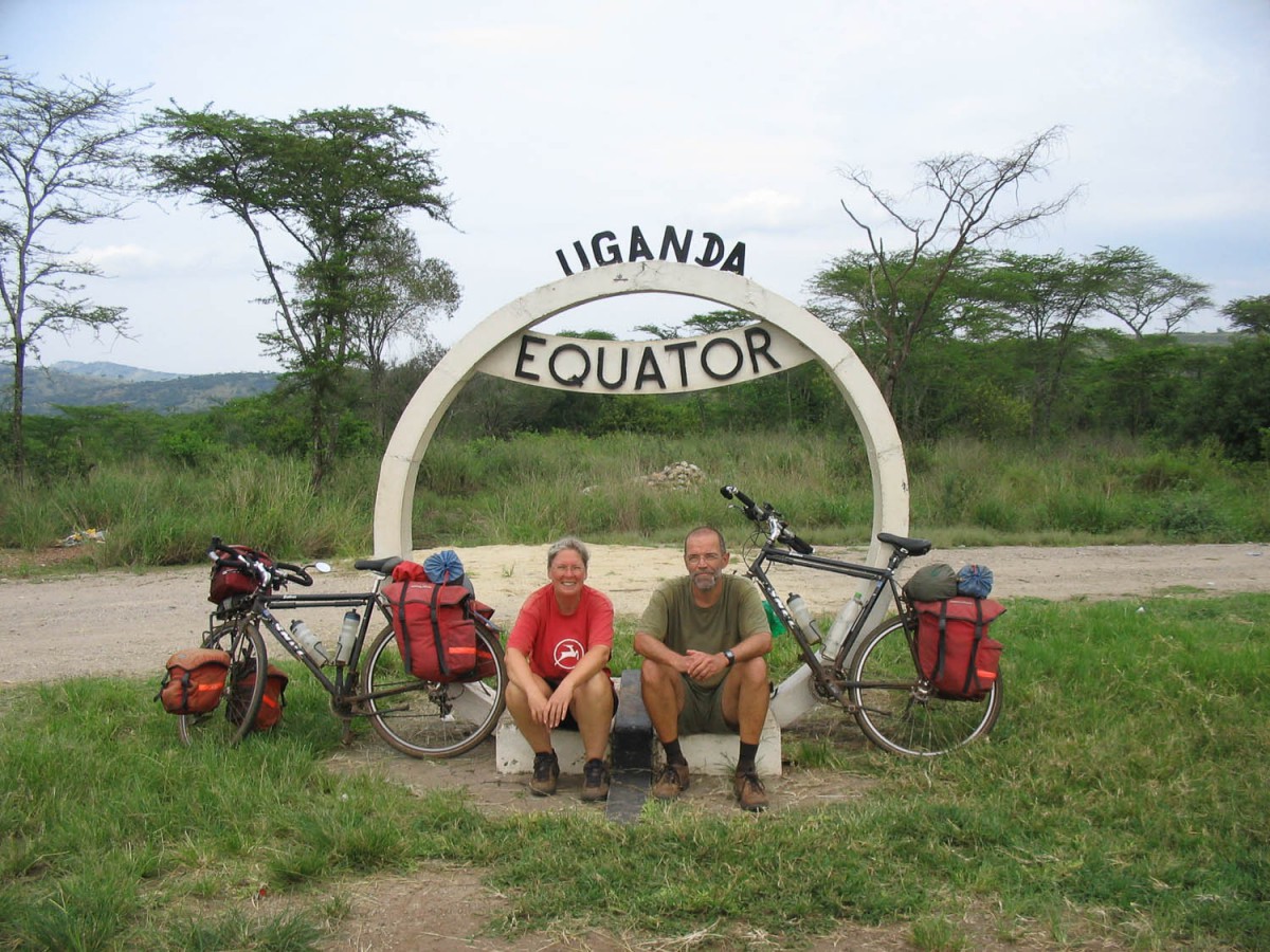
At the equator
The Katwe road already is inside the NP. We spotted elephants, buffaloes and many other animals in the distance. Some even at close range. The road is corrugated, bumpy and soft all the 17 km’s to the main gate.
Cyclists are allowed to continue the 7 km’s to Mweya where all the accommodation is. All other roads in the park are off-limits to bkers due to the high concentrations of wildlife, we were told.
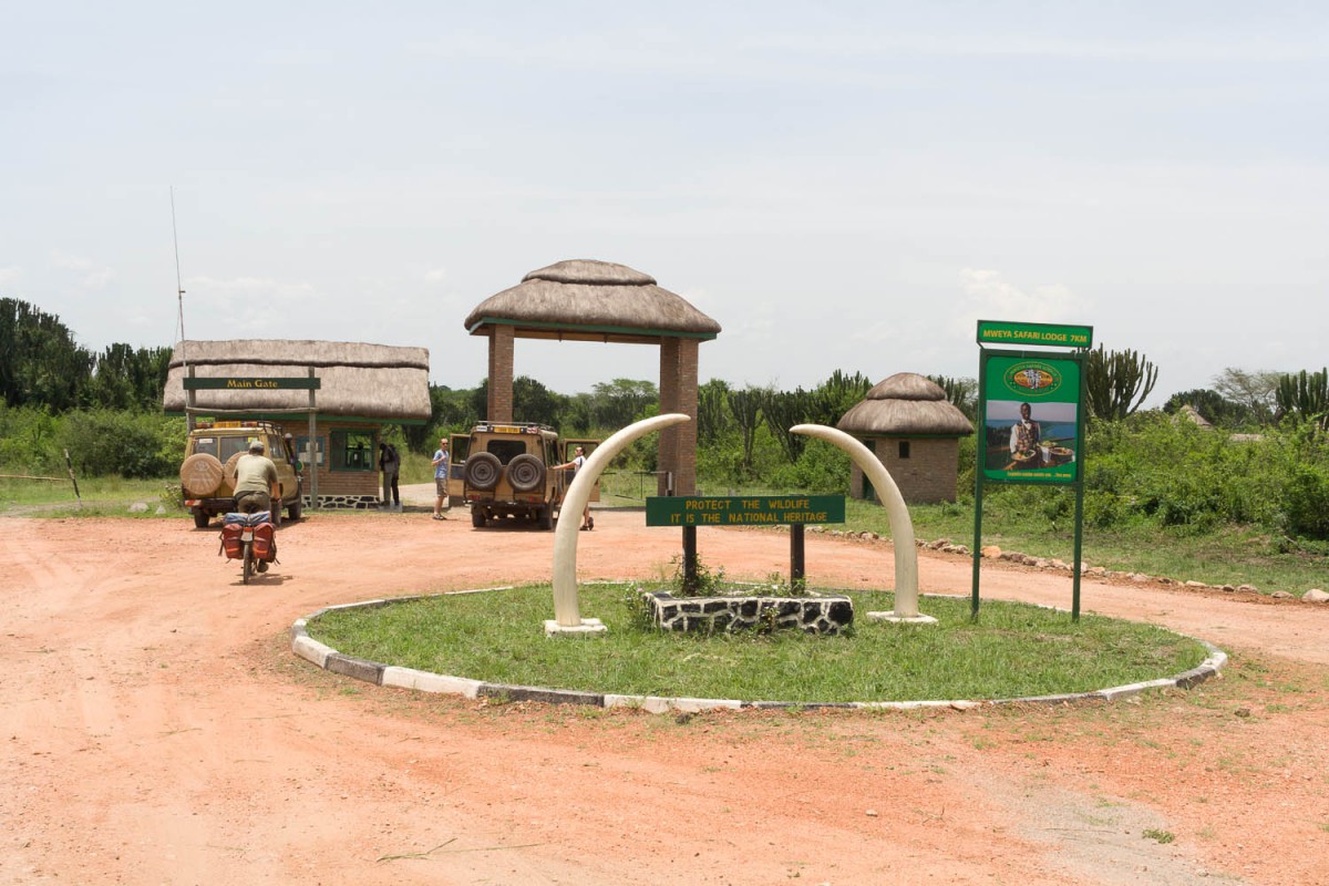
Queen Elizabeth NP main gate
See the separate Uganda National Park page for more details
Mweya – Kichwamba (45 km)
As only the Katwe road may be used by cyclists you’ll have to exit the same way. An alternative would be to hitchhike (or hire a taxi) to the Katunguru gate on the main highway.
Katunguru at is the bridge across the Kanzingu Channel. A small village with a dusty souvenir shop and not much else. The new improved highway ends here and a narrower older potholed road continues further south. When you leave the park behind the road climbs steeply out of the Rift Valley.
A view point offers superb views over the park below and the Ruwenzori Mountains in the distance.
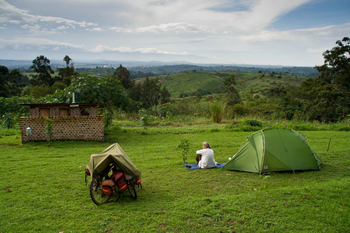
Just beyond the viewpoint is Kichwamba where you can stay or camp at the Kingfisher Lodge. This is probably the campsite with the must spectacular views in Uganda. The rooms here are very expensive!
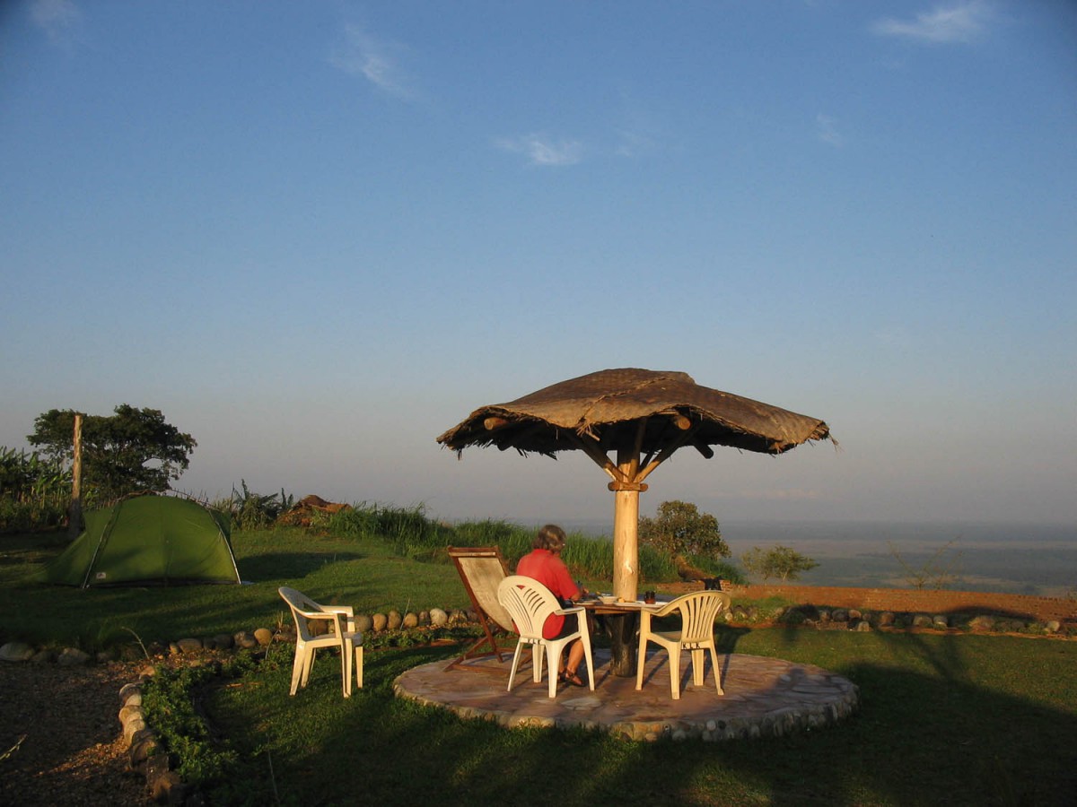
breakfast at campsite with a view
Kichwamba – Mbarara (100 km)
The road climbs further out of the Rift Valley. Very few traffic here; most of the cars are taxis. As in all of Uganda children seem to go mad when seeing tourists; screaming “Mzungu, Mzungu” for as long as they can see you (and longer). We noticed an increase in people (mostly children) asking for money.
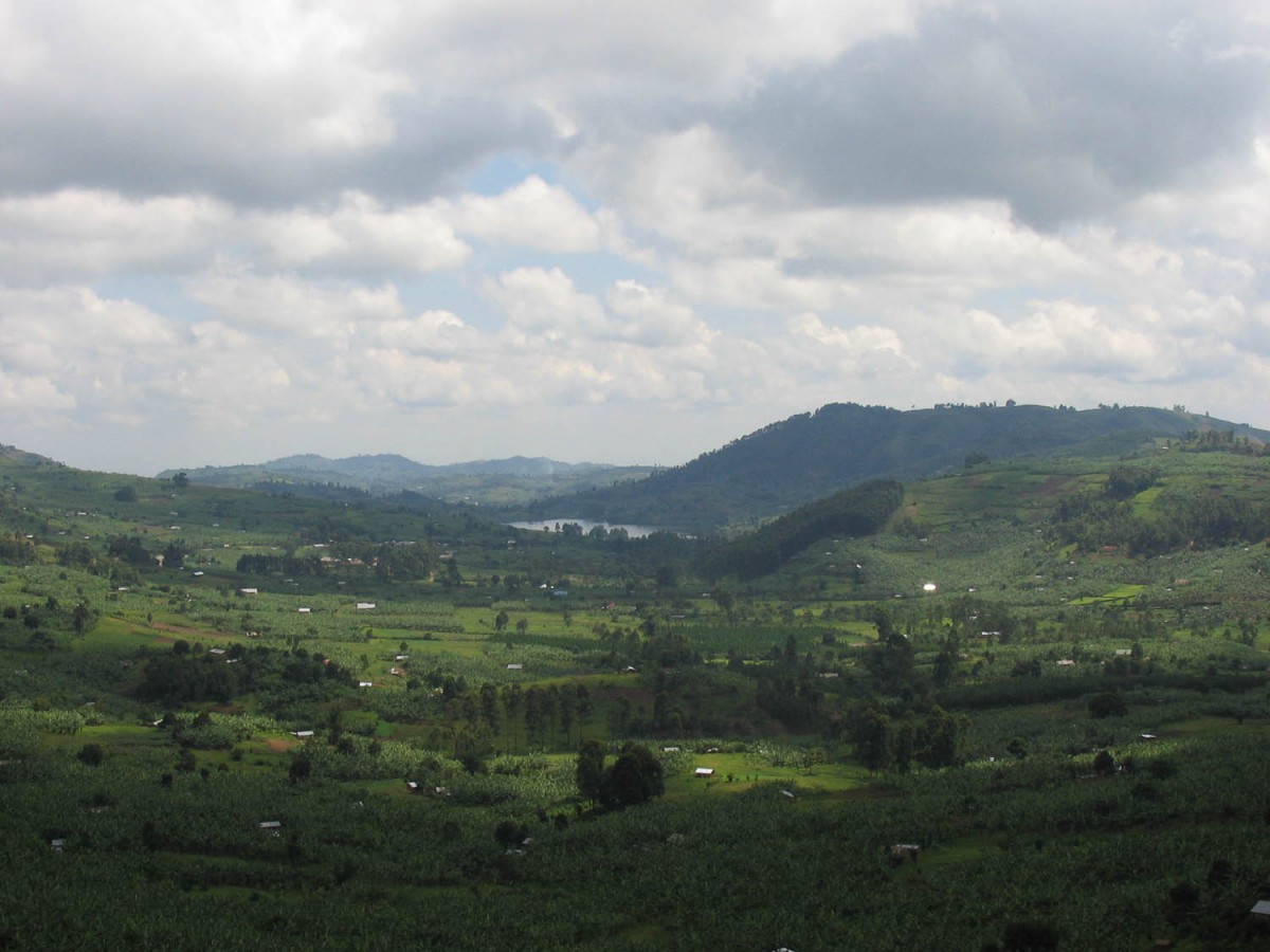
Uganda countryside
On this hilly road you’ll pass through the Kalinzu Forest Reserve. The Visitors Centre offers good value chimp tracking tours and has a very basic campsite. No food available here.
Twenty km’s south are Ishaka and Bushenyi with all the facilities. The road becomes increasingly busy. You’ll leave the hills behind. In this flat banana growing area you can easily cover some distance. Mbarara is busy and looks like a real city.
Mbarara – Lake Mburo NP (55 km)
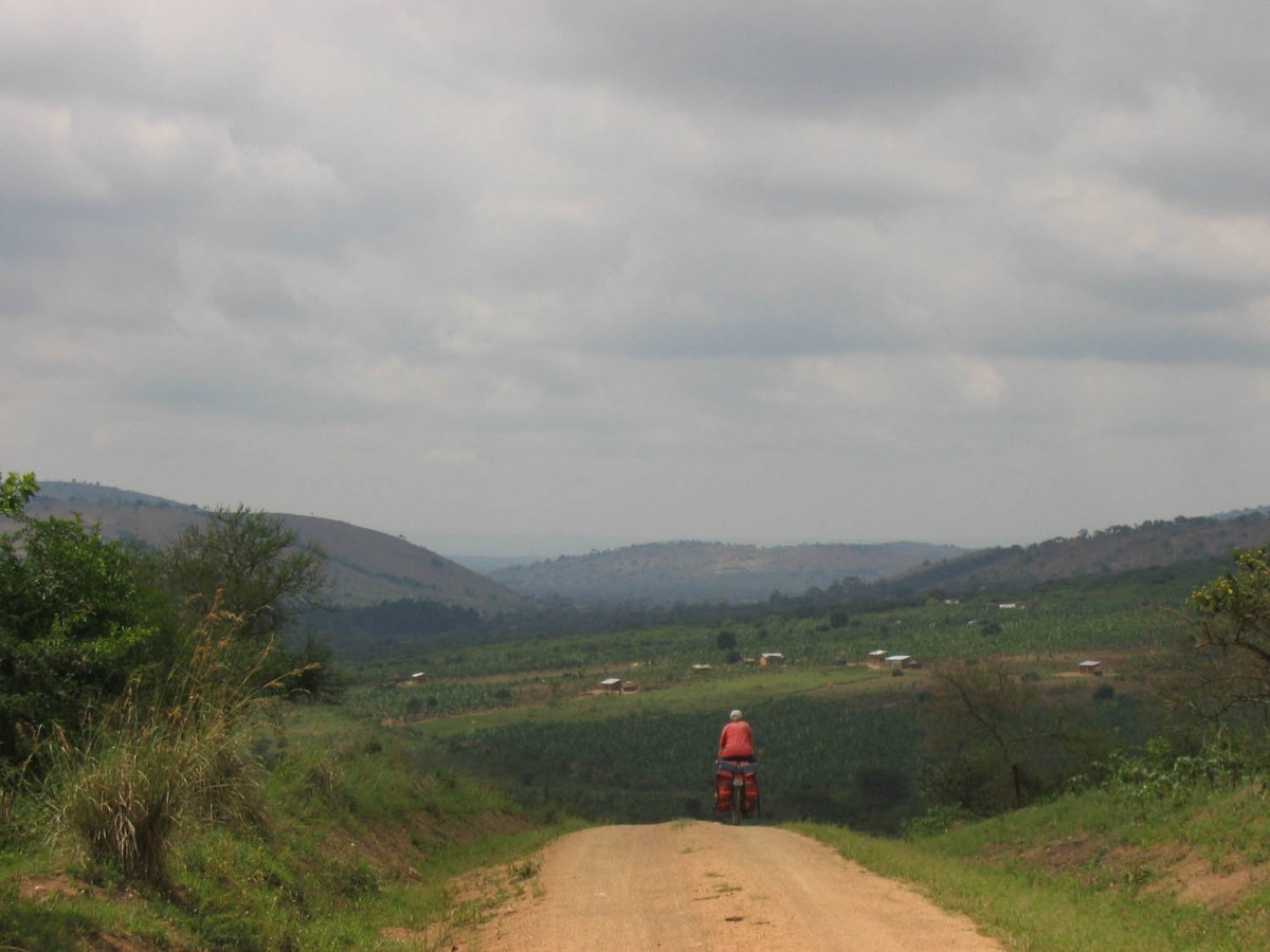
the road tot Lake Mburo NP
From busy Mbarara to the turn off for Lake Mburo NP at the village of Sanga it’s 32 km. The highway is increasingly bumpy and potholed.
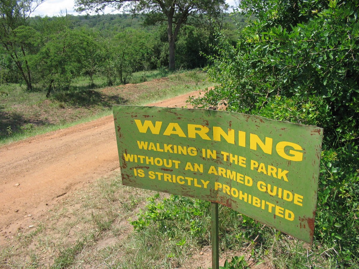
sign in Lake Mburo NP
The dirt road to the Sanga Gate of the National Park has recently (2006) been upgraded and smoothed, so it’s an easy 13 km ride to the gate.
Lake Mburo NP – Masaka (25 km)
Because of a close encounter with buffaloes the day before we took a taxi ride for the first 14 km to the Nsara Gate, where the park officially ends. Although the park ends at the gate, wildlife still can be seen along the remaining miles to the Mbarara – Masaka highway.
Back on the pavement, the small town of Lyantonde is not more than 10 km away. Lyantonde has several hotels and other services.
The 65 km to Masaka that follow are moderately hilly on a narrow and potholed road. Traffic increases; watch out for the speeding busses.
Masaka – Kalangate (Sesse Islands) (75 km)
The unsignposted turn-off at Nyendo to the ferry to the Sesse Islands is difficult to find. Our East Africa Lonely Planet guide gave a more or less accurate description but probably you will have to ask for directions.
The 40 km to the ferry, the road is rough and dusty but most of it is as flat as a pancake. The ferry is no longer free, we had to pay 1000 Ush per person. The official departure time is 14.00 hrs but we left a hour later. The trip across to the Sesse Islands takes one hour.
The distance to Kalangata at the other side if the island is 30 km The road is surprisingly good but very hilly. Once the traffic from the ferry has passed, you´ll have the road for yourself most of the time. It´s a beautiful and recommended ride through sleepy villages and forests.
For those who don´t want to hurry to Kalangata: very close to the ferry harbour we spotted a sign for a lodge (The Scorpion Lodge) that also offered camping.
Kalangata offers a wide range of accommodation and camping facilities. We stayed one night at the Sesse Islands Beach Hotel (overpriced and run down) and one night at the Panorama Lodge (good value).
Back to Entebbe
The daily ferry from Kalangata leaves at 8 o´clock sharp. Park your bike and enjoy the boat ride to Entebbe.
