All information on these pages is based on our personal experiences while cycling in South Africa in September 2002.
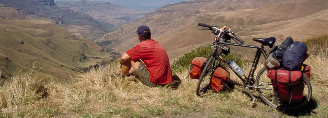
We flew to Durban, cycled along the south coast, turned west and crossed Lesotho. We continued through Golden Gate and Royal Natal National Parks, via Howick and Pietermaritzburg cycled back to Durban.
“Is it safe to cycle in South Africa?”
After our return many people were curious about cycling in South Africa. “What was the weather like? Did you have many punctures? One question was asked most frequently: “Is it safe over there?”.
Yes, it is safe over there! Of course the normal precautions apply. Keep valuables out of sight etc. We wouldn’t want to bike through central Durban at night but outside the cities your security is no problem. People are friendly and helpful. We didn’t feel unsafe for one moment. This also applies to the Lesotho part of our trip.
Maps; getting around
1. Kwazulu-Natal Tourist Map; scale 1 : 1.100.000. Available from Tourist Information offices at the airport and in major towns. This useful free map shows distances (not always very accurate), road numbers and a lot of general information about Kwazulu Natal. Available from Tourist Information offices.
2. Drakensberg and Kwazulu-Natal Midlands Tourist Map; scale 1 : 250.000 (Map Studio – Cape Town). We purchased this map in the Netherlands. It shows street maps of major towns, places of interest, accommodation and game parks. The map shows relief, road numbers and distances (not accurate). It covers the area from Pietermaritzburg to Harrismith.
3. Süd Afrika; scale 1 : 1.700.000 (Reise Know-How Verlag). We purchased this map in the Netherlands. It shows relief, road numbers and distances (not accurate). Useful for planning longer trips.
Signposting along all the roads we used is good; all distances are measured in kilometres.
Books
We used the well-known Lonely Planet travel guide.
South Africa on the WWW
We searched the web for useful bike sites and found these. All links open in a new browser window.
- The official South African Tourism Website
Useful for general info. - Travel Guide To South Africa By Bike.
Page by International Bicycle Fund. Practical information is limited to one page.
Roads and Traffic
All main roads are in a good condition and generally speaking traffic is light. Even better, most roads have a shoulder (small strip on both sides separated by a yellow line) that can be used as a bicycle-lane. On mountainous parts the steepest sections will have wide passing lanes.
The only unpaved road we cycled on this trip in South Africa was the steep and rough road up Sani Pass. The complete route we followed can be done on a lightweight racing- or touring bike.
A problem along all roads are the broken bottles along the edges of road. Problem spots are junctions an other places where people obviously are waiting for busses etc. On a normal trip we have zero or only one flat tyre; now we had four of them!
Traffic is on the left hand side of the road.
Your bicycle – preparation – spare parts
Food and drinks
For the self catering every major town has a well-stocked supermarket. Most shops in the town centres close on Saturday afternoon and Sunday.
It’s safe to drink water from the tap. At some places farm stalls along main roads sell farm produce and cold drinks.
Climate
We visited South Africa and Lesotho in September (2002). This is spring on the southern hemisphere. We had many warm and sunny days (25° C) but also some rain and some days with extremely dense fog near the coast. Up in Lesotho (at an elevation of around 2000 – 2500 m ) days were cool and nights were cold.
During a unusual cold front moving north from the Antarctic we had snow and ice in the Lesotho Mountains. We also stayed an extra day at Sani Top Chalet because the wind blew at gale froce and made it impossible to continue into Lesotho.
The advantage of this low-season period is that campgrounds and hotels are never very busy. Try to avoid December and January as this is the holiday season.
Detailed weather information can be found at:
General forecasts by the South African Weather service.
Wildlife
Yes, South Africa is famous for it’s wildlife. No, we did not see much more than a few zebra’s and wildebeest at a game reserve. Outside parks and reserves you don’t meet game.
Where to stay
Hotels and B&B
Rooms in lodges, hotels and B&B’s are widely available along the route we followed. Farms often offer B&B. A nice double room with breakfast will cost you Rand 200 – 300. Major towns will also have budget / backpacker accommodation. Our entire trip through South Africa can be done without a tent.
Camping (Caravan Parks)
Many towns and national parks have camping facilities, including flushing toilets, hot showers and bathtubs. A campsite will cost around Rand 60 to 80 for a tent site. Our entire trip through South Africa could be done camping.
Alternatives
As a cyclist you may have to stop for a night at villages where there is no campground or hotel. In South Africa we spend a night at the Highflats police station. We slept very well in the courtroom and even were invited to take a hot bath at the Station Commissioners home!
Other ways of getting around
Of course cycling is the best way to get around, but South Africa is a large country so you may want to consider one or more of these alternatives:
Hitch hiking
Many South Africans drive ‘bakkies’ (pick-up trucks) that are ideal for people with bikes. The usual precautions on hitchhiking apply.
Mini-bus taxis
Mainly black South-Africans use the mini-bus taxis. The taxis seem to go everywhere but we are not sure they will take one or more persons with bikes. These buses always seem to be very very full.
Domestic flight
We flew from Jo’burg to Durban with NationWide and had no problems getting our (boxed) bicycles in the plane.
